geo.wikisort.org - Mountains
Mount Ḥaṣṣ or Mount Aḥaṣṣ (Arabic: جبل الحص or جبل الأحص; northern Syrian vernacular: ǧabal əl-Ḥəṣṣ) is a 500-metre-high plateau (maximum height 638 m) on the northern fringe of the Syrian Desert. It is located in the Safīrah District of Aleppo Governorate in Syria.
| Mount al-Hass | |
|---|---|
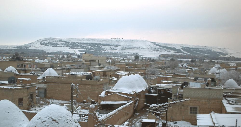 View of Mount Ḥaṣṣ from Safīrah | |
| Highest point | |
| Elevation | 638 m (2,093 ft) |
| Coordinates | 35°58′12″N 37°18′42″E |
| Naming | |
| English translation | جبل الحص |
| Language of name | ar |
| Geography | |
 Mount al-Hass Location of Mount al-Hass | |
| Location | Aleppo Governorate, Syria |
Location and description
The plateau extends for 60 km with a width of about 30 km on the western side of Lake Jabboul from Safīrah in the north to Sabkhat Kharāyij (Arabic: سبخة الخرايج) and Sabkhat Ḥammām (Arabic: سبخة همام) in the south. To the east lie the Qinnasrīn plain (southern Aleppo plain) and the Maṭkh lowland. A lesser elevation called Mount Shabīth (Arabic: جبل شبيث) (highest point 360 m) is found in the southeast, beyond which lie Sabkhat Shabīth (Arabic: سبخة شبيث). The plain of Khunāṣir separates between Mount Ḥaṣṣ and Mount Shabīth.[1]
The area has more than 150 villages inhabited by Bedouins or people of Bedouinic ancestry. It is one of the poorest regions in Syria. A development project aims to improve living standards.[2]
An ancient fortress dating to classical antiquity has been recently uncovered on Mount Ḥaṣṣ.[3]
References
- Abd as-Salam, Adil (1991) General Geography of Syria (Arabic)
- esyria (Arabic)
- "الصفحة الرئيسية".
Capital: Aleppo | ||||||||||||||||||||
|  | |||||||||||||||||||
|
| ||||||||||||||||||||
| ||||||||||||||||||||
| ||||||||||||||||||||
| ||||||||||||||||||||
| ||||||||||||||||||||
| ||||||||||||||||||||
| ||||||||||||||||||||
| ||||||||||||||||||||
This article about a location in Aleppo Governorate, Syria is a stub. You can help Wikipedia by expanding it. |
Другой контент может иметь иную лицензию. Перед использованием материалов сайта WikiSort.org внимательно изучите правила лицензирования конкретных элементов наполнения сайта.
WikiSort.org - проект по пересортировке и дополнению контента Википедии