geo.wikisort.org - River
Nahal Amud (Hebrew: נחל עמוד), also known as the Wadi al-Amud, is a stream in the Upper Galilee region of Israel that flows into the Sea of Galilee.
| Amud | |
|---|---|
 Nahal Amud | |
| Native name |
|
| Physical characteristics | |
| Source | |
| • location | Near Kadita, Israel |
| • coordinates | 33°0′46.57″N 35°28′2.87″E |
| • elevation | 816 m (2,677 ft) |
| Mouth | Sea of Galilee |
• location | Ginosar, Israel |
• coordinates | 32°51′11.98″N 35°31′56.9″E |
• elevation | −209 metres (−686 ft) |
| Length | 24.9 km (15.5 mi) |
History
The source of the stream, Ramat Dalton, is located 800 meters above sea level. Its drainage basin includes the peaks of Mount Canaan (955 meters) and Mount Meron (1,204 meters) and flows south through eastern Galilee to the northwest part of the Sea of Galilee – a height of less than 200 meters below sea level.
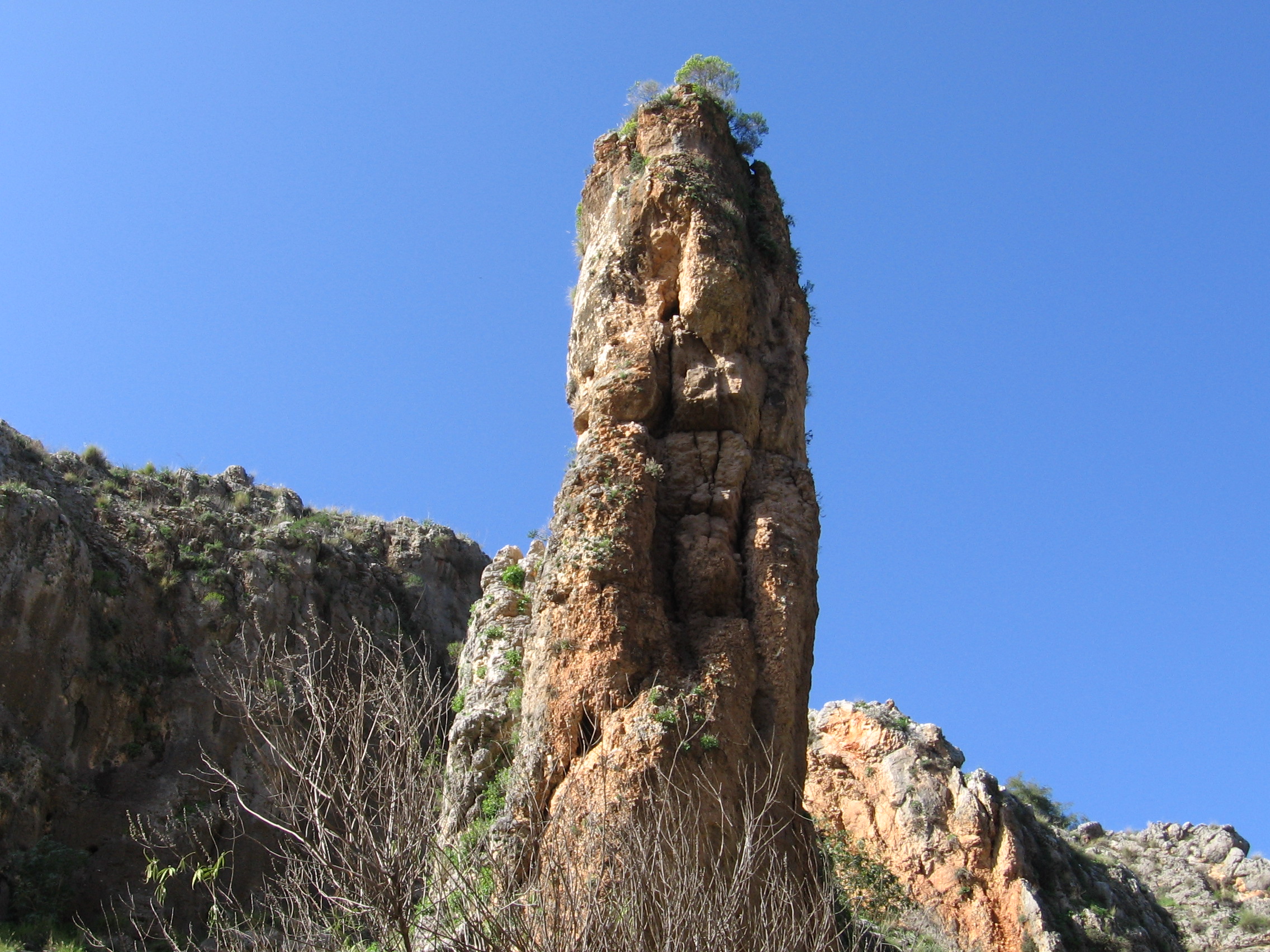
The stream is named after a pillar that rises high above ground and is located near a channel of the stream near Kibbutz Hukok. The gorge that forms the channel at this point holds many caves once inhabited by Homo heidelbergensis and later by Neanderthal Man such as the cave at Zuttiyeh and the Amud cave. They were the object of the first paleoanthropological excavations in Mandatory Palestine in 1925–1926.[1] The caves contained hominin remains as well as Mousterian and Acheulean artifacts.
Most of Nahal Amud (8923 dunams) was declared a nature reserve in 1972.[2]
See also
- Geography of Israel
- Hiking in Israel
- Archaeology of Israel
- Amud 1
References
- Excavations in the Wadi Amud
- "List of National Parks and Nature Reserves" (PDF) (in Hebrew). Israel Nature and Parks Authority. Archived from the original (PDF) on 2009-10-07. Retrieved 2010-09-27.
External links
Authority control | |
|---|---|
| General |
|
| National libraries | |
This article relating to anthropology is a stub. You can help Wikipedia by expanding it. |
This paleontological site article is a stub. You can help Wikipedia by expanding it. |
На других языках
- [en] Nahal Amud
[ru] Амуд
Аму́д (Нахал-Аму́д[1]; ивр. נַחַל עַמּוּד) — ручей на севере Израиля, в Верхней Галилее[2]. Начинается на возвышенности Дальтон близ мошава Дальтон[en][3], течёт в южном направлении между холмами, на которых расположен город Цфат, и горой Мерон, и впадает в Тивериадское озеро (озеро Кинерет) в его северо-западной части, близ кибуца Гиносар. На большей части своего протяжения ручей является пересыхающим, однако на участке, проходящем близ Цфата, вода течёт круглый год[источник не указан 3272 дня]. Значительная часть русла ручья (около 20 км[источник не указан 336 дней]) и прилегающей к нему территории является заповедником Нахаль Амуд[2].Другой контент может иметь иную лицензию. Перед использованием материалов сайта WikiSort.org внимательно изучите правила лицензирования конкретных элементов наполнения сайта.
WikiSort.org - проект по пересортировке и дополнению контента Википедии