geo.wikisort.org - River
The Mangoro River is the largest river on the east coast of Madagascar by basin size and water volume, and is 300 km in length.[2]
| Mangoro River | |
|---|---|
 Mangoro | |
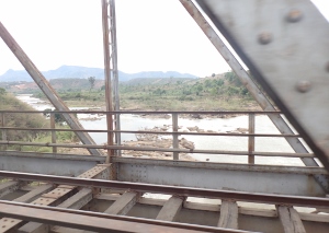
 Mangoro River | |
| Native name | Mangoro (Malagasy) |
| Location | |
| Country | Madagascar |
| Physical characteristics | |
| Source | |
| • location | NE of Anjozorobe |
| • elevation | 1,100 m (3,600 ft) |
| Mouth | |
• location | Indian Ocean |
• coordinates | 20°0′17.8848″S 48°46′54.0192″E |
• elevation | 0 m (0 ft) |
| Length | 300 km (190 mi)[1] |
| Basin size | 17,175 km2 (6,631 sq mi) |
| Basin features | |
| Tributaries | |
| • right | Nosivolo River |
Overview
The Mangoro begins northeast of the town of Anjozorobe in the Analamanga region, at approximately 1,100 meters. Its primary tributaries are the Onive River (which joins on the right bank at 200 km from the river source) and Nosivolo River.[3][1] Its mouth is at the Indian Ocean near the town of Ambodiharina.
Owing to its many tributaries, the Mangoro maintains a high flow year round, making it an ideal river for rafting.[4]
As of 2012, the Sherritt International Corporation planned to use the Mangoro River as a source of water for a slurry pipeline carrying ore for the Ambatovy project mines, raising environmental concerns.[5]
Wildlife
There are small populations of crocodiles in the more placid sections of the river, but their population is minimal and continues to plummet.[4]
References
- Campbell, Gwynn. David Griffiths and the Missionary "History of Madagascar", p. 488-89 (Brill 2012) (citing Aldegheri, Marius. The Rivers and Streams on Madagascar, in Battistini, Rene & G. Richard-Vindard (ed.), Biogeography and Ecology in Madagascar (1972))
- "Mangoro River (Madagascar)". LC Linked Data Service (Library of Congress). Retrieved 2013-03-05.
- "MADAGASCAR: New Livelihoods to Protect A River's Life". Global Issues, Inter Press Service. 2010-11-25. Retrieved 2013-03-05.
- "Mangoro river". Retrieved 5 March 2013.
- "Another Mining Horror Story? Sherritt International Corporation's Ambatovy Project in Madagascar". MiningWatch Canada. 2012-04-10. Retrieved 2013-03-05.

| Authority control |
|
|---|
На других языках
[de] Mangoro
Der Mangoro ist ein Fluss im Osten Madagaskars.- [en] Mangoro River
[es] Río Mangoro
El Río Mangoro es el río más largo de la costa este de Madagascar por el tamaño de la cuenca y el volumen de agua, con 300 km de longitud.[1]Другой контент может иметь иную лицензию. Перед использованием материалов сайта WikiSort.org внимательно изучите правила лицензирования конкретных элементов наполнения сайта.
WikiSort.org - проект по пересортировке и дополнению контента Википедии