geo.wikisort.org - River
The Lariang River is a river in Sulawesi, Indonesia.[1]
| Lariang River Sungai Lariang, Salu Lariang, Uwai Lariang | |
|---|---|
| Native name | Salo Lariang |
| Physical characteristics | |
| Source | |
| • location | Sulawesi |
| Mouth | Macassar Strait |
• location | Lariang, West Sulawesi |
• coordinates | 1°25′00″S 119°17′31″E |
• elevation | 0 m (0 ft) |

Lariang
Mouth of Lariang River
Course
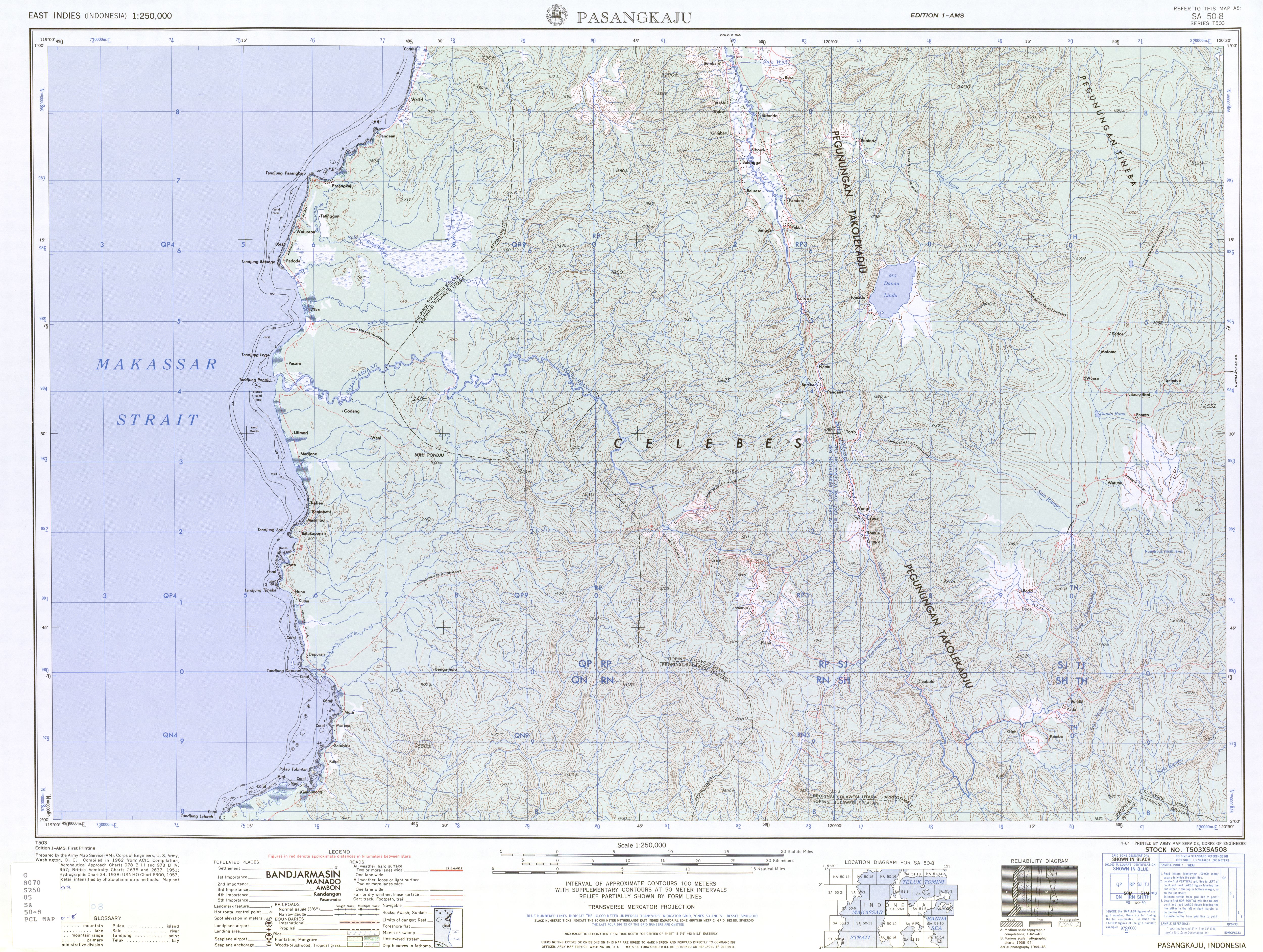
Its tributary, the Pebatua River, arises in Donggala Regency, Central Sulawesi, and forms the Lariang when it is joined by the Koro River from the left (south) at 1°39′50″S 120°2′47″E.[2] The river, as the Lariang,[3] goes on to form part of the border between Central Sulawesi and West Sulawesi and enters the Macassar Strait just past the town of Lariang.[4][5] The mouth is at 1°25′00″S 119°17′31″E.
See also
References
- Rand McNally, The New International Atlas, 1993.
- Pasangkaju, SA 50-8 (topographic map 1:250,000), Series T503, United States Army Map Service, April 1964
- Some maps such as "Lariang, Sulawesi Barat, Sulawesi, Indonesia". Collins Maps. Archived from the original on 2013-06-28. and "City (town): Lariang". TipTopGlobe. no longer use the name Lariang, but use Pebatua for the entire length.
- "Plate 19 Indonesia Central: Philippines". Times Atlas of the World (seventh ed.). John Bartholomew and Sons, Ltd. 1985. ISBN 978-0-7230-0265-9.
- The 1964 U.S. Army topographic map Pasangkaju does not show the town of Lariang.
Текст в блоке "Читать" взят с сайта "Википедия" и доступен по лицензии Creative Commons Attribution-ShareAlike; в отдельных случаях могут действовать дополнительные условия.
Другой контент может иметь иную лицензию. Перед использованием материалов сайта WikiSort.org внимательно изучите правила лицензирования конкретных элементов наполнения сайта.
Другой контент может иметь иную лицензию. Перед использованием материалов сайта WikiSort.org внимательно изучите правила лицензирования конкретных элементов наполнения сайта.
2019-2026
WikiSort.org - проект по пересортировке и дополнению контента Википедии
WikiSort.org - проект по пересортировке и дополнению контента Википедии