geo.wikisort.org - River
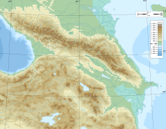
The Kuma (Russian: Кума́) is a river on the Black Sea-Caspian Steppe of southern Russia. It flows northeast into the Caspian Sea. It is 802 kilometres (498 mi) long, and has a drainage basin of 33,500 square kilometres (12,900 sq mi).[1] Its source is in the Greater Caucasus, in the republic Karachay-Cherkessia, west of Kislovodsk. It flows in northeastern direction, through Stavropol Krai (towns Mineralnye Vody, Zelenokumsk, Budyonnovsk, Neftekumsk) and further east through the Caspian Depression as the natural border between Kalmykia and Dagestan. That part of the Kuma's valley forms the eastern part of the Kuma–Manych Depression, separating the East European Plain from the Caucasus region. The Kuma flows into the Kizlyar Gulf of the Caspian Sea near the border between Dagestan and Kalmykia.
This article needs additional citations for verification. (July 2016) |
| Kuma | |
|---|---|
 | |
| Location | |
| Country | Russia |
| Physical characteristics | |
| Source | Skalisty Range, Caucasus |
| • location | 43°49′44″N 42°06′19″E |
| Mouth | Caspian Sea |
• coordinates | 44°48′36″N 46°54′02″E |
| Length | 802 km (498 mi) |
| Basin size | 33,500 km2 (12,900 sq mi) |
| Basin features | |
| Tributaries | |
| • right | Podkumok |
Most of the rivers that flow north from the Caucasus Mountains and into Terek–Kuma Lowland are caught by the Kuban and Terek. It rises between the basins of those two rivers so the Kuma is mainly a steppe river. It is much used for irrigation.
Construction projects
If the plans for the proposed Eurasia Canal, linking the Caspian Sea with the Black Sea, are ever implemented, it will likely follow the Kuma River valley in its eastern section.
References
- "Река Кума in the State Water Register of Russia". textual.ru (in Russian).
На других языках
[de] Kuma (Kaspisches Meer)
Die Kuma (russisch Кума́) ist ein 802 km langer Zufluss des Kaspischen Meeres im Nordkaukasus und im Kaukasusvorland (Russland).- [en] Kuma (Russia)
[es] Río Kumá
El río Kumá (en Ruso: Кумá) es un largo río localizado en la parte meridional de la Rusia europea que desagua en el mar Caspio. Su longitud total es de 802 km y su cuenca drena una superficie de 33 500 km² (similar a Moldavia y mayor que Bélgica). El nombre del río procede del túrquico kum que significa arena del cual asimismo proceden los nombres de los cumanos y de los cumucos.[it] Kuma (tributario del Mar Caspio)
Il Kuma è un fiume della Russia ciscaucasica, tributario del mar Caspio; scorre nel territorio delle Repubbliche Autonome di Karačaj-Circassia, del Daghestan, della Calmucchia e del kraj di Stavropol'.[ru] Кума (река, впадает в Каспийское море)
Кума́ (абаз. Гвым, кабард.-черк. Гум[2], карач.-балк. Къум[3], чечен. ГӀум-хи[4], кум. Кум) — река на Северном Кавказе. Длина 802 км, бассейн 33,5 тыс. км². Основные притоки: правые — Подкумок, Золка, Дарья; левые — Суркуль, Сухой и Мокрый Карамыки, Томузловка, Мокрая Буйвола.Другой контент может иметь иную лицензию. Перед использованием материалов сайта WikiSort.org внимательно изучите правила лицензирования конкретных элементов наполнения сайта.
WikiSort.org - проект по пересортировке и дополнению контента Википедии


