geo.wikisort.org - River
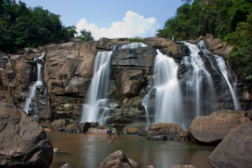
The Jonha Falls (also called Gautamdhara Falls) is a waterfall located in Ranchi district in the Indian state of Jharkhand.
| Jonha Falls | |
|---|---|
 | |
 Jonha Falls | |
| Location | Ranchi district, Jharkhand |
| Coordinates | 23°20′30″N 85°36′30″E |
| Total height | 43 metres (141 ft) |
| Watercourse | Raru River |
Geography
M: municipality, CT: census town, R: rural/ urban centre, N: neighbourhood, T: tourist centre, D: dam, H: historical/ religious centre
Owing to space constraints in the small map, the actual locations in a larger map may vary slightly
Location
Jonha Falls is located at 23°20′30″N 85°36′30″E
Note: The map alongside presents some of the notable locations in the district. All places marked in the map are linked in the larger full screen map.
The falls
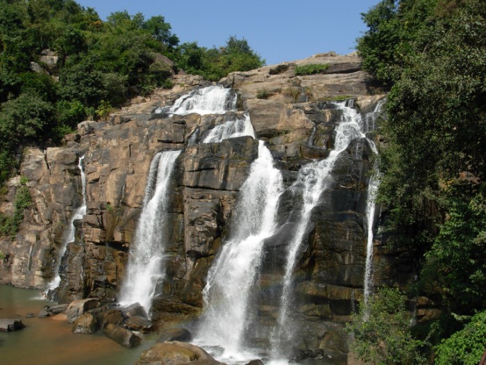
Situated at an edge of the Ranchi plateau, the Jonha Falls is an example of a hanging valley falls. The Gunga River hangs over its master stream, Raru River and forms the falls.[1] One has to descend 722 steps to admire the surroundings.[2] Water in the falls drops from a height of 43 metres (141 ft).[3]
The Jonha Falls is an example of a nick point caused by rejuvenation. Knick point, also called a nick point or simply nick, represents breaks in slopes in the longitudinal profile of a river caused by rejuvenation. The break in channel gradient allows water to fall vertically giving rise to a waterfall.[4]
Culture
There is a tourist rest house which encloses a Buddhist shrine with a deity of Lord Gautama Buddha.[2] A temple and an ashram dedicated to Buddha was built atop Gautam Pahar by the sons of Baldeo Das Birla.[5] A fair is organized in Jonha every Tuesday and Saturday.[2]
Transport
The Jonha Falls is 40 kilometres (25 mi) from Ranchi. It is approachable by both road and train.[6] Jonha Station is just 1.5 km from the fall. For travel by road, one has to take the Ranchi-Purulia Road and after travelling for about 20 miles (32 km) one has to travel about 3 miles (4.8 km) off the main road.[7]
See also
References
- Bharatdwaj, K (2006). Physical Geography: Hydrosphere By K. Bharatdwaj. ISBN 9788183561679. Retrieved 2 May 2010.
- "Jonha Falls". must see India. Retrieved 29 April 2010.
- "High and dry- Dasam drained, Hundru a trickle". The Telegraph 29 April 2009. Retrieved 29 April 2010.
- A.Z.Bukhari (2005). Encyclopedia of nature of geography. p. 110. ISBN 9788126124435. Retrieved 11 July 2010.
- "Waterfall Around Ranchi". exoticindia. Retrieved 29 April 2010.
- "Johna Falls". Ranchi district administration. Retrieved 29 April 2010.
- Sir John Houlton, Bihar, the Heart of India, p. 144, Orient Longmans, 1949
This article related to a location in Jharkhand is a stub. You can help Wikipedia by expanding it. |
Другой контент может иметь иную лицензию. Перед использованием материалов сайта WikiSort.org внимательно изучите правила лицензирования конкретных элементов наполнения сайта.
WikiSort.org - проект по пересортировке и дополнению контента Википедии