geo.wikisort.org - River
The Buller River is a river in the South Island of New Zealand.[1] One of the country's longest rivers, it flows for 170 kilometres (110 mi) from Lake Rotoiti through the Buller Gorge and into the Tasman Sea near the town of Westport. Within the Buller Gorge and downstream from the Deepdale River joining, the Buller crosses from Tasman District into Buller District. The Paparoa Range separates the Buller River from the Grey River. A number of flora and fauna are found in the Buller catchment, many of these extending onto the slopes of the Paparoa Range.
| Buller | |
|---|---|
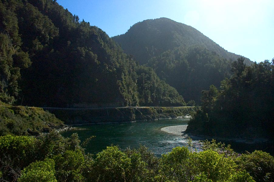
 Buller River near Berlins | |
 The Buller River system | |
| Etymology | named for Charles Buller |
| Native name | Kawatiri (Māori) |
| Location | |
| Country | New Zealand |
| Region | Tasman, West Coast |
| Cities | Saint Arnaud, Murchison, Westport |
| Physical characteristics | |
| Source | Southern Alps (Saint Arnaud Range) |
| • location | Lake Rotoiti, New Zealand |
| • coordinates | 41°48′10″S 172°49′20″E |
| Mouth | Tasman Sea |
• location | Karamea Bight, New Zealand |
• coordinates | 41°43′45″S 171°35′20″E |
• elevation | 0 m (0 ft) |
| Length | 177 km (110 mi) |
| Discharge | |
| • average | 429 m3/s (15,100 cu ft/s) |
| Basin features | |
| Tributaries | |
| • left | Travers, Gowan, Mangles, Matakitaki, Maruia, Inangahua, Blackwater, Ohikanui |
| • right | Hope, Owen, Matiri |
The river is named after Charles Buller, Member of Parliament in the United Kingdom of Great Britain and Ireland (UK) and director of the New Zealand Company, a UK-based company in the early 1800s with a royal charter supporting colonization efforts of New Zealand. The original Māori name for the Buller is Kawatiri.
The Buller River upstream from Murchison along with the Mangles River are popular for whitewater kayaking and recreational fishing.[2] State Highway 6 follows the river for much of its length.
This river has an annual mean flow of 429 cubic metres per second (15,100 cu ft/s)[citation needed] and boasts the highest flood flow of any New Zealand river which is over 14,000 cubic metres per second (490,000 cu ft/s)[citation needed].
Tributaries
The Buller has several major tributaries. These include (in order from Lake Rotoiti) the Gowan River, the Matakitaki River, the Maruia River, and the Inangahua River. Other smaller tributaries include the Hope, Owen, Mangles, Matiri, Blackwater, Ohikaiti River, and Ohikanui River.
In July 2001 the Buller Water Conservation Order came into force, listing the waters of the Buller River and tributaries that are to be retained in their natural state or protected because of the outstanding characteristics, features and values of the waters.[3]
Line notes
- Encyclopedia of New Zealand (1966)
- Marion Hobbs. 2001
- "Water conservation orders". Archived from the original on 10 February 2013. Retrieved 10 August 2007.
References
- Encyclopedia of New Zealand. 1966
- Marion Hobbs. 2001. Water Conservation Order for Buller River to take. Official website of the New Zealand Government
На других языках
[de] Buller River
Der Buller River ([[Maorische Sprache|Māori]] Kawatiri) ist ein Fluss auf der Südinsel von Neuseeland.- [en] Buller River
[ru] Буллер (река)
Буллер[1] или Каватири[2] (англ. Buller River, маори Kawatiri)[3] — река, протекающая в северо-западной части Южного острова Новой Зеландии в регионах Тасман и Уэст-Кост. Впадает в Тасманово море[1].Другой контент может иметь иную лицензию. Перед использованием материалов сайта WikiSort.org внимательно изучите правила лицензирования конкретных элементов наполнения сайта.
WikiSort.org - проект по пересортировке и дополнению контента Википедии