geo.wikisort.org - River
The Black Fork is a principal tributary of the Cheat River in the Allegheny Mountains of eastern West Virginia, USA. It is a short stream, about four miles (6 km) in length,[2] formed by the confluence of two other streams not far above its mouth.[4] It was traditionally considered one of the five Forks of Cheat.
| Black Fork | |
|---|---|
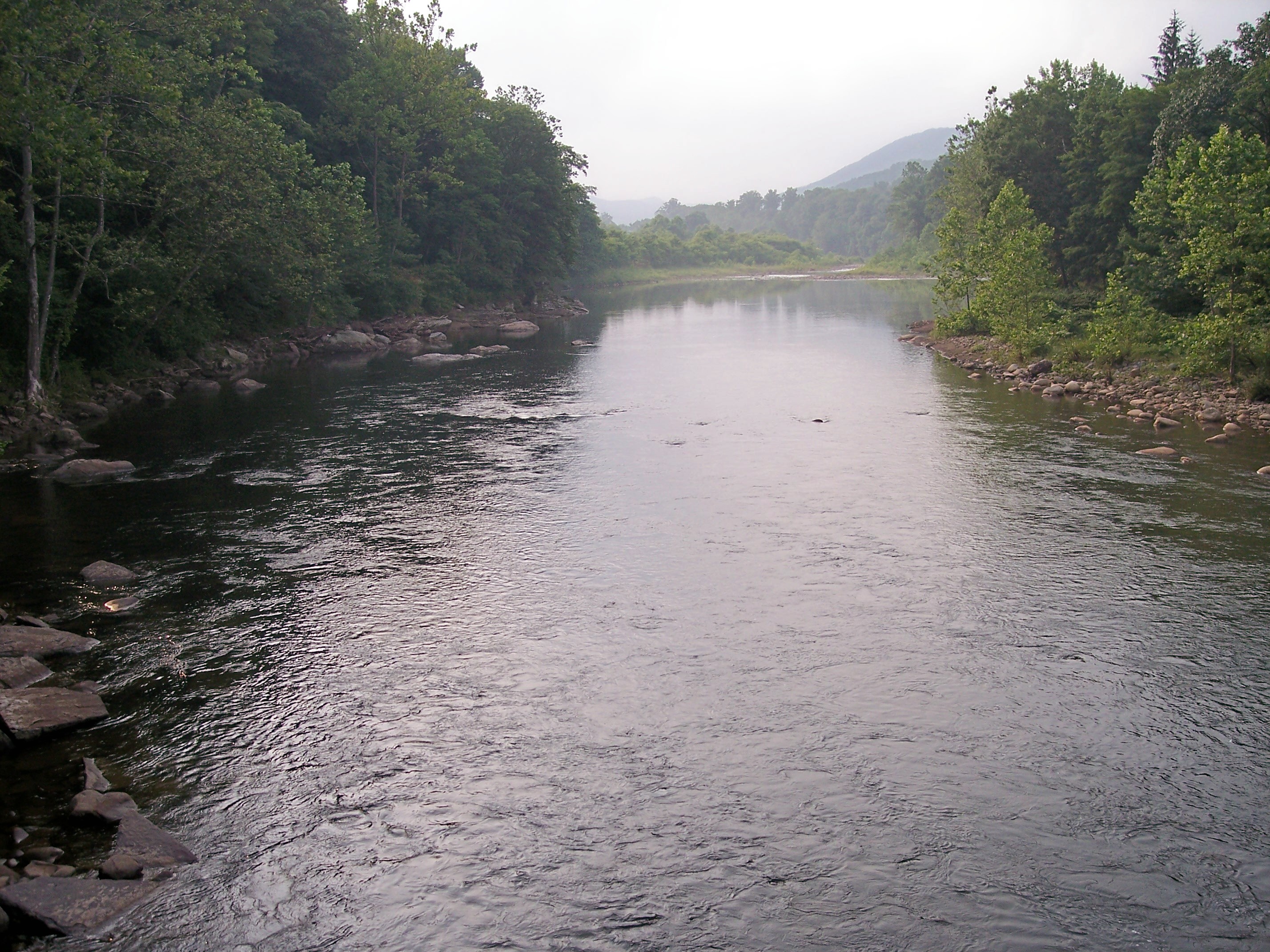
 The Black Fork at Hendricks, West Virginia looking upstream. The confluence of the Blackwater River (left) and the Dry Fork (right) is visible. | |
 Map of the Monongahela River basin, with Black Fork highlighted. | |
| Location | |
| Country | United States |
| State | West Virginia |
| County | Tucker |
| Physical characteristics | |
| Source | Dry Fork |
| • location | Col between Harper and Yokum knobs, Randolph County |
| • coordinates | 38°44′01″N 79°38′52″W |
| • elevation | 3,740 ft (1,140 m) |
| 2nd source | Blackwater River |
| • location | Canaan Valley, Tucker County |
| • coordinates | 39°03′32″N 79°29′04″W |
| • elevation | 3,540 ft (1,080 m) |
| Source confluence | |
| • location | Hendricks |
| • coordinates | 39°04′20″N 79°37′45″W[1] |
| • elevation | 1,700 ft (520 m) |
| Mouth | Cheat River |
• location | Parsons |
• coordinates | 39°06′39″N 79°40′44″W |
• elevation | 1,621 ft (494 m) |
| Length | 4 mi (6.4 km)[2] |
| Basin size | 500 sq mi (1,300 km2)[3] |
Geography
Via the Cheat, Monongahela and Ohio Rivers, it is part of the watershed of the Mississippi River, draining an area of 500 square miles (1,295 km²).[3] The Black Fork flows for its entire length in Tucker County. It is formed at the town of Hendricks by the confluence of the Dry Fork and the Blackwater River, and flows generally northwestwardly through Hambleton to Parsons, where it joins the Shavers Fork to form the Cheat River.[4]
Name
The U.S. Board on Geographic Names settled on "Black Fork" as the stream's name in 1930. According to the Geographic Names Information System, it has also been known historically as "Blackwater Fork" and as the Blackwater River.[1]
 The Black Fork at Hendricks, as viewed downstream
 The Black Fork at Parsons

See also
- List of West Virginia rivers
- Blackwater Canyon
References
- Julian, Norman. 2006. "Cheat River." The West Virginia Encyclopedia. Ken Sullivan, editor. Charleston, WV: West Virginia Humanities Council. ISBN 0-9778498-0-5.
- U.S. Geological Survey Geographic Names Information System: Black Fork
- The American Rivers Outstanding Rivers List, Second Edition, May 1991. Compiled and edited by Matthew H. Huntington and John D. Echeverria. Washington, DC: American Rivers, Inc.
- West Virginia Department of Environmental Protection. Watershed Atlas Project Archived 2005-04-04 at the Wayback Machine: Cheat River watershed Archived October 4, 2006, at the Wayback Machine. Sum of watershed areas of Dry Fork, Blackwater River, Glady Fork, Laurel Fork, Gandy Creek, and Red Creek. Retrieved on December 11, 2006.
- DeLorme (1997). West Virginia Atlas & Gazetteer. Yarmouth, Maine: DeLorme. ISBN 0-89933-246-3.
На других языках
[de] Black Fork (Cheat River)
Der Black Fork ist ein nur 6 km langer Quellfluss des Cheat River im Osten des US-Bundesstaates West Virginia.- [en] Black Fork (Cheat River tributary)
[ru] Блэк-Форк
Блэк-Форк (англ. Black Fork) — река на востоке штата Западная Виргиния, США. Правая составляющая реки Чит, которая в свою очередь является одной из составляющих реки Мононгахила. Длина составляет около 6 км[2]; площадь бассейна — 1295 км²[3]. На всём своём течении протекает через территорию округа Такер. Образуется путём слияния рек Драй-Форк и Блэкуотер в районе города Хендрикс и течёт преимущественно в северо-западном направлении через города Хамблтон и Парсонс. В районе города Парсон соединяется с рекой Шейверс-Форк, образуя реку Чит.Другой контент может иметь иную лицензию. Перед использованием материалов сайта WikiSort.org внимательно изучите правила лицензирования конкретных элементов наполнения сайта.
WikiSort.org - проект по пересортировке и дополнению контента Википедии