geo.wikisort.org - River
Shavers Fork of the Cheat River is situated in the Allegheny Mountains of eastern West Virginia, USA. It is 88.5 mi (142.5 km) long[3] and forms the Cheat at its confluence with Black Fork at Parsons.[6] It was traditionally considered one of the five Forks of Cheat and its upper reaches constitute the highest river in the eastern United States.[7]
| Shavers Fork | |
|---|---|
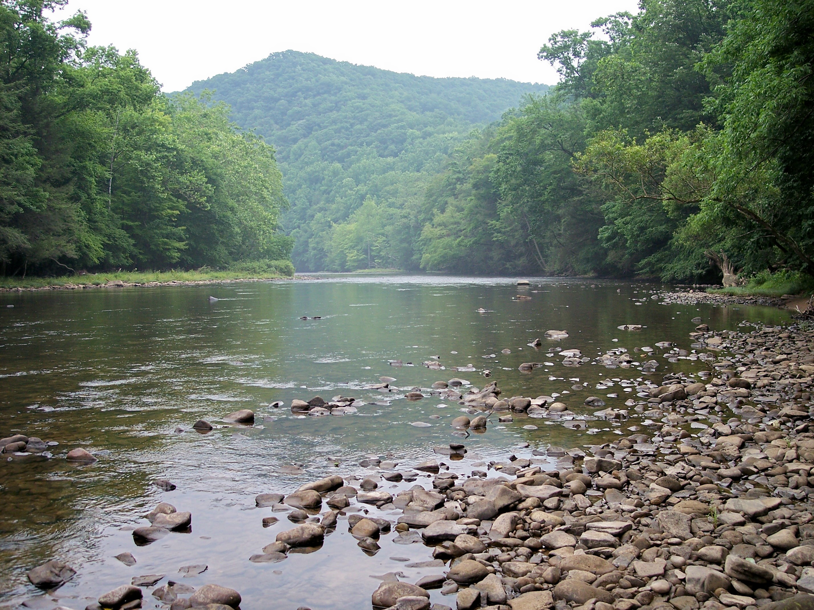 Shavers Fork at Stuart Recreation Area in the Monongahela National Forest | |
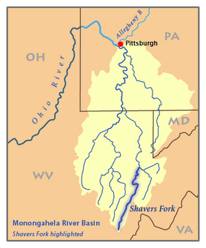 Map of the Monongahela River basin, with Shavers Fork highlighted. | |
| Location | |
| Country | United States |
| State | West Virginia |
| Counties | Tucker, Randolph, Pocahontas |
| Physical characteristics | |
| Source | Thorny Flat, Cheat Mountain |
| • location | Pocahontas County, West Virginia |
| • coordinates | 38°23′44″N 79°59′02″W[1] |
| • elevation | 4,553 ft (1,388 m)[2] |
| Mouth | Cheat River[1] |
• location | Parsons, West Virginia |
• coordinates | 39°06′39″N 79°40′43″W |
• elevation | 1,621 ft (494 m) |
| Length | 89 mi (143 km)[3] |
| Basin size | 214 sq mi (550 km2)[3] |
| Discharge | |
| • location | Bowden, West Virginia[4] |
| • average | 445 cu ft/s (12.6 m3/s) |
| • minimum | 99 cu ft/s (2.8 m3/s)(1976) |
| • maximum | 27,600 cu ft/s (780 m3/s)(2010) |
| Discharge | |
| • location | Cheat Bridge, WV[5] |
| • average | 188 cu ft/s (5.3 m3/s) |
Geography
Shavers Fork, via the Cheat, Monongahela and Ohio Rivers, is part of the watershed of the Mississippi River, draining an area of 214 mi² (554 km²).[3] It flows for much of its length through the Monongahela National Forest, and drains mostly rural and forested areas. 97% of the river's basin is forested, and two-thirds of it is public land.[3]
Shavers Fork rises in north-central Pocahontas County at Thorny Flat, highest peak of Cheat Mountain (4,848 ft/1,478 m) and the site of Snowshoe Mountain ski resort. Its headwaters flow through the ghost town of Spruce. The river then flows generally north-northeastwardly through Randolph and Tucker Counties, where its valley is the trough between Cheat Mountain (to the west) and Shavers Mountain (to the east). Settlements along its course include Cheat Bridge, Bemis, Bowden, and Porterwood. The "High Falls of Cheat" (15 feet [4.6 m] high) is a few miles upstream of Bemis. Shavers Fork ultimately joins the Black Fork at Parsons to form the Cheat at an elevation of 1621 ft (494 m).[3][1][6]
Names

The creek was named after the local Shaver family.[8] According to the Geographic Names Information System, Shavers Fork has also been known historically as:[1]
- Chavers Fork
- Main Cheat River
- Shafers Fork
- Shaffers Fork of Cheat River
- Shaver's Fork
- Shavers Fork River
- Shavers Fork of Cheat River
See also
- List of West Virginia rivers
- List of waterfalls in West Virginia
References
- "Shavers Fork". Geographic Names Information System. United States Geological Survey. Retrieved 2004-04-24.
- "Shavers Fork Source". Elevation Query. U.S. Geological Survey. Retrieved 2008-04-24.[permanent dead link]
- Godfrey, Tanya. 2006. "Shavers Fork." The West Virginia Encyclopedia. Ken Sullivan, editor. Charleston, WV: West Virginia Humanities Council. ISBN 0-9778498-0-5.
- "USGS 03068800 SHAVERS FORK BELOW BOWDEN, WV". National Water Information System. U.S. Geological Survey. Retrieved 2008-04-24.
- "USGS 03067510 SHAVERS FORK NR CHEAT BRIDGE, WV". National Water Information System. U.S. Geological Survey. Retrieved 2008-04-24.
- DeLorme (1997). West Virginia Atlas & Gazetteer. Yarmouth, Maine: DeLorme. ISBN 0-89933-246-3.
- Bender, Steve (2002) “Cheat River: West Virginia” Southern Living, Southern Progress Corporation, Spring 2002.
- Kenny, Hamill (1945). West Virginia Place Names: Their Origin and Meaning, Including the Nomenclature of the Streams and Mountains. Piedmont, WV: The Place Name Press. p. 567.
External links
- The Nature Conservancy's Upper Shavers Fork Preserve Archived 2007-09-27 at the Wayback Machine
На других языках
[de] Shavers Fork
Der Shavers Fork ist ein 143 km langer Nebenfluss des Cheat Rivers im US-Bundesstaat West Virginia.- [en] Shavers Fork
[ru] Шейверс-Форк
Шейверс-Форк (англ. Shavers Fork) — река на востоке штата Западная Виргиния, США. Левая составляющая реки Чит, которая в свою очередь является одной из составляющих реки Мононгахила. Длина составляет 143 км[2]; площадь бассейна — около 554 км². Средний расход воды в районе города Боуден — 13 м³/с[3].Другой контент может иметь иную лицензию. Перед использованием материалов сайта WikiSort.org внимательно изучите правила лицензирования конкретных элементов наполнения сайта.
WikiSort.org - проект по пересортировке и дополнению контента Википедии