geo.wikisort.org - Reservoir
Lock and Dam No. 5A is a lock and dam located near Fountain City, Wisconsin and Goodview, Minnesota on the Upper Mississippi River around river mile 728.5.
This article includes a list of general references, but it lacks sufficient corresponding inline citations. (December 2018) |
| Lock and Dam No. 5A | |
|---|---|
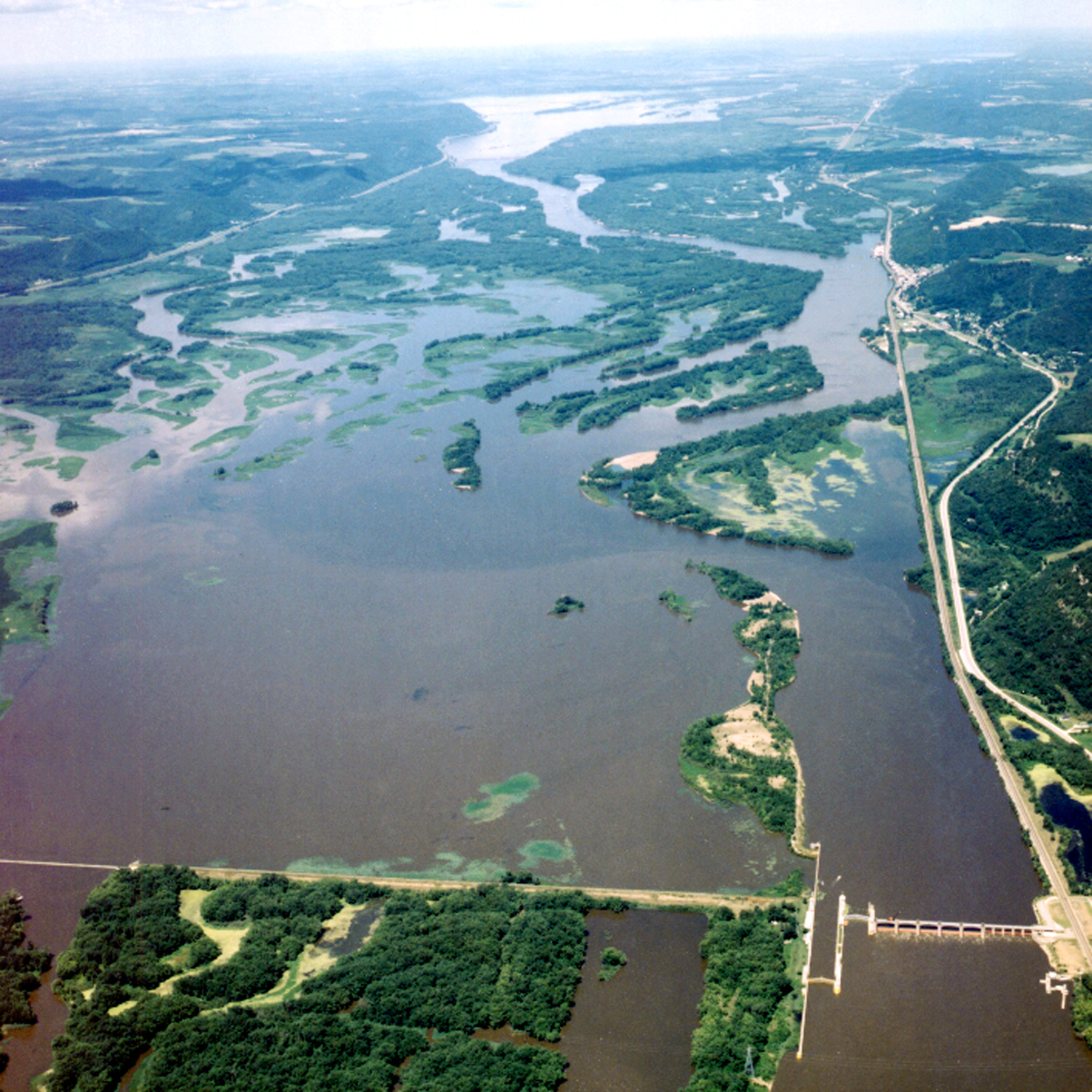 Lock and Dam 5A, Upper Mississippi River. View is upriver to the northwest. | |
 Location of Lock and Dam No. 5A in Wisconsin | |
| Location | Buffalo County, Wisconsin / Winona County, Minnesota, United States. Near Fountain City, Wisconsin. |
| Coordinates | 44.085119°N 91.673698°W |
| Construction began | 1932 |
| Opening date | June 1936 |
| Operator(s) | |
| Dam and spillways | |
| Impounds | Upper Mississippi River |
| Length | 682 feet (207.9 m)(movable portion) |
| Reservoir | |
| Creates | Pool 5A |
| Total capacity | 39,600 acre⋅ft (0.0488 km3) |
| Catchment area | 59,105 sq mi (153,080 km2) |
Construction
It was constructed in 1932, placed in operation in 1936. Its last major rehabilitation was from 1989 through 2000.
Description
The dam consists of a concrete structure 682 feet (207.9 m) long with five roller gates and five tainter gates with an earth embankment 22,000 feet (6,705.6 m) long. Its concrete overflow spillway is 1,000 feet (304.8 m) long and its lock is 110 feet (33.5 m) wide by 600 feet (182.9 m) long.
Ownership
The lock and dam are owned and operated by the St. Paul District of the United States Army Corps of Engineers-Mississippi Valley Division.
 |
 |
See also
- Public Works Administration Dams list
- Upper Mississippi River National Wildlife and Fish Refuge
References
External links
- U.S. Army Corps of Engineers, St. Paul District: Lock and Dam 5A
- U.S. Army Corps of Engineers, St. Paul District: Lock and Dam 5A brochure
- Historic American Engineering Record (HAER) No. MN-23, "Upper Mississippi River 9-Foot Channel Project, Lock & Dam No. 5A, Winona, Winona County, MN", 103 photos, 10 data pages, 7 photo caption pages
Текст в блоке "Читать" взят с сайта "Википедия" и доступен по лицензии Creative Commons Attribution-ShareAlike; в отдельных случаях могут действовать дополнительные условия.
Другой контент может иметь иную лицензию. Перед использованием материалов сайта WikiSort.org внимательно изучите правила лицензирования конкретных элементов наполнения сайта.
Другой контент может иметь иную лицензию. Перед использованием материалов сайта WikiSort.org внимательно изучите правила лицензирования конкретных элементов наполнения сайта.
2019-2024
WikiSort.org - проект по пересортировке и дополнению контента Википедии
WikiSort.org - проект по пересортировке и дополнению контента Википедии