geo.wikisort.org - Reservoir
Lake Wakatipu (Māori: Whakatipu Waimāori) is an inland lake (finger lake) in the South Island of New Zealand. It is in the southwest corner of the Otago region, near its boundary with Southland. Lake Wakatipu comes from the original Māori name Whakatipu wai-māori.[1]
| Lake Wakatipu | |
|---|---|
| Whakatipu Waimāori | |
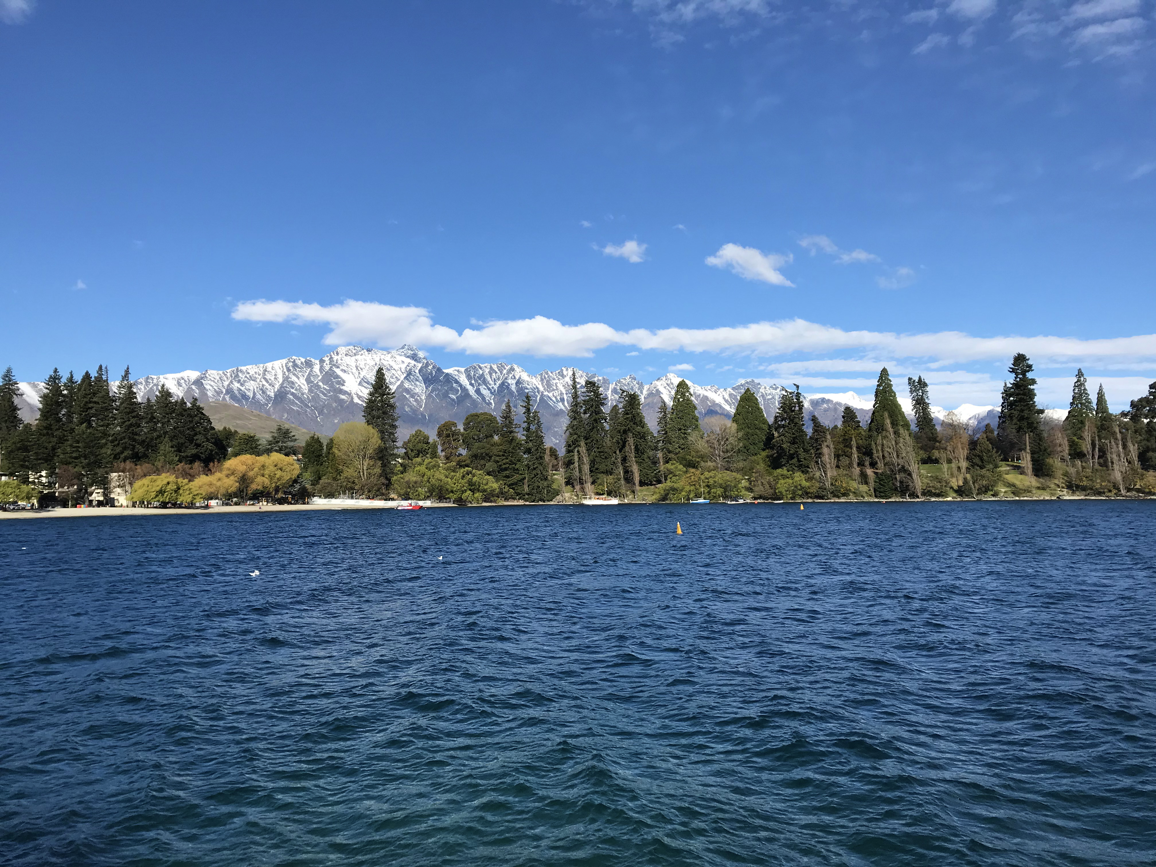 Lake Wakatipu and The Remarkables | |
 Lake Wakatipu Lake Wakatipu is in the Otago Region of the South Island. | |
| Location | Queenstown-Lakes District, Otago Region, South Island |
| Coordinates | 45°3′S 168°30′E |
| Lake type | Glacial lake |
| Native name | Whakatipu Waimāori (Māori) |
| Primary inflows | Dart River / Te Awa Whakatipu, Rees River |
| Primary outflows | Kawarau River |
| Catchment area | 2,674 km2 (1,032 sq mi) |
| Basin countries | New Zealand |
| Max. length | 75.2 km (46.7 mi) |
| Max. width | 5 km (3.1 mi) |
| Surface area | 289 km2 (112 sq mi) |
| Average depth | 230 metres (750 ft) |
| Max. depth | 380 metres (1,250 ft) |
| Residence time | c. 12 years |
| Surface elevation | 310 m (1,020 ft) |
| Islands | Pig Island, Pigeon Island, Tree Island & Hidden Island. |
| Settlements | Kingston, Queenstown, Glenorchy |
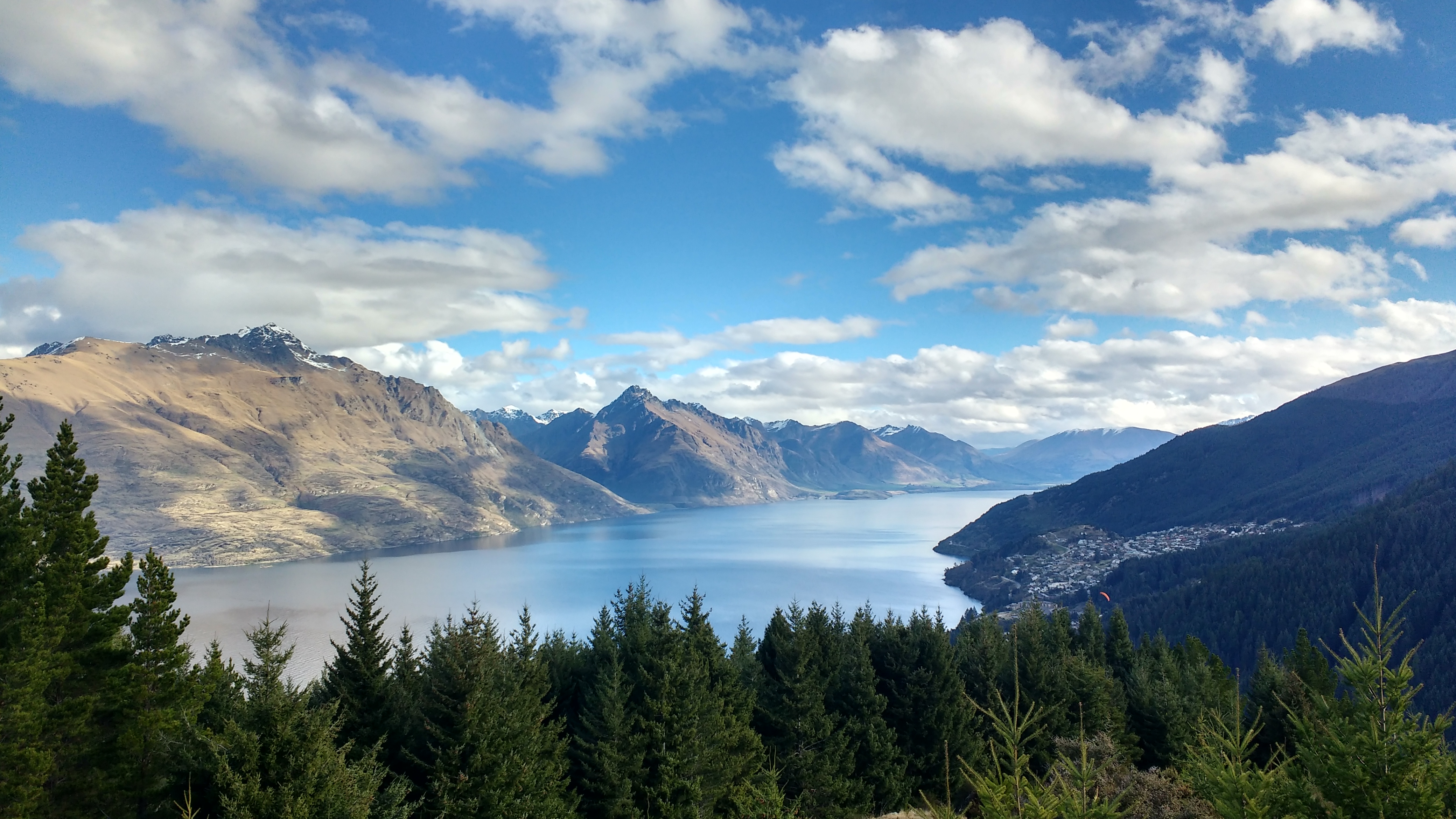
With a length of 80 kilometres (50 mi), it is New Zealand's longest lake, and, at 291 km2 (112 sq mi), its third largest. The lake is also very deep, its floor being below sea level, with a maximum depth of 380 metres (1,250 ft). It is at an altitude of 310 metres (1,020 ft), towards the southern end of the Southern Alps / Kā Tiritiri o te Moana. The general topography is a reversed "N" shape or "dog leg". The Dart River / Te Awa Whakatipu flows into the northern end, the lake then runs south for 30 kilometres before turning abruptly to the east. Twenty kilometres (12.4 mi) further along, it turns sharply to the south, reaching its southern end 30 kilometres (19 mi) further south, near Kingston.
The lake is drained by the Kawarau River, which flows out from the lake's only arm, the Frankton Arm, 8 km (5.0 mi) east of Queenstown. Until about 18,000 years ago the Mataura River drained Lake Wakatipu. The Kingston Flyer follows part of the former river bed now blocked by glacial moraine.[2] Queenstown is on the northern shore of the lake close to eastern end of its middle section. It has a seiche of period 26.7 minutes which, in Queenstown Bay, causes the water level to rise and fall some 200 millimetres (8 in).[3]
Lake Wakatipu is renowned for its scenic beauty, as it is surrounded by mountains. Two mountain ranges, the Remarkables and the Tapuae-o-Uenuku / Hector Mountains, lie along its southeastern edge. It is a popular venue for adventure tourism, with skifields, paragliding, bungy jumping and tramping tracks within easy reach. A vintage steamboat, the TSS Earnslaw regularly plies its waters. Several vineyards are nearby in Gibbston.


Etymology
The full original name of the lake is Whakatipu-wai-Māori.[4] While the lake lacks an official name,[5] it is generally referred to as "Lake Wakatipu".[4]
The name is believed to originate from the Waitaha people, who were later displaced by Kāti Māmoe. Elders from the modern iwi Ngāi Tahu say that while the name Whakatipu is archaic and its original meaning is a mystery, whaka means causative and tipu means growth.[4] Wakatipu could mean "growing bay" if the original was Whakatipu and the h elided as a result of the Southern Māori dialect.[6] The dialect is also known for dropping final vowels. Waka can also mean 'hollow'.[6] Wakatipua or Whakatipua (Canoe/Bay of spirits) have been recorded historically, as has Wakatapu (sacred vessel).
Whakatipu is also the name of another six unrelated geographical features in the South Island, including Tarahaka Whakatipu, the Harris Saddle at the head of the Routeburn Track; Te Awa Whakatipu, the main Dart River / Te Awa Whakatipu flowing into the lake; Whakatipu Katuka, the Hollyford River and Valley; and Whakatipu Kohurangi, Māori Bay in Pelorus Sound, Marlborough.[7]
A legend says that the lake bed was formed when a giant ogre, Kopu-wai, was burned while lying asleep, leaving only his heart behind, which according to the same legend is the cause of the rhythmic rise and fall of the lake's seiche.
Flooding
Lake Wakatipu has experienced periodic flooding [8] affecting the lakeside communities of Kingston, Glenorchy and Queenstown. Notable flooding events include the 1878 Queenstown floods, which affected a large part of the outlying Queenstown and Otago areas, the 1995 Queenstown floods, and most notably the 1999 Queenstown floods, which significantly damaged the Queenstown CBD and road infrastructure resulting in approximately $50 million worth of damage.[9][10][11]
Wildlife
Lake Wakatipu is a habitat for the longfin eel (a specimen caught in 1886 is the largest known of this species[12]), brown trout, salmon and rainbow trout.[13] These and other fish support predators such as the pied shag. The black-billed gull is often found around the lake while the most common birds are the black-billed gull and the introduced mallard. A smaller bird often not noticed because of its size is the New Zealand scaup.
In popular culture

Film
Lake Wakatipu doubled as the Scottish Loch Ness in the 2007 film The Water Horse: Legend of the Deep.[14]
The lake was a backdrop for several scenes in The Lord of the Rings: The Fellowship of the Ring, including Amon Hen.
Television
Lake Wakatipu is the eponymous lake in the murder mystery television series Top of the Lake (2013).[15]
See also
- List of lakes in New Zealand
References
- "Māori name for Lake". Archived from the original on 2012-12-20. Retrieved 2012-06-09.
- Turnbull, I M (2000), Geology of the southeastern Eyre Mountains relevant to tenure review (PDF), Wellington, N.Z.: Department of Conservation, ISSN 1171-9834
- "Lake Wakatipu at Willow Place". www.orc.govt.nz. Retrieved 2019-05-31.
- Kuprienko, Dasha (5 December 2017). "Is it Wakatipu or Whakatipu?". Stuff. Retrieved 17 January 2021.
- "Place name detail: Lake Wakatipu". New Zealand Gazetteer. New Zealand Geographic Board. Retrieved 13 August 2021.
- H. Beattie (1920). "Art. XII.—The Southern Maori, and Greenstone: Addenda". Transactions and Proceedings of the Royal Society of New Zealand. 52: 51–52.
- Jamieson, Debbie (16 January 2021). "Call to return the missing 'wh' to South Island Māori place names". Stuff. Retrieved 17 January 2021.
- "Lake Wakatipu flood hazard (ORC)" (PDF).
- "Flood events 1995-2004". www.civildefence.govt.nz. Retrieved 2019-05-31.
- Williams, Guy (2014-11-15). "Learning from the big flood". Otago Daily Times Online News. Retrieved 2019-05-31.
- "Back in the Day: Queenstown hit by extreme flooding". TVNZ. Retrieved 2019-05-31.
- Fishing World Records
- "Lake Wakatipu Fishing". Archived from the original on 2014-12-20. Retrieved 2011-04-28.
- Miller, Gerri. "Inside 'The Water Horse'". HowStuffWorks, Inc. Retrieved 2008-07-07.
- Lane, Megan (August 17, 2013). "Top of the Lake: Is New Zealand's greatest actor New Zealand itself?". BBC News Magazine.
External links
На других языках
[de] Lake Wakatipu
Der Lake Wakatipu ist der drittgrößte Binnensee Neuseelands und nach dem Lake Te Anau der zweitgrößte auf der Südinsel.- [en] Lake Wakatipu
[es] Wakatipu
El lago Wakatipu es un lago interior de la isla Sur de Nueva Zelanda. Se encuentra en la esquina sudoccidental de la región de Otago, cerca de su límite con Southland.[fr] Lac Wakatipu
Le lac Wakatipu est un lac de Nouvelle-Zélande situé sur l'Île du Sud, au sud-ouest d'Otago, non loin de la frontière avec le Southland. Wakatipu provient du mot māori Whakatipu wai-māori.[it] Lago Wakatipu
Il lago Wakatipu è un lago di origine glaciale dell'Isola del Sud della Nuova Zelanda.[ru] Уакатипу (озеро)
Уакатипу (англ. Lake Wakatipu) — озеро на острове Южный в Новой Зеландии. Находится на территории региона Отаго недалеко от границы с регионом Саутленд. Высота над уровнем моря — 310 м[1].Другой контент может иметь иную лицензию. Перед использованием материалов сайта WikiSort.org внимательно изучите правила лицензирования конкретных элементов наполнения сайта.
WikiSort.org - проект по пересортировке и дополнению контента Википедии