geo.wikisort.org - Reservoir
Lake Wānaka is New Zealand's fourth-largest lake and the seat of the town of Wānaka in the Otago region.[2][3] The lake is 278 meters above sea level, covers 192 km2 (74 sq mi), and is more than 300 m (980 ft) deep.[4][5]
| Lake Wānaka | |
|---|---|
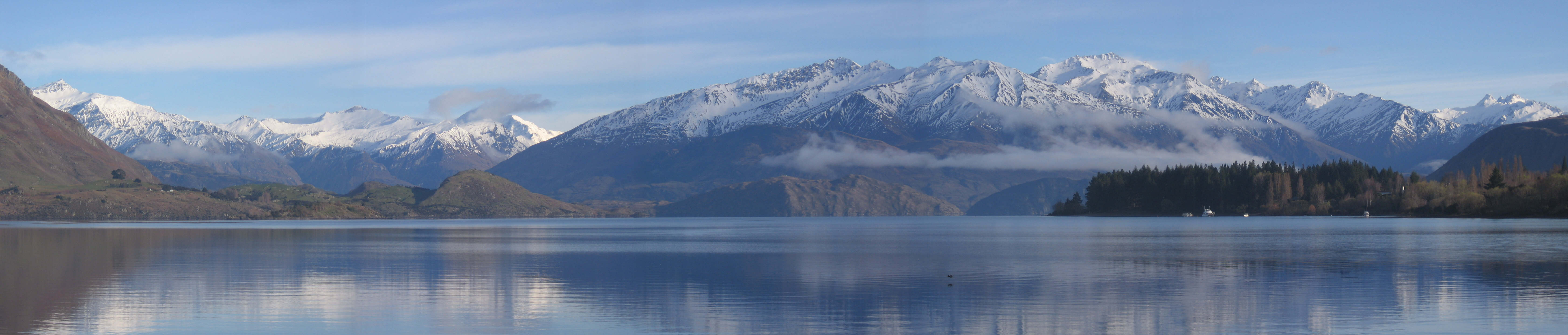
 View of Lake Wānaka from Mt. Roy. | |
 Lake Wānaka | |
 Location on the South Island | |
| Location | Queenstown-Lakes District, Otago, South Island |
| Coordinates | 44°30′S 169°08′E |
| Primary inflows | Makarora River, Mātukituki River |
| Primary outflows | Clutha River / Mata-Au |
| Basin countries | New Zealand |
| Max. length | 42 km (26 mi) |
| Max. width | 10 km (6.2 mi) |
| Surface area | 192 km2 (74 sq mi) |
| Max. depth | est. 311 m (1,020 ft)[1] |
| Surface elevation | 278 m (912 ft) |
| Islands | Harwich Island, Mou Tapu, Mou Waho, Ruby Island, Stevensons Island |
"Wānaka" is the South Island dialect pronunciation of wānanga, which means "the lore of the tohunga or priest"[2] or a place of learning.[6][Note 1]
Geography
Geography
Lake Wānaka lies at the heart of the Otago Lakes in the lower South Island of New Zealand. The township of Wānaka, which sits in a glacier-carved basin on the shores of the lake, is the gateway to Mt Aspiring National Park. Lake Hāwea is a 15-minute drive away, en route to the frontier town of Makarora, the last stop before the West Coast Glacier region. To the south is the historic Cardrona Valley, a popular scenic alpine route to neighbouring Queenstown.
Geology
Lake Wānaka lies in a u-shaped valley formed by glacial erosion during the last ice age more than 10,000 years ago. It is fed by the Mātukituki and Makarora Rivers, and is the source of the Clutha River / Mata-Au.
At its greatest extent, which is roughly along a north–south axis, the lake is 42 kilometres long. Its widest point, at the southern end, is 10 kilometres. The lake's western shore is lined with high peaks rising to over 2000 metres above sea level. Along the eastern shore the land is also mountainous, but the peaks are somewhat lower.
Nearby Lake Hāwea lies in a parallel valley carved by a neighbouring glacier eight kilometres to the east. At their closest point (a rocky ridge called The Neck), the lakes are only 1000 metres apart.[9]
Four small islands within the lake include Ruby Island, Stevensons Island, Mou Tapu and Mou Waho (Harwich) Island.[10] Some host ecological sanctuaries, such as one for buff weka on Stevensons Island.[11] Mou Tapu island is 120 hectares in size and is a pest free island. Mountain stone weta and the Southern Alps gecko can be found here.[12]
The towns of Wānaka and Albert Town are near the lake's outflow into the Clutha River / Mata-Au.
Climate
| Climate data for Lake Wānaka | |||||||||||||
|---|---|---|---|---|---|---|---|---|---|---|---|---|---|
| Month | Jan | Feb | Mar | Apr | May | Jun | Jul | Aug | Sep | Oct | Nov | Dec | Year |
| Average high °C (°F) | 23.9 (75.0) |
23.4 (74.1) |
20.8 (69.4) |
17.3 (63.1) |
12.2 (54.0) |
8.4 (47.1) |
8.4 (47.1) |
11.0 (51.8) |
14.4 (57.9) |
16.8 (62.2) |
19.8 (67.6) |
21.9 (71.4) |
16.5 (61.7) |
| Average low °C (°F) | 10.8 (51.4) |
10.4 (50.7) |
8.4 (47.1) |
5.1 (41.2) |
1.6 (34.9) |
−0.9 (30.4) |
−1.2 (29.8) |
−0.2 (31.6) |
2.4 (36.3) |
5.0 (41.0) |
7.3 (45.1) |
9.6 (49.3) |
4.9 (40.7) |
| Average precipitation mm (inches) | 56.9 (2.24) |
50.2 (1.98) |
60.7 (2.39) |
56.4 (2.22) |
62.7 (2.47) |
54.5 (2.15) |
52.2 (2.06) |
52.8 (2.08) |
56.4 (2.22) |
63.1 (2.48) |
54.7 (2.15) |
51.9 (2.04) |
672.5 (26.48) |
| Mean monthly sunshine hours | 231.5 | 201.7 | 182.6 | 164.0 | 135.5 | 120.5 | 126.6 | 155.8 | 172.5 | 193.8 | 202.2 | 212.1 | 2,098.8 |
| Source: http://www.lakewanaka.co.nz/content/library/Weather_data.pdf | |||||||||||||
Human history
Exploration and settlement
For Māori, the Wānaka area was a natural crossroads. The Haast Pass gave access to the West Coast and its pounamu; the Cardrona Valley led to the natural rock bridge "Whatatorere", which was the only place that the Kawarau River and Mata-Au (the Clutha River) could be crossed without boats.[13] Native reeds were used to build mōkihi, small boats that enabled a swift return downriver to the east coast.[14][15] The Cromwell basin supported a large population of moa, which were hunted to extinction about 500 years ago.[13]
Until the early nineteenth century, Wānaka was visited annually by Ngāi Tahu who sought pounamu in the mountains above the Haast River and hunted eels and birds over summer, returning to the east coast by descending Mata-Au in mōkihi (reed boats).[14]
According to the Ngāi Tahu, Lake Wānaka was dug by the Waitaha explorer Rākaihautū with his kō (foot plough) named Tūwhakaroria. After Waitaha arrived in the Uruao waka at Whakatū (Nelson), Rākaihautū divided his people into two groups. Rākaihautū led his group down the middle of the island, digging the freshwater lakes of Te Waipounamu (the South Island).[8]
Numerous kāinga mahinga kai (food-gathering places) and kāinga nohoanga (settlements) were located around the lake. The Kāti Māmoe settlement at the southern end of the lake was named Parakarehu. The area was invaded by the Ngāi Tahu in the early 18th century.[16]
Ngāi Tahu use of the land was ended by attacks by North Island tribes.[13] In the last years of the Musket Wars, in 1836 the Ngati Tama chief Te Puoho led a 100-person taua (war party), armed with muskets, down the West Coast and over the Haast Pass. They fell on the Ngāi Tahu encampment between Lake Wānaka and Lake Hāwea, capturing 10 people and killing and eating two children.[17] Although Te Puoho was later killed by the southern Ngāi Tahu leader Tuhawaiki,[18] Māori seasonal visits to the area ceased.
The first recorded map of Lake Wānaka was drawn in 1844 by the southern Ngāi Tahu leader Te Huruhuru.[8] The first Pākehā to see the lake was Nathaniel Chalmers in 1853.[19] Guided by Reko and Kaikoura, he walked from Tuturau (Southland) to the lake via the Kawarau River. However he was stricken by dysentery, so his guides returned him down the Clutha, shooting the rapids in a mōkihi.[20]
By 1861, several sheep stations had been established in and around the south end of the lake, and in 1862, the lake itself was surveyed in a whaleboat.[7]
Names
The name "Lake Wanaka" was in use in 1863 when the first survey of the proposed township of Wanaka was made.[21]
The town was renamed "Pembroke" within a month of the surveyor returning his books to Dunedin. It reverted to "Wanaka" on 1 September 1940, to reduce confusion between the names of the town and the lake.[21]
The official name of the lake was updated from "Lake Wanaka" to "Lake Wānaka" in 2019,[2] and the town's name to "Wānaka" in 2021.[22]
Current use and tourism

The lake is now a popular resort, and is much used in the summer for fishing, boating and swimming. The nearby mountains and fast-flowing rivers support adventure tourism year-round.
Popular activities include alpine and cross-country skiing and snowsports, tramping, mountain-biking, mountaineering, rock-climbing and parapenting.[23]
Conservation
As one of the few lakes in the South Island with an unmodified shoreline, the lake is protected by special legislation, the Lake Wanaka Preservation Act of 1973. The Act established a 'Guardians of Lake Wanaka' group, appointed by the Minister of Conservation, which advises on measures to protect the lake.[24]
Oxygen weed (Lagarosiphon major), an aquarium plant and invasive species native to Southern Africa, has been a problem in the lake's ecosystem for some time. Attempts to eradicate the weed have not been successful. Substantial suction dredging operations have shown promise, but tend to miss isolated spots which then regrow into larger weed beds.[25]
In popular culture
A willow growing just inside the lake, often known as That Wanaka Tree, is a tourist attraction in its own right, featuring on many tourists' Instagram feeds.[26]

In film
The region has been the setting for many international films, including The Lord of the Rings,[27] The Hobbit,[28] the Legend of S,[29] and A Wrinkle in Time.[30] Lake Wānaka was mentioned several times in the 2006 movie Mission: Impossible III as a location the lead couple visited and as the answer to Ethan Hunt's question on the phone to verify the identity of his wife.
The New Zealand cook and author Annabel Langbein, who owns a small estate at the side of the lake, filmed her series The Free Range Cook and Simple Pleasures here.
As a doomsday refuge
New Zealand, and Wānaka and Queenstown in particular, have been reported to be a favoured refuge for the 'super rich' in the event of a cataclysm.[31] One such high net worth individual is Peter Thiel, who purchased 193 hectares (480 acres) of lakeside land in 2015.[32] While he had not yet developed it as of 2020[update],[33] plans have been announced to develop it as a luxury resort.[34]
See also
- Lakes of New Zealand
- List of lakes in New Zealand
- Otago Geography
- Roys Peak
- Sentinel Peak (New Zealand)
Explanatory notes
References
- McKinnon, Malcolm (29 July 2015). "Lakes Wānaka and Hāwea". Te Ara: The Encyclopedia of New Zealand.
- "Place name detail: Lake Wānaka". New Zealand Gazetteer. New Zealand Geographic Board. Retrieved 10 April 2020.
- Lake Wānaka (from the Tourism New Zealand website)
- Otago Regional Council (Lake level monitoring)
- Taonga, New Zealand Ministry for Culture and Heritage Te Manatu. "19. – Otago places – Te Ara: The Encyclopedia of New Zealand". www.teara.govt.nz.
- "Wanaka". New Zealand History. Nga korero a ipurangi o Aotearoa. New Zealand Ministry for Culture and Heritage. Retrieved 7 November 2020.
- Wanaka, Lake (from Te Ara: The Encyclopedia of New Zealand, The 1966 New Zealand Encyclopaedia)
- "Lake Wānaka". Kā Huru Manu. Nga Rūnanga o Ngāi Tahu. Retrieved 19 April 2020.
- Lakes: Laka Wanaka and Hawea Archived 14 April 2012 at the Wayback Machine (from the Tourism New Zealand website)
- "Mou Waho Island (Harwich) Scenic Reserve, Lake Wanaka". Land Information New Zealand (LINZ). Retrieved 7 February 2021.
- "What's Up DOC – Wanaka". Television New Zealand. Retrieved 13 October 2011.
- "Wanaka islands". www.doc.govt.nz. Retrieved 7 February 2021.
- Janet Stephenson, Heather Bauchop, and Peter Petchey (2004). Bannockburn Heritage Landscape Study (PDF). p. 29.
{{cite book}}: CS1 maint: multiple names: authors list (link) - Malcolm McKinnon. "Otago region – Māori history and whaling". Te Ara – the Encyclopedia of New Zealand. Retrieved 7 January 2021.
- Hoturoa Barclay-Kerr. "Waka – canoes – Other types of waka". Te Ara – the Encyclopedia of New Zealand. Retrieved 7 January 2021.
- Taylor, W. A. "Lore and History of the South Island Maori". New Zealand Electronic Texts Collection. Retrieved 19 April 2020.
- S Percy Smith (1910). History and Traditions of the Maoris of the West Coast North Island of New Zealand Prior to 1840. New Plymouth: Polynesian Society.
- Atholl Anderson (1990). "Te Puoho-o-te-rangi". Te Ara – the Encyclopedia of New Zealand. Vol. 1. Retrieved 11 July 2017.
- Jock Phillips. "European exploration – Otago and Southland". Te Ara – the Encyclopedia of New Zealand. Retrieved 11 July 2017.
- Roger Frazer (1990). "Chalmers, Nathanael". Te Ara – the Encyclopedia of New Zealand. Dictionary of New Zealand Biography. Vol. 1. Retrieved 13 July 2017.
- Dovey, Pam (13 June 2017). "A look back at Pembroke (Wanaka Township)". Wanaka Sun. Wanaka Sun. Retrieved 31 July 2021.
- "Amendments—New Zealand Geographic Board Ngā Pou Taunaha o Aotearoa – 2021-ln3385 – New Zealand Gazette". gazette.govt.nz. Retrieved 2 September 2021.
- "Wanaka in detail: activities". Retrieved 22 May 2021.
- Briefing to the incoming Minister of Conservation 2011 – containing information about Statutory bodies, including the Guardians (from the Department of Conservation website, Friday 14 December 2012)
- "Assessment of the 2005/06 Lagarosiphon major programme in Lake Wanaka" (PDF). Archived from the original (PDF) on 20 September 2009. (1.20 MiB) (NIWA report, June 2006, from the Land Information New Zealand website)
- "Wanaka's famous Instagram tree attacked with a saw". The Guardian. Retrieved 18 April 2020.
- "The Lord of the Rings Location: Tarras & Wanaka".
- "The Hobbit Trilogy Filming Locations".
- Otago Daily Times (5 May 2017). "Chinese fantasy filming in Wanaka". Retrieved 27 January 2018.
- "Witherspoon, Winfrey and Kaling in Wanaka and Lake Hāwea".
- Osnos, Evan (23 January 2017). "Doomsday Prep for the Super-Rich". The New Yorker (30 January 2017). Retrieved 18 April 2020.
- "Facebook billionaire Peter Thiel a Kiwi citizen, owns Wanaka estate". New Zealand Herald. Retrieved 18 April 2020.
- "Thiel's Wanaka estate reportedly left 'neglected'". Otago Daily Times. 16 May 2020. Retrieved 17 May 2020.
- "Exclusive: US billionaire Peter Thiel proposes luxury lodge near Wanaka". The New Zealand Herald. 1 September 2021.
External links
 Media related to Lake Wānaka at Wikimedia Commons
На других языках
[de] Lake Wānaka
Der Lake Wānaka ist der viertgrößte Binnensee Neuseelands und befindet sich im Westen der Region Otago auf der Südinsel des Landes. Die Maori-Bezeichnung Wānaka leitet sich wahrscheinlich vom Begriff Oanaka ab, was so viel wie "Platz des Anaka" bedeutet.- [en] Lake Wānaka
[fr] Lac Wanaka
Le lac Wanaka est un lac de l'île du Sud en Nouvelle-Zélande, située dans la région d'Otago à une altitude de 300 m. Recouvrant 192 km2, il est le quatrième plus grand lac de la Nouvelle-Zélande[1]. Sa profondeur maximale est estimée à 300 m.[it] Lago Wanaka
Il lago Wanaka è un bacino d'acqua morenico che si trova nella regione di Otago in Nuova Zelanda.[ru] Уанака (озеро)
Уанака (англ. Lake Wanaka) — озеро в Новой Зеландии в регионе Отаго. Площадь — 193 км²[1]. Высота — 280 метров над уровнем моря[1].Другой контент может иметь иную лицензию. Перед использованием материалов сайта WikiSort.org внимательно изучите правила лицензирования конкретных элементов наполнения сайта.
WikiSort.org - проект по пересортировке и дополнению контента Википедии