geo.wikisort.org - Reservoir
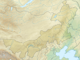
Lake Dai, also known by its Chinese name Daihai, is a lake in Liangcheng County, Ulanqab Prefecture, Inner Mongolia, China.
| Lake Dai 岱海 | |
|---|---|
 View of lake taken during ISS Expedition 23 | |
 Lake Dai 岱海 | |
| Location | Liangcheng County, Ulanqab Prefecture, Inner Mongolia, China |
| Coordinates | 40°34′05″N 112°41′22″E |
| Basin countries | China |
| Max. length | 25 km (16 mi) |
| Max. width | 20 km (12 mi) |
| Surface area | 160 km2 (62 sq mi) |
| Average depth | 9 m (30 ft) |
| Max. depth | 15–18 m (49–59 ft) |
| Lake Dai | |||||||||
|---|---|---|---|---|---|---|---|---|---|
| Chinese | 岱海 | ||||||||
| |||||||||
Geography
Lake Dai is a round lake with an area of about 160 km2 (62 sq mi), measuring about 25 kilometers (16 mi) from east to west and about 20 kilometers (12 mi) from north to south. It has an average depth of about 9 meters (30 ft) and a maximal depth of 15–18 meters (49–59 ft).
History
Under the Qin, Huangqi and Dai lakes formed the northern boundaries of Yanmen Commandery, marking part of the northern frontier of the Chinese empire.[1]
References
Citations
Bibliography
- Li Shizhen (2017), Hua Linfu; et al. (eds.), Ben Cao Gang Mu Dictionary, Vol. II: Geographical and Administrative Designations, Berkeley: University of California Press, ISBN 9780520291966.
External links
На других языках
[de] Daihai
Der See Daihai oder Dai Hai (chinesisch .mw-parser-output .Hani{font-size:110%}岱海, Pinyin Dài Hǎi, englisch Daihai Lake) ist ein See im Osten des Kreises Liangcheng der bezirksfreien Stadt Ulanqab im chinesischen Autonomen Gebiet der Inneren Mongolei. Es handelt sich um einen sogenannten Grabenbruchsee. Ursprünglich war er ein Salzsee, der sich aber durch Zustrom von Flüssen allmählich zu einem Süßwassersee gewandelt hat.- [en] Lake Dai
Текст в блоке "Читать" взят с сайта "Википедия" и доступен по лицензии Creative Commons Attribution-ShareAlike; в отдельных случаях могут действовать дополнительные условия.
Другой контент может иметь иную лицензию. Перед использованием материалов сайта WikiSort.org внимательно изучите правила лицензирования конкретных элементов наполнения сайта.
Другой контент может иметь иную лицензию. Перед использованием материалов сайта WikiSort.org внимательно изучите правила лицензирования конкретных элементов наполнения сайта.
2019-2025
WikiSort.org - проект по пересортировке и дополнению контента Википедии
WikiSort.org - проект по пересортировке и дополнению контента Википедии