geo.wikisort.org - Горы
Пеннины (англ. Pennines) — невысокие (не более 900 метров высоты) горы в Великобритании, расположенные в северной Англии. Отделяют Северо-Западную Англию от Йоркшира и Северо-Восточной Англии.
| Пеннинские горы | |
|---|---|
| англ. Pennines | |
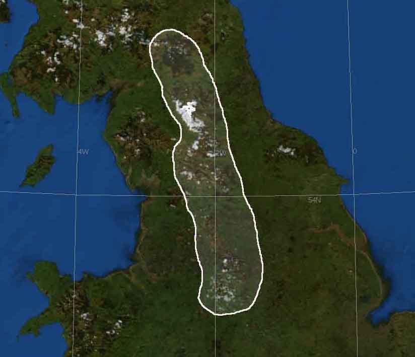 Пеннинские горы на карте Великобритании. | |
| Характеристики | |
| Площадь | 31 048 км² |
| Длина | 356 км |
| Ширина | 160 км |
| Высшая точка | |
| Высочайшая вершина | Кросс-Фелл |
| Высшая точка | 893[1] м |
| Расположение | |
| 54°10′ с. ш. 1°54′ з. д.HGЯO | |
| Страна |
|
| Регион | Англия |

Общая длина около 350 км, высота до 893 м (гора Кросс-Фелл). Горные породы — в основном известняк и песчаник. Имеются торфяники и месторождения каменного угля. Открытие в XVII—XVIII веках угольных месторождений, в частности, Йоркширского угольного бассейна, послужило толчком к развитию прилегающих к горам районов, однако Пеннинские горы — по-прежнему один из наименее населённых районов Великобритании.
В Пеннинских горах расположен Национальный парк «Пик-Дистрикт».
Примечания
- Peakbagger.com. Дата обращения: 12 февраля 2013. Архивировано 15 октября 2013 года.
Ссылки
- Пеннинские горы // Словарь современных географических названий / Рус. геогр. о-во. Моск. центр; Под общ. ред. акад. В. М. Котлякова. Институт географии РАН. — Екатеринбург: У-Фактория, 2006.
- Энциклопедия «Кругосвет» Архивная копия от 9 января 2009 на Wayback Machine
На других языках
[de] Pennines
Die Pennines [.mw-parser-output .IPA a{text-decoration:none}ˈpɛnaɪnz] (dt. auch Penninen) sind ein rund 400 km langes Mittelgebirge in England. Sie verlaufen vom Peak District in den Midlands über Teile von Greater Manchester, die Yorkshire Dales, die West Pennine Moors in Lancashire und die Cumbria Fells zu den Cheviot Hills an der Grenze zu Schottland. Die Pennines werden häufig als das „Rückgrat Englands“ bezeichnet.[1][en] Pennines
The Pennines (/ˈpɛnaɪnz/), also known as the Pennine Chain or Pennine Hills,[1] are a range of uplands running between three regions of Northern England: North West England on the west, and North East England and Yorkshire and the Humber on the east. Commonly described as the "backbone of England",[2][3] the range stretches northwards from the Peak District at the southern end, through the South Pennines, the Yorkshire Dales and North Pennines to the Tyne Gap, which separates the range from the Cheviot Hills across the Anglo-Scottish border (some definitions include the Cheviot Hills). South of the Aire Gap is a western spur into east Lancashire, comprising the Rossendale Fells, West Pennine Moors[4] and the Bowland Fells in North Lancashire.[5] The Howgill Fells[6] and Orton Fells[7] in Cumbria are sometimes considered to be Pennine spurs to the west of the range. The Pennines are an important water catchment area with numerous reservoirs in the head streams of the river valleys.[es] Peninos
Los Peninos (Pennines en inglés) son una formación montañosa situada entre el sur de Escocia y el norte de Inglaterra. A menudo son llamados "la espina dorsal de Inglaterra".[1][2][3] Los Peninos forman una cadena continua que se prolonga desde los Midlands, por los Valles de Yorkshire, partes de Mánchester, al este de Lancashire y Cumbria, perdiéndose por las Colinas Cheviot, en la frontera escocesa. Su longitud total es aproximadamente de 250 millas, unos 400 kilómetros.[fr] Pennines
Les Pennines sont une chaîne de montagne du Royaume-Uni située dans le centre et le nord de l'Angleterre. De par son extension nord-sud, sa position centrale dans la Grande-Bretagne et constituant le seul relief vraiment étendu de l'Angleterre, elle est surnommée « la colonne vertébrale de l'Angleterre », en anglais the backbone of England. Son nom est issu du celtique penno qui signifie « tête » > « sommet ».[it] Monti Pennini
I monti Pennini (Pennines in inglese) sono una catena montuosa o collinare inglese, che si estende dal Peak District nelle Midlands fino alle Cheviot Hills, sul confine scozzese, per una lunghezza di 400 chilometri. Questa catena non è molto alta ed è per questo che si parla spesso di colline.- [ru] Пеннинские горы
Текст в блоке "Читать" взят с сайта "Википедия" и доступен по лицензии Creative Commons Attribution-ShareAlike; в отдельных случаях могут действовать дополнительные условия.
Другой контент может иметь иную лицензию. Перед использованием материалов сайта WikiSort.org внимательно изучите правила лицензирования конкретных элементов наполнения сайта.
Другой контент может иметь иную лицензию. Перед использованием материалов сайта WikiSort.org внимательно изучите правила лицензирования конкретных элементов наполнения сайта.
2019-2026
WikiSort.org - проект по пересортировке и дополнению контента Википедии
WikiSort.org - проект по пересортировке и дополнению контента Википедии