geo.wikisort.org - Mountains
Zard-Kuh (meaning "Yellow Mountain", also spelled Zardkuh, Zarduh Kuh[2] or Zard Kuh-e Bakhtiari; Persian: زردکوه بختیاری) is a sub-range in the central Zagros Range, Iran.
| Zard-Kuh زردکوه بختیاری | |
|---|---|
| Kolunchin | |
 | |
| Highest point | |
| Elevation | 4,221 m (13,848 ft)[1] |
| Prominence | 2,095 m (6,873 ft)[1] |
| Listing | Ultra |
| Coordinates | 32°21′52″N 50°4′39″E |
| Naming | |
| English translation | Yellow Mountain |
| Language of name | Persian |
| Geography | |
 Zard-Kuh زردکوه بختیاری Iran | |
| Parent range | Zagros Mountains |
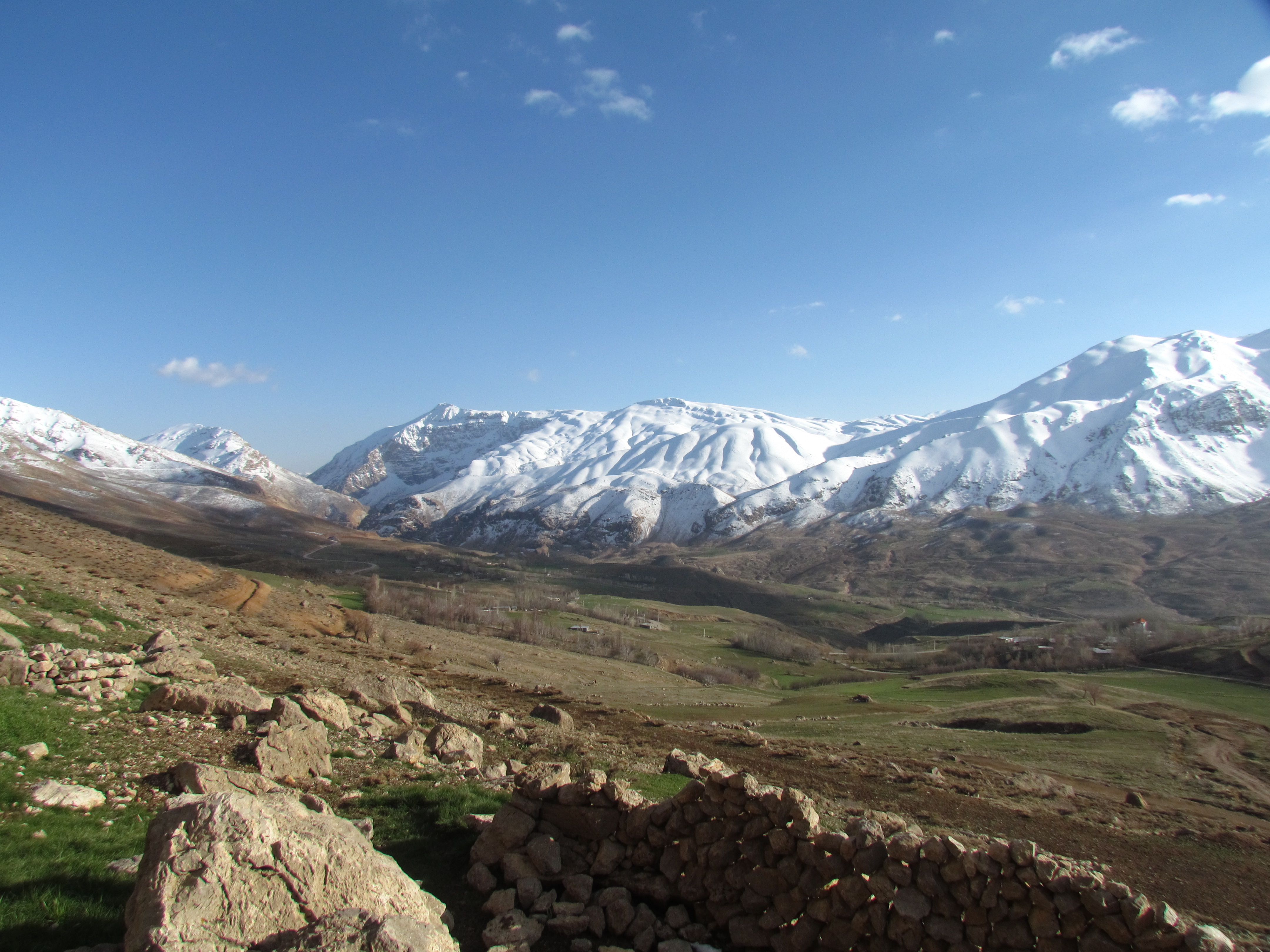
With an elevation of 4221 metres, the Zard-Kuh is located in the Zagros Mountains in the Chaharmahal and Bakhtiari Province of Iran.[3] The Karun and also Zayanderud rivers start in the Zagros mountains near the Zard-Kuh. There are small glaciers on the mountain owing to the relatively high precipitation, which are the only glaciers in the subtropics outside the Himalayas, Andes and Trans-Mexican Volcanic Belt.[4]
Geologically, the Zard-Kuh is situated in the Sanandaj-Sirjan geologic and structural zone of Iran and is mainly made of Cretaceous limestone.[5]
The famous early documentary Grass captures on film the Bakhtiari tribe's crossing of Zard-Kuh barefoot in the snow with 50,000 people and 125,000 animals.
See also
References
- "Iran: 54 Mountain Summits with Prominence of 1,500 meters or greater" Peaklist.org. Sources differ significantly on the elevation of this peak. Peakbagger for example gives an elevation of 4,548 m and a prominence of 2,443 m. Retrieved 2012-04-29.
- Rawlinson, George. 2002. The Seven Great Monarchies of the Ancient Eastern World (Vol. 2: Babylonia, Media and Persia)
- Microsoft Encarta World Atlas, 2001, Microsoft Corporation
- Glaciers of Iran
- Geological Map of Iran, National Geoscience Database of Iran, www.ngdir.ir
External links
| Authority control |
|
|---|
This Chaharmahal and Bakhtiari province location article is a stub. You can help Wikipedia by expanding it. |
На других языках
[de] Zard Kuh
Zard Kuh oder Zard-e Kuh-e Bakhtiari (persisch زردکوه, sprich: Zardkuh; Zard Kuh bedeutet „gelber Berg“) ist ein 4221 m hoher Berg im Zāgros-Gebirge. Er liegt in der Nähe der Stadt Kuhrang in der iranischen Provinz Tschahār Mahāl und Bachtiyāri.- [en] Zard-Kuh
[fr] Zard Kuh
Zard Kuh, Zardkuh ou Zard-e Kuh-e Bakhtiari (en persan : زردكوه بختياري) est un massif des monts Zagros. Son sommet principal, Kolonchin, culmine à 4 221 m d'altitude, ce qui lui vaut d'être le deuxième massif le plus élevé[1] des monts Zagros (après le massif de Dena) et d'être recouvert de neiges éternelles. Il s'élève dans la préfecture de Kuhrang dans la province de Chahar Mahaal et Bakhtiari en Iran. La rivière Bazoft, affluent du fleuve Karoun, prend sa source dans les monts Zagros, à proximité du Zard Kuh.[it] Zard Kuh
Zard Kuh (toponimo che significa montagna gialla - reso anche Zardkuh o Zard-e Kuh, in persiano زردكوه) è una montagna di 4.221 m di altezza che si erge al centro della catena dei monti Zagros in Iran, a nord del Golfo Persico.Другой контент может иметь иную лицензию. Перед использованием материалов сайта WikiSort.org внимательно изучите правила лицензирования конкретных элементов наполнения сайта.
WikiSort.org - проект по пересортировке и дополнению контента Википедии