geo.wikisort.org - Mountains
Skjaldbreiður (Icelandic pronunciation: [ˈscaltˌpreiːðʏr̥], "broad shield") is an Icelandic lava shield formed in one huge and protracted eruption roughly 9,000 years ago[citation needed]. The extensive lava fields which were produced by this eruption, flowed southwards, and formed the basin of Þingvallavatn, Iceland's largest lake, and Þingvellir, the "Parliament Plains" where the Icelandic national assembly, the Alþing was founded in 930.
This article may be expanded with text translated from the corresponding article in Icelandic. (January 2022) Click [show] for important translation instructions.
|
| Skjaldbreiður | |
|---|---|
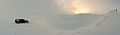
 Skjaldbreiður as seen from Þingvellir | |
| Highest point | |
| Elevation | 1,060 m (3,480 ft) |
| Coordinates | 64°24′36″N 20°45′44″W |
| Naming | |
| English translation | broad shield |
| Language of name | Icelandic |
| Geography | |
 Skjaldbreiður Iceland | |
| Geology | |
| Age of rock | 9,000 years |
| Mountain type | shield volcano |
The volcano summit is at 1,060 metres, and its crater measures roughly 300 metres in diameter.
Straddling the Mid-Atlantic ridge, the lava fields from Skjaldbreiður have been torn and twisted over the millennia, forming a multitude of fissures and rifts inside the Þingvellir National Park, the best known of which are Silfra, Almannagjá [ˈalˌmanːaˌcauː], Hrafnagjá [ˈr̥apnaˌcauː] and Flosagjá [ˈflɔːsaˌcauː].
Gallery
 Skjaldbreiður crater in snow.
References
- Scarth, Alwyn; Tanguy, Jean-Claude (2001). Volcanoes of Europe. Oxford University Press. pp. 243 pp. ISBN 0-19-521754-3.
- Thordarson, Thor; Hoskuldsson, Armann (2002). Iceland (Classic Geology in Europe 3). Terra Publishing. pp. 208 pp. ISBN 1-903544-06-8.
На других языках
[de] Skjaldbreiður
Der Skjaldbreiður (isl. breiter Schild) ist ein Schildvulkan im Südwesten Islands. Er liegt auf dem Gemeindegebiet von Bláskógabyggð. Er entstand bei einem Ausbruch vor etwa 9.000 Jahren. Der Vulkan ist 1060 m hoch, sein Krater hat einen Durchmesser von etwa 300 m. Sein Basisdurchmesser liegt bei etwa 15 km.- [en] Skjaldbreiður
[fr] Skjaldbreiður
Le Skjaldbreiður, est un volcan bouclier d'Islande culminant à 1 060 mètres d'altitude.[ru] Скьяльдбрейдюр
Скьяльдбрейдюр (исл. Skjaldbreiður — широкий щит) — щитовой вулкан на юго-западе Исландии в муниципалитете Блаускоугабиггд. Возник в результате мощного извержения примерно 9000 лет назад. Вулкан достигает высоты 1060 м, диаметр кратера составляет около 300 м. Диаметр основания достигает 15 км.Другой контент может иметь иную лицензию. Перед использованием материалов сайта WikiSort.org внимательно изучите правила лицензирования конкретных элементов наполнения сайта.
WikiSort.org - проект по пересортировке и дополнению контента Википедии