geo.wikisort.org - Mountains
The Serra do Mar ([ˈsɛʁɐ du ˈmaɾ], Portuguese for Sea's Ridge or Sea Ridge) is a 1,500 km long system of mountain ranges and escarpments in Southeastern Brazil.
| UNESCO World Heritage Site | |
|---|---|
 | |
| Location | Rio De Janeiro, São Paulo, Paraná, Santa Catarina, Rio Grande do Sul, Minas Gerais, Espírito Santo Brazil |
| Criteria | Natural: (vii)(ix)(x) |
| Reference | 893rev |
| Inscription | 1999 (23rd Session) |
| Area | 468,193 ha (1,807.70 sq mi) |
| Buffer zone | 1,223,557 ha (4,724.18 sq mi) |
| Coordinates | 24°10′S 48°0′W |
 Location of Serra do Mar in Brazil | |


Geography
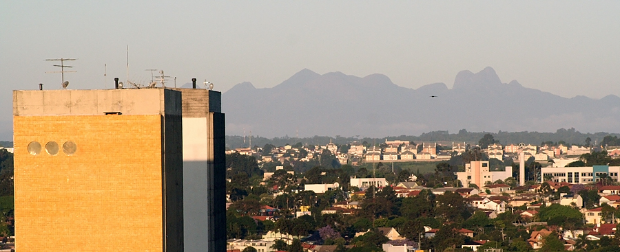
The Serra do Mar runs parallel to the Atlantic Ocean coast from the state of Espírito Santo to southern Santa Catarina,[1] although some literature includes the Serra Geral in the Serra do Mar, in which case the range would extend to northeastern Rio Grande do Sul.
The main escarpment forms the boundary between the sea-level littoral and the inland plateau (planalto), which has a mean altitude of 500 to 1,300 metres (1,600 to 4,300 ft). This escarpment is part of the Great Escarpment that runs along much of the eastern coast of Brazil south from the city of Salvador, Bahia.
Mountain ranges
The mountain ranges are discontinuous in several places and are given individual names such as Serra de Bocaina, Serra de Paranapiacaba, Serra Negra, Serra dos Órgãos, Serra do Indaiá, etc. The range also extends to some large islands near the coastline, such as Ilhabela and Ilha Anchieta. With an altitude of 2,255 metres (7,398 ft), Pico da Caledônia in Nova Friburgo is among the highest points in Serra do Mar.
Geologically, the range belongs to the massive crystalline rock platform that forms Eastern South America, and tectonically it is very stable. Most of the elevations of Serra do Mar were formed about 60 million years ago.
Natural history

At the time of the European discovery of Brazil (1500), the Serra do Mar supported a rich and highly diversified ecosystem, composed mainly of lush tropical rain forest, called Atlantic Forest (Mata Atlântica). Due to urbanization and deforestation, however, most of the forest cover has been destroyed and what cover remains is almost exclusively on the steep escarpments facing the sea.
A chain of national and state parks, ecological stations and biological reserves now protect the Mata Atlântica and its biological heritage, but acid rain, pollution, poachers, clandestine loggers, forest fires and encroachment by urban areas and farms are still causing active destruction, particularly in the areas around cities. Several large metropolises, such as Vale do Itajaí, Curitiba, São Paulo and Rio de Janeiro, are near the Serra do Mar.
Reforestation and recuperation of biological diversity are notoriously difficult to bring about in destroyed rain forest habitats.
See also
- Flora of the Atlantic Forest
- Ecoregions of the Atlantic Forest biome
- List of plants of Atlantic Forest vegetation of Brazil
Serra do Mar.
References
- Angulo, R. J., G. C. Lessa, M. C. de Souza (2009). The Holocene Barrier Systems of Paranaguá and Northern Santa Catarina Coasts, Southern Brazil. Lecture Notes in Earth Sciences 107: 135-176.
World Heritage Sites in Brazil | ||
|---|---|---|
| North Region |
|   |
| Northeast Region |
| |
| Central-West Region | ||
| Southeast Region |
| |
| South Region |
| |
| ||
На других языках
[de] Serra do Mar
Die Serra do Mar (portugiesisch für Gebirgszug des Meeres) ist ein 1500 km langer Gebirgszug im Südosten Brasiliens in den Bundesstaaten Espírito Santo, Rio de Janeiro, São Paulo, Paraná und Santa Catarina, der parallel zum Atlantischen Ozean verläuft. Sie ist Teil des südlichen brasilianischen Berglandes. Seine durchschnittliche Höhe liegt zwischen 500 und 1300 m und seine höchste Erhebung ist der Pico Maior de Friburgo mit 2316 m.- [en] Serra do Mar
[es] Serra do Mar
La sierra del Mar (en portugués, Serra do Mar) es una cadena montañosa del relieve brasileño que se extiende aproximadamente unos 1500 km a lo largo del litoral desde el este hacia el sur del país, yendo desde el Estado de Río de Janeiro hasta el norte del Estado de Santa Catarina.[1] El punto más elevado es el pico Maior de Friburgo, con una altura de 2310 m s. n. m..[fr] Serra do Mar
La serra do Mar est une formation montagneuse du sud du Brésil. Elle s'étend sur 1 500 km le long du littoral atlantique, de l'État de l'Espírito Santo au sud de Santa Catarina, passant par les États de Rio de Janeiro, de São Paulo et du Paraná.[it] Serra do Mar
Serra do Mar (ˈsɛʁɐ du ˈmaɾ, dal significato in portoghese di cresta di mare) è un sistema montuoso lungo 1.500 km nel sud-est del Brasile.[ru] Серра-ду-Мар
Се́рра-ду-Мар (порт. Serra do Mar) — горная система Бразильского плоскогорья[1] в юго-восточной части Бразилии[2]. Простирается вдоль побережья Атлантического океана на 1500 км — от севера штата Санта-Катарина до северо-восточной части штата Рио-де-Жанейро.Другой контент может иметь иную лицензию. Перед использованием материалов сайта WikiSort.org внимательно изучите правила лицензирования конкретных элементов наполнения сайта.
WikiSort.org - проект по пересортировке и дополнению контента Википедии