geo.wikisort.org - Mountains
The Queen Maud Mountains are a major group of mountains, ranges and subordinate features of the Transantarctic Mountains, lying between the Beardmore and Reedy Glaciers and including the area from the head of the Ross Ice Shelf to the Antarctic Plateau in Antarctica. Captain Roald Amundsen and his South Pole party ascended Axel Heiberg Glacier near the central part of this group in November 1911, naming these mountains for the Norwegian queen Maud of Wales.[2] Despite the name, they are not located within Queen Maud Land.
| Queen Maud Mountains | |
|---|---|
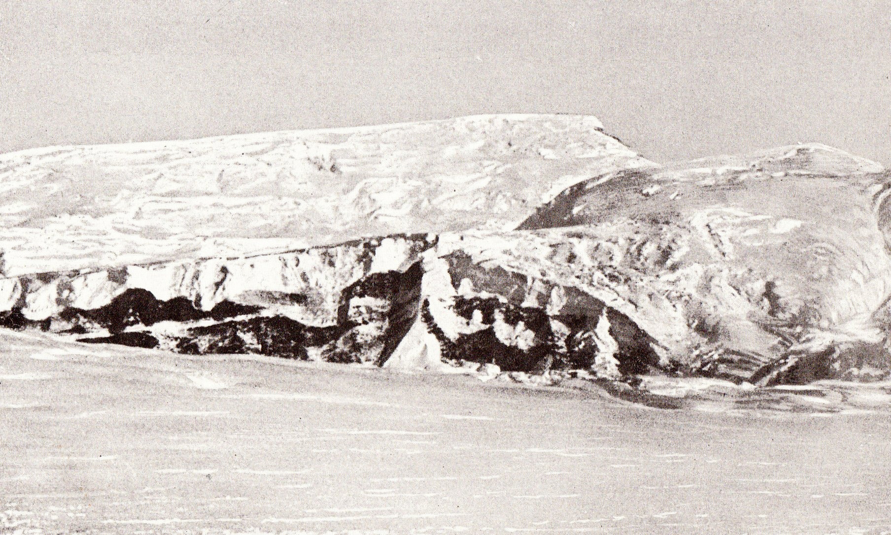 Photo of Mount Fridtjof Nansen in the Queen Maud Mountains taken by Roald Admundsen | |
| Highest point | |
| Peak | Mount Kaplan[1] |
| Elevation | 4,230 m (13,880 ft) |
| Coordinates | 84°33′00″S 175°19′00″W |
| Geography | |
 Queen Maud Mountains Location of Queen Maud mountains in Antarctica | |
Elevations bordering the Beardmore Glacier, at the western extremity of these mountains, were observed by the British expeditions led by Ernest Shackleton (1907–09) and Robert Falcon Scott (1910-13), but the mountains as a whole were mapped by several American expeditions led by Richard Evelyn Byrd (1930s and 1940s), and United States Antarctic Program (USARP) and New Zealand Antarctic Research Program (NZARP) expeditions from the 1950s through the 1970s.[2]
Features
Geographical features include:
Barton Mountains
Bush Mountains
- Anderson Heights
- Kosco Glacier
- McIntyre Promontory
- Mincey Glacier
- Mount Boyd
- Mount Cromie
- Ramsey Glacier
Commonwealth Range
- Airdrop Peak
- Beardmore Glacier
- Beetle Spur
- Celebration Pass
- Dolphin Spur
- Ebony Ridge
- Flat Top
- Hood Glacier
- Keltie Glacier
- Lands End Nunataks
- Ludeman Glacier
- Mount Cyril
- Mount Donaldson
- Mount Harcourt
- Mount Henry
- Mount Kathleen
- Mount Kyffin
- Mount Patrick
- Mount Robert Scott
- Osicki Glacier
- Pain Neve
- Separation Range
- Siege Dome
Dominion Range
- Ashworth Glacier
- Browns Butte
- Davis Nunataks
- Kane Rocks
- Koski Glacier
- Meyer Desert
- Mill Glacier
- Mount Cecily
- Mount Mills
- Plunket Point
- Rutkowski Glacier
- Scott Icefalls
- Vandament Glacier
Gothic Mountains
- Organ Pipe Peaks
- Sanctuary Glacier
- The Spectre
Grosvenor Mountains
- Aitken Nunatak
- Block Peak
- Hayman Nunataks
- Hayman
- Johnston Heights
- Larkman Nunatak
- Mauger Nunatak
- Mount Block
- Mount Bumstead
- Mount Cecily
- Mount Pratt
- Mount Raymond
- Otway Massif
Hays Mountains
- Cappellari Glacier
- Cox Peaks
- Dragons Lair Névé
- Fission Wall
- Forbidden Valley
- Heinous Peak
- Koerwitz Glacier
- Mount Armstrong
- Mount Astor
- Mount Borcik
- Mount Colbert
- Mount Crockett
- Mount Dayton
- Mount Dietz
- Mount Gevers
- Mount Goodale
- Mount Griffith
- Mount Stump
- Mount Thorne
- Mount Vaughan
- Mount Walshe
- Scott Glacier
- Sledging Col
- Souchez Glacier
- Vaughan Glacier
Herbert Range
- Axel Heiberg Glacier
- Bell Peak
- Bigend Saddle
- Cohen Glacier
- Mount Balchen
- Mount Betty
- Mount Cohen
- Sargent Glacier
- Strom Glacier
- Zigzag Bluff
Hughes Range
- Alan Tower Waterman
- Campbell Cliffs
- Canyon Glacier
- Good Glacier
- Haynes Table
- Lane Plateau
- Millington Glacier
- Mount Brennan
- Mount Bronk
- Mount Cartwright
- Mount Kaplan
- Mount Odishaw
- Pain Neve
- Perez Glacier
- Shanklin Glacier
La Gorce Mountains
- Ackerman Ridge
- Beard Peak
- Delta Peak
- Gjertsen Promontory
- Goldstream Peak
- Graves Nunataks
- Hourglass Buttress
- Johansen Peak
- Kessens Peak
- Klein Glacier
- Mount Gjertsen
- Mount Grier
- Mount Mooney
- Mount Paine
- Robison Glacier
- Scott Glacier
- Surprise Spur
- Waterhouse Spur
Prince Olav Mountains
- Allaire Peak
- Barrett Glacier
- Cape Irwyn
- Centennial Peak
- Clark Spur
- Gough Glacier
- Hardiman Peak
- Harwell Glacier
- Holzrichter Glacier
- Jones Peak
- Krout Glacier
- Longhorn Spurs
- McGregor Glacier
- Mercik Peak
- Mount Campbell
- Mount Dodge
- Mount Finley
- Mount Fisher
- Mount Hall
- Mount Kenney
- Mount Krebs
- Mount Llano
- Mount McCue
- Mount Munson
- Mount Oliver
- Mount Ray
- Mount Roe
- Mount Sellery
- Mount Smithson
- Mount Wade
- Mount Wells
- Mount Wendland
- Watt Ridge
- Zotikov Glacier
Quarles Range
- Bowman Glacier
- Cooper Glacier
- Mohn Basin
- Mount Belecz
- Mount Dean
- Mount Ruth Gade
- Mount Wedel-Jarlsberg
- Schobert Nunatak
Rawson Mountains
- Amundsen Glacier
- Mount Weaver
- Mount Wyatt
- Scott Glacier
Supporters Range
- Ashworth Glacier
- Jensen Glacier
- Laird Glacier
- Mill Glacier
- Mill Stream Glacier
- Mount Henry Lucy
- Mount Iveagh
- Mount Judd
- Mount Kinsey
- Mount Westminster
- Mount White
- Ranfurly Point
- Scully Terrace
- Snakeskin Glacier
Tapley Mountains
- Albanus Glacier
- Bobo Ridge
- Durham Point
- Evans Butte
- Leverett Glacier
- Mount Andes
- Mount Bushnell
- Mount Durham
- Mount Herr
- Mount Seebeck
- Mount Stahlman
- Mount Wallace
- Pincer Point
- Roe Glacier
- Scott Glacier
Other features
- Amphibole Peak
- Amundsen Glacier
- Amundsen Icefall
- Anderson Ridge
- Barracouta Ridge
- Bartlett Bench
- Beck Peak
- Breyer Mesa
- Butchers Spur
- Bynum Peak
- Cascade Bluff
- Cenotaph Hill
- Chevron Rocks
- Christy Glacier
- Collinson Ridge
- Coloured Peak
- Cowie Dome
- Crack Bluff
- Crilly Hill
- Cunningham Glacier
- Curtis Peaks
- Davis Hills
- Dick Glacier
- Dunn Spur
- Epidote Peak
- Epler Glacier
- Erb Range
- Erickson Glacier
- Faulkner Escarpment
- Feeney Col
- Fernette Peak
- Ford Spur
- Forman Glacier
- Fram Mesa
- Fulgham Ridge
- Fuller Dome
- Garcia Point
- Gardner Ridge
- Gerasimou Glacier
- Gjelsvik Peak
- Goodale Glacier
- Gray Peak
- Gregory Ridge
- Haas Glacier
- Hansen Spur
- Hare Peak
- Held Glacier
- Holdsworth Glacier
- Howe Glacier
- Husky Dome
- Husky Heights
- June Nunatak
- Keel Hill
- Kitching Ridge
- Kranz Peak
- Kutschin Peak
- Layman Peak
- Lee Peak
- Lindstrøm Peak
- Liv Glacier
- McCuistion Glacier
- McDonough Nunataks
- McNally Peak
- Moffett Glacier
- Moraine Canyon
- Mount Alice Gade
- Mount Amherst
- Mount Andrews
- Mount Behling
- Mount Benjamin
- Mount Bennett
- Mount Bjaaland
- Mount Blackburn
- Mount Blood
- Mount Bowlin
- Mount Bowser
- Mount Clarke
- Mount Clough
- Mount Cole
- Mount Cope
- Mount Czegka
- Mount Danforth
- Mount Deardorff
- Mount Denauro
- Mount Dockery
- Mount Don Pedro Christophersen
- Mount Ehrenspeck
- Mount Ellsworth
- Mount Fairweather
- Mount Farley
- Mount Ferguson
- Mount Fridtjof Nansen
- Mount Gardiner
- Mount Hanssen
- Mount Harkness
- Mount Hassel
- Mount Hermanson
- Mount Innes-Taylor
- Mount Johnstone
- Mount Kendrick
- Mount Kristensen
- Mount Maloney
- Mount McKercher
- Mount Meeks
- Mount Nansen
- Mount Nelson
- Mount Noville
- Mount Orndorff
- Mount Prestrud
- Mount Przywitowski
- Mount Pulitzer
- Mount Redifer
- Mount Riley
- Mount Roland
- Mount Rosenwald
- Mount Russell
- Mount Ruth
- Mount Saltonstall
- Mount Schevill
- Mount Stubberud
- Mount Suarez
- Mount Sundbeck
- Mount Toth
- Mount Valinski
- Mount Verlautz
- Mount Warden
- Mount Wasko
- Mount Wilbur
- Mount Wisting
- Muck Glacier
- Munizaga Peak
- Nilsen Plateau
- Norway Glacier
- Olds Peak
- Olsen Crags
- Pallid Peak
- Parker Bluff
- Patterson Peak
- Pegmatite Peak
- Pendant Ridge
- Polaris Peak
- Poulter Glacier
- Price Bluff
- Rawson Mountains
- Rawson Plateau
- Red Raider Rampart
- Reedy Glacier
- Reid Spur
- Roaring Cliffs
- Robinson Bluff
- Sagehen Nunataks
- Schmidt Peak
- Scudder Mountain
- Seabee Heights
- Shackleton Glacier
- Sheridan Bluff
- Simmonds Peak
- Simplicity Hill
- Steagall Glacier
- Sverre Hassel
- Szabo Bluff
- Tate Glacier
- Taylor Nunatak
- Taylor Ridge
- Teller Peak
- Thomas Spur
- Thrinaxodon Col
- Titan Dome
- Tongue Peak
- Van Reeth Glacier
- Waldron Spurs
- Watson Escarpment
- Waugh Peak
- Webster Knob
- Witalis Peak
- Yeats Glacier
See also
- List of mountains in Queen Maud Land
References
- "Queen Maud Mountains". Peakbagger. Retrieved 25 May 2017.
- "Queen Maud Mountains". Geographic Names Information System. United States Geological Survey, United States Department of the Interior. Retrieved 2004-11-03.
Authority control | |
|---|---|
| General |
|
| National libraries | |
На других языках
[de] Königin-Maud-Gebirge
Das Königin-Maud-Gebirge ist eine Bergkette in Antarktika. Es bildet den das Rossmeer gegen Süden zum Polarplateau hin abgrenzenden Teil des Transantarktischen Gebirges. Höchster Gipfel des Königin-Maud-Gebirges ist der 4230 m hohe Mount Kaplan. Das Gebirge reicht vom Beardmore-Gletscher im Westen bis zum östlich gelegenen Reedy-Gletscher sowie vom Ross-Schelfeis im Norden bis zum südlich gelegenen Polarplateau.- [en] Queen Maud Mountains
[es] Montañas Reina Maud
La cordillera de la Reina Maud es un grupo importante de montañas, cordilleras y accidentes subordinados de las montañas Transantárticas, que se encuentra entre los glaciares Beardmore y Reedy e incluye el área desde la cabeza de la barrera de hielo de Ross hasta la meseta polar en la Antártida. El capitán Roald Amundsen y su grupo del Polo Sur ascendieron el glaciar Axel Heiberg cerca de la parte central de este grupo en noviembre de 1911, nombrando estas montañas por la Reina Maud de Noruega.[1][fr] Chaîne de la Reine-Maud
La chaîne de la Reine-Maud ou montagnes de la Reine-Maud est un des principaux groupes de montagnes de la chaîne Transantarctique.[it] Monti della Regina Maud
I Monti della Regina Maud sono un importante gruppo di montagne, dorsali, picchi e vette che fanno parte dei Monti Transantartici, situati tra il Ghiacciaio Beardmore e il Ghiacciaio Reedy; includono nelle loro pertinenze anche l'area che va dalla Barriera di Ross fino all'Altopiano Antartico, nell'Antartide.[ru] Куин-Мод (хребет)
Куи́н-Мод (англ. Queen Maud Mountains, норв. Dronning Mauds Fjell) — группа горных хребтов в Антарктиде, в средней части системы Трансантарктических гор.Другой контент может иметь иную лицензию. Перед использованием материалов сайта WikiSort.org внимательно изучите правила лицензирования конкретных элементов наполнения сайта.
WikiSort.org - проект по пересортировке и дополнению контента Википедии