geo.wikisort.org - Mountains
The Panmah Muztagh is a subrange of the Karakoram range, in Shigar, a district of Gilgit-Baltistan, Pakistan.
| Panmah Muztagh | |
|---|---|
 Panmah Muztagh above the Biafo Glacier: Latok Group (centre-left) and Baintha Brakk (The Ogre)(very left) | |
| Highest point | |
| Peak | Baintha Brakk |
| Elevation | 7,285 metres (23,901 ft) |
| Coordinates | 35°57′N 75°45′E |
| Geography | |
 Panmah Muztagh Location of the Panmah Muztagh within the greater Karakoram region 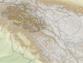 Panmah Muztagh Panmah Muztagh (Gilgit Baltistan)  Panmah Muztagh Panmah Muztagh (Pakistan)  Panmah Muztagh Panmah Muztagh (Ladakh)  Panmah Muztagh Panmah Muztagh (India)  Panmah Muztagh Panmah Muztagh (Xinjiang)  Panmah Muztagh Panmah Muztagh (China) | |
| Countries | Pakistan |
| Regions | Gilgit-Baltistan |
| Parent range | Karakoram |
 | |
Geography
Panmah Muztagh highest peaks are not particularly high by Karakoram standards, but they are exceedingly steep rock spires, unlike many of the peaks in the surrounding subranges.[1] In particular, the highest of the Panmah peaks, Baintha Brakk (The Ogre) (7,285 m/23,901 feet), is a very difficult climb; it has seen only three ascents. The nearby Latok group is of similar difficulty.[1][2] Both groups lie on the north side of the long Biafo Glacier.
The Panmah Muztagh lies in the heart of the Karakoram, northwest of the Baltoro Muztagh (home of the eight thousand meter peaks of the Karakoram), and southeast of the Hispar Muztagh. On the southwest, it is separated from the Spantik-Sosbun Mountains by the Biafo Glacier. The Skamri Glacier and the Braldu Glacier separate it from the Wesm Mountains to the north. The Panmah, Nobande Sobande, Choktoi, and Chiring Glaciers lie within the range.[3]
Notable peaks of the Panmah Muztagh
| Mountain | Height (m) | Height (ft) | Coordinates | Prominence (m)[4] | Parent mountain | First ascent | Ascents (attempts) |
|---|---|---|---|---|---|---|---|
| Baintha Brakk | 7,285 | 23,901 | 35°56′51″N 75°45′12″E | 1,891 | Distaghil Sar | 1977 | 3 (14) |
| Latok I (Latok Central) | 7,151 | 23,461 | 35°55′41″N 75°49′21″E | 1,475 | Baintha Brakk | 1979 | ??? |
| Latok II (Latok West) | 7,108 | 23,320 | 35°55′12″N 75°48′09″E | 400 | Latok I | 1977 | ??? |
| Latok III (Latok East) | 6,949 | 22,798 | 35°55′12″N 75°50′23″E | 650 | Latok I | 1979 | ??? |
References
- Andy Fanshawe and Stephen Venables, Himalaya Alpine-Style, Hodder and Stoughton, 1995, ISBN 0-340-64931-3.
- American Alpine Journal, 2001, p. 365
- Jerzy Wala, Orographical Sketch Map of the Karakoram, Swiss Foundation for Alpine Research, Zurich, 1990.
- Approximate values, from Digital Elevation Data
This Gilgit-Baltistan location article is a stub. You can help Wikipedia by expanding it. |
На других языках
[de] Panmah Muztagh
Der Panmah Muztagh ist ein Teil des Karakorum-Gebirges. Der flächenmäßig größere Teil liegt in Baltistan, einem Bezirk der autonomen Region Gilgit-Baltistan in Pakistan. Die Grenze zwischen Pakistan und China verläuft über den östlichen Teil der Bergkette.- [en] Panmah Muztagh
[es] Panmah Muztagh
La Panmah Muztagh es un subcordillera del Karakórum, en el Baltistán, un distrito de Gilgit-Baltistán, Pakistán. Sus montañas más altas no son particularmente elevadas para los estándares del Karakórum, pero se caracterizan por ser enormes moles graniticas y contar con paredes casi verticales, a diferencia de las montañas de su entorno.[1] En particular, el más alto de los picos de la subcordillera, el Baintha Brakk (El Ogre) con 7.285 m, tiene una gran dificultad de escalada y sólo ha sido ascendido dos veces. El cercano Grupo Latok tiene dificultades similares.[1][2] Ambos grupos se encuentran al norte del gran Glaciar Biafo uno de los glaciares más importantes del Karakórum.Другой контент может иметь иную лицензию. Перед использованием материалов сайта WikiSort.org внимательно изучите правила лицензирования конкретных элементов наполнения сайта.
WikiSort.org - проект по пересортировке и дополнению контента Википедии