geo.wikisort.org - Mountains
Mount Emei ([ɤ̌.měɪ]; Chinese: 峨眉山[1]; pinyin: Éméi shān), alternately Mount Omei, is a 3,099-meter-tall (10,167 ft) mountain in Sichuan Province, China, and is the highest of the Four Sacred Buddhist Mountains of China.[2] Mount Emei sits at the western rim of the Sichuan Basin. The mountains west of it are known as Daxiangling.[3] A large surrounding area of countryside is geologically known as the Permian Emeishan Large Igneous Province, a large igneous province generated by the Emeishan Traps volcanic eruptions during the Permian Period.
| Mount Emei | |
|---|---|
| Emei Shan | |
 | |
| Highest point | |
| Elevation | 3,099 m (10,167 ft) |
| Prominence | 1,069 m (3,507 ft) |
| Coordinates | 29°31′11″N 103°19′57″E |
| Geography | |
 Mount Emei  Mount Emei Mount Emei (China) | |
UNESCO World Heritage Site | |
| Official name | Mount Emei Scenic Area, including Leshan Giant Buddha Scenic Area |
| Type | Mixed |
| Criteria | iv, vi, x |
| Designated | 1996 (20th session) |
| Reference no. | 779 |
| Region | Asia-Pacific |
| Mount Emei | |||||||||||||||||||||||||||||
|---|---|---|---|---|---|---|---|---|---|---|---|---|---|---|---|---|---|---|---|---|---|---|---|---|---|---|---|---|---|
"Mount Emei" in Chinese characters | |||||||||||||||||||||||||||||
| Chinese | 峨眉山[1] | ||||||||||||||||||||||||||||
| |||||||||||||||||||||||||||||
| Part of a series on |
| Chinese martial arts (Wushu) |
|---|
 |
|
Administratively, Mount Emei is located near the county-level city of the same name (Emeishan City), which is in turn part of the prefecture-level city of Leshan. It was made a UNESCO World Heritage Site in 1996.[4]
As a sacred mountain
Mount Emei is one of the Four Sacred Buddhist Mountains of China, and is traditionally regarded as the bodhimaṇḍa, or place of enlightenment, of the bodhisattva Samantabhadra. Samantabhadra is known in Mandarin as Pǔxián Púsà (普賢菩薩).
Sources of the 16th and 17th centuries allude to the practice of martial arts in the monasteries of Mount Emei,[5] which made the earliest extant reference to the Shaolin Monastery as Chinese boxing's place of origin.[6]
Buddhist architecture on Emei
This is the location of the first Buddhist temple built in China in the 1st century CE.[4] The site has seventy-six Buddhist monasteries of the Ming and Qing dynasties, most of them located near the mountain top. The monasteries demonstrate a flexible architectural style that adapts to the landscape. Some, such as the halls of Baoguosi, are built on terraces of varying levels, while others, including the structures of Leiyinsi, are on raised stilts. Here the fixed plans of Buddhist monasteries of earlier periods were modified or ignored in order to make full use of the natural scenery. The buildings of Qingyinge are laid out in an irregular plot on the narrow piece of land between the Black Dragon River and the White Dragon River. The site is large and the winding footpath is 50 km (31 mi) long, taking several days to walk.[7]
Cable cars ease the ascent to the two temples at Jinding (3,077 m), an hour's hike from the mountain's peak.[2][8]
Climate
The summit of Mount Emei has an alpine subarctic climate (Köppen Dwc), with long, cold (but not severely so) winters, and short, cool summers. The monthly 24-hour average temperature ranges from −5.7 °C (21.7 °F) in January to 11.6 °C (52.9 °F) in July, and the annual mean is 3.07 °C (37.5 °F). Precipitation is common year-round (occurring on more than 250 days), but due to the influence of the monsoon, rainfall is especially heavy in summer, and more than 70% of the annual total occurs from June to September.
| Climate data for Mount Emei (1971−2000) | |||||||||||||
|---|---|---|---|---|---|---|---|---|---|---|---|---|---|
| Month | Jan | Feb | Mar | Apr | May | Jun | Jul | Aug | Sep | Oct | Nov | Dec | Year |
| Record high °C (°F) | 16.7 (62.1) |
18.5 (65.3) |
20.5 (68.9) |
22.7 (72.9) |
21.7 (71.1) |
22.5 (72.5) |
22.1 (71.8) |
21.5 (70.7) |
19.8 (67.6) |
19.3 (66.7) |
19.5 (67.1) |
16.3 (61.3) |
22.7 (72.9) |
| Average high °C (°F) | −0.3 (31.5) |
0.4 (32.7) |
4.1 (39.4) |
7.8 (46.0) |
10.5 (50.9) |
12.9 (55.2) |
15.2 (59.4) |
14.9 (58.8) |
11.2 (52.2) |
7.2 (45.0) |
4.0 (39.2) |
1.6 (34.9) |
7.5 (45.5) |
| Daily mean °C (°F) | −5.7 (21.7) |
−4.9 (23.2) |
−1.3 (29.7) |
2.9 (37.2) |
6.3 (43.3) |
9.3 (48.7) |
11.6 (52.9) |
11.2 (52.2) |
7.7 (45.9) |
3.5 (38.3) |
−0.3 (31.5) |
−3.5 (25.7) |
3.1 (37.6) |
| Average low °C (°F) | −9.2 (15.4) |
−8.1 (17.4) |
−4.8 (23.4) |
−0.3 (31.5) |
3.6 (38.5) |
6.8 (44.2) |
9.2 (48.6) |
9.0 (48.2) |
5.5 (41.9) |
1.2 (34.2) |
−3.2 (26.2) |
−6.8 (19.8) |
0.2 (32.4) |
| Record low °C (°F) | −19.2 (−2.6) |
−19.1 (−2.4) |
−17.2 (1.0) |
−9.8 (14.4) |
−7.4 (18.7) |
−0.2 (31.6) |
2.1 (35.8) |
2.8 (37.0) |
−3.5 (25.7) |
−11.1 (12.0) |
−14.7 (5.5) |
−19.7 (−3.5) |
−19.7 (−3.5) |
| Average precipitation mm (inches) | 15.4 (0.61) |
23.8 (0.94) |
50.3 (1.98) |
112.1 (4.41) |
161.6 (6.36) |
220.1 (8.67) |
366.5 (14.43) |
428.4 (16.87) |
210.8 (8.30) |
101.4 (3.99) |
42.8 (1.69) |
16.0 (0.63) |
1,749.2 (68.88) |
| Average precipitation days (≥ 0.1 mm) | 16.9 | 19.1 | 22.3 | 22.3 | 23.2 | 23.6 | 22.7 | 21.9 | 23.8 | 24.7 | 20.0 | 15.1 | 255.6 |
| Source: Weather China | |||||||||||||
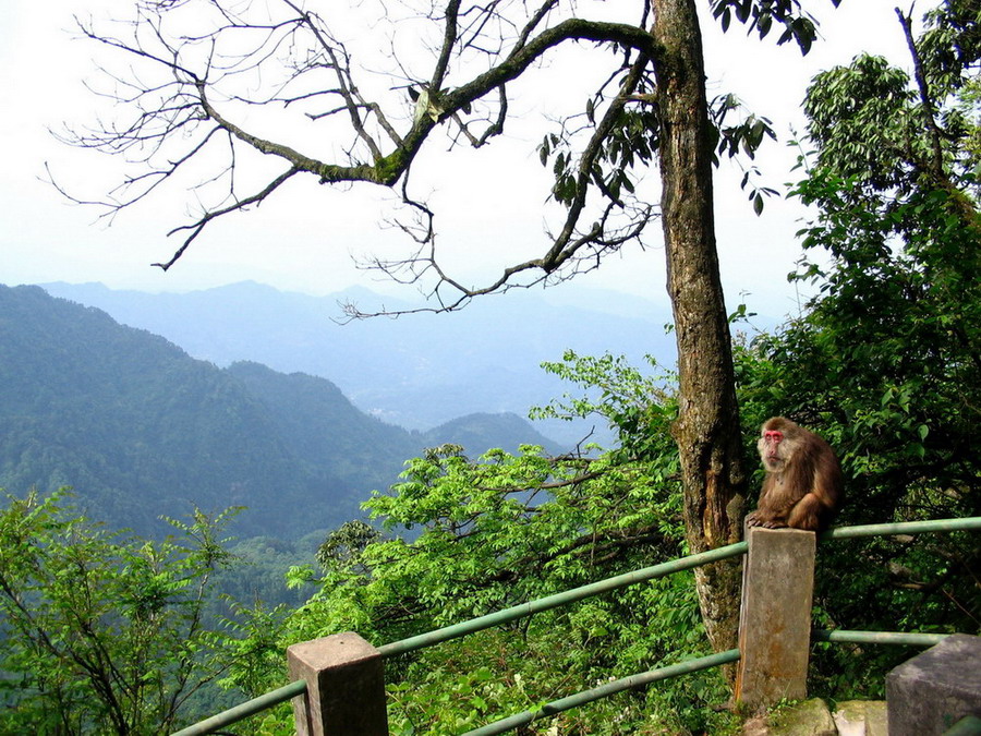
Indigenous animals
Visitors to Mount Emei will likely see dozens of Tibetan macaques, which can often be viewed taking food from tourists. Local merchants sell nuts for tourists to feed the monkeys. Other featured animals includes Rana adenopleura, Vibrissaphora liui and Pheretima praepinguis.
Flora
Mount Emei is known for its high level of endemism and approximately 200 plant species in various plant families have been described from this mountain.
A rare species of Fir tree is endemic to this mountain it is Abies Fabri.
Gallery
 Wanfoding
 A temple at the Golden Summit
 Massive statue of Samantabhadra at the summit of Mount Emei
 Baoguosi, a Buddhist temple
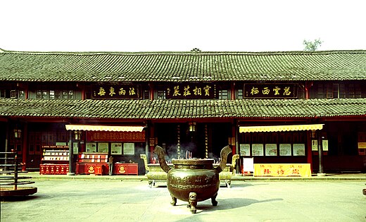 Buddhist temple at Mount Emei
 Wooden bridgewalk over the Crystal Stream, western slopes
 Macaque indigenous to the region
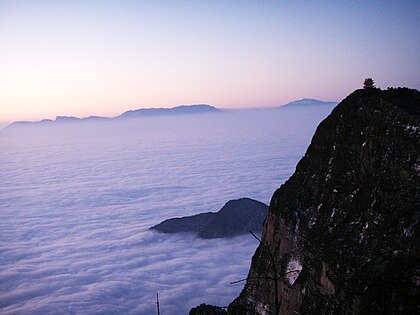 Sunrise over Mount Emei
 Sunrise over a sea of clouds at Mount Emei
 Guangfu pavilion, with summit visible in background
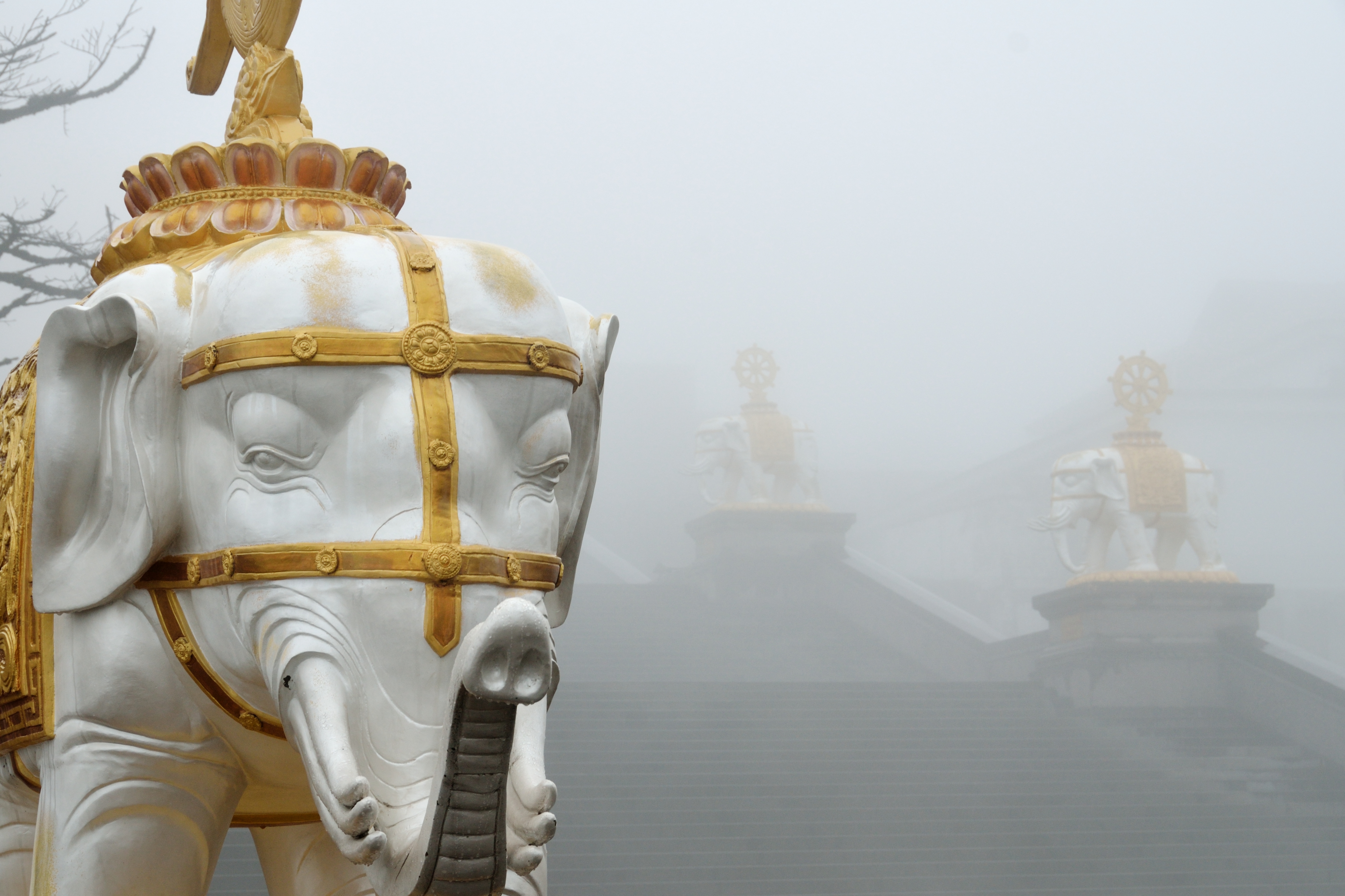
 Elephant statues on the steps leading to the statue of Samantabhadra
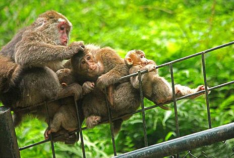 Monkeys of Mount Emei
 Mount Emei and Exiu Lake
 Mount Emei and Exiu Lake


See also
- Emei Sect
- Zuo Ci
References
- In the name "Emei", the character méi 眉 is sometimes written 嵋.
- Hayes, Holly (2009) Emei Shan, Sacred Destinations. Updated 24 July 2009.
- E.g., 实用中国地图集 (Shiyong Zhongguo Dituji, "Practical Atlas of China"), 2008, ISBN 978-7-5031-4772-2; map of Sichuan on pp. 142–143
- "Mount Emei Scenic Area, including Leshan Giant Buddha Scenic Area". UNESCO. Retrieved 2007-09-06.
- Zhāng Kǒngzhāo 張孔昭 (c. 1784). Boxing Classic: Essential Boxing Methods 拳經拳法備要 Quánjīng Quánfǎ Bèiyào (in Chinese).
- Henning, Stanley E. (Fall 1999). "Academia Encounters the Chinese Martial Arts". China Review International. 6 (2): 319–332. doi:10.1353/cri.1999.0020. ISSN 1069-5834..
- Dazhang, Sun (2002). Chinese Architecture -- The Qing Dynasty (English ed.). Yale University Press. pp. 328–329. ISBN 0-300-09559-7.
- Gluckman, Ron (2002). Getting to the Top, Silk Road, December 2002. Hong Kong; Dragon Airlines.
External links
- Religion and the environment in China, 中国的宗教与环境 - chinadialogue article
- Mount Emei, including Leshan Giant Buddha, Scenic Area: official Unesco site
World Heritage Sites in China | ||
|---|---|---|
| East |
|  |
| South Central |
| |
| Southwest |
| |
| North |
| |
| Northeast |
| |
| Northwest |
| |
| Multiple regions |
| |
Authority control | |
|---|---|
| General |
|
| National libraries | |
| Other |
|
На других языках
[de] Emei Shan
Der Emei Shan (chinesisch .mw-parser-output .Hant{font-size:110%}峨嵋山 / 峨眉山, Pinyin Éméi Shān, W.-G. O-mei Shan – „emporragender Augenbrauen-Berg“) ist einer der vier heiligen buddhistischen Berge in China. Mit einer Höhe von 3099 m ragt er aus dem Becken der Provinz Sichuan. Er ist namensgebend für den Emeishan-Trapp.- [en] Mount Emei
[es] Monte Emei
El monte Emei es una montaña situada en la provincia de Cuatro Valles, en la zona antigua del estado de Shu, en el suroeste de China. Es una de las cuatro montañas sagradas del budismo en la zona tradicional de Han.[fr] Mont Emei
Le mont Emei (chinois simplifié : 峨嵋山 ; chinois traditionnel : 峨眉山 ; pinyin : éméishān) ou Omei, ou Emei Shan, est l'une des quatre montagnes sacrées bouddhiques de Chine, située sur le territoire de la ville d'Emeishan dans la province du Sichuan.[it] Monte Emei
Il monte Emei (峨嵋山S, Éméi ShānP, O2-mei2 Shan1W, letteralmente "Montagna del Sopracciglio Delicato") è una montagna nella provincia del Sichuan (centro-ovest della Cina).[ru] Эмэйшань
Эмэйша́нь (кит. упр. 峨嵋山, пиньинь Éméi Shān) — гора в провинции Сычуань. Название горы иногда записывается иероглифами как 峨眉山 («Высокая Бровь»), а также 峩嵋山 и 峩眉山, но все они произносятся одинаково. Эмэйшань наряду с Путошанем, Утайшанем и Цзюхуашанем является одной из четырёх священных гор китайских буддистов. В 1996 году ЮНЕСКО присвоило этому району статус Всемирного культурного наследия[2].Другой контент может иметь иную лицензию. Перед использованием материалов сайта WikiSort.org внимательно изучите правила лицензирования конкретных элементов наполнения сайта.
WikiSort.org - проект по пересортировке и дополнению контента Википедии