geo.wikisort.org - Mountains
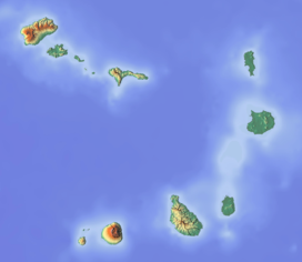
Morro Negro is a hill located near the east coast of the island of Boa Vista, Cape Verde. Its elevation is 156 m. The nearest village is Cabeça dos Tarrafes, 5.5 km to the northwest.
| Morro Negro | |
|---|---|
 Morro Negro | |
| Highest point | |
| Elevation | 156 m (512 ft) |
| Listing | List of mountains in Cape Verde |
| Coordinates | 16°6′13″N 22°40′41″W |
Turtle Nature Reserve
The hill forms a part of the Turtle Nature Reserve (Portuguese: Reserva Natural Tartaruga), which covers 14.39 km2 of land area and 134.36 km2 of marine area.[1][2] The reserve protects the beaches as nesting areas for its turtle population, and its wetlands and salty lands for birds.
Lighthouse
 | |
 | |
| Location | Morro Negro Boa Vista Cape Verde |
|---|---|
| Coordinates | 16°6′8.8″N 22°40′39.0″W |
| Tower | |
| Constructed | ~1930 |
| Foundation | concrete base |
| Construction | concrete tower |
| Height | 11.9 metres (39 ft) |
| Shape | quadrangular tower with balcony and lantern attached to 1-storey keeper’s house |
| Markings | white tower, red lantern |
| Power source | solar power |
| Light | |
| Focal height | 163 metres (535 ft) |
| Range | 31 nautical miles (57 km; 36 mi)[3] |
| Characteristic | Fl W 20s. |
| Cape Verde no. | PT-2102[4] |
There is a lighthouse on the hill.[4] The lighthouse was built around 1930. It is 12 meters tall and its focal height is 163 meters.[4] Its light range is 31 nautical miles (57 km; 36 mi).[3]
See also
- List of lighthouses in Cape Verde
- List of mountains in Cape Verde
References
- Protected areas in the island of Boa Vista - Municipality of Boa Vista, March 2013 (in Portuguese)
- Resolução nº 36/2016, Estratégia e Plano Nacional de Negócios das Áreas Protegidas
- List of Lights, Pub. 113: The West Coasts of Europe and Africa, the Mediterranean Sea, Black Sea and Azovskoye More (Sea of Azov) (PDF). List of Lights. United States National Geospatial-Intelligence Agency. 2018.
- Rowlett, Russ. "Lighthouses of Cape Verde". The Lighthouse Directory. University of North Carolina at Chapel Hill.
Текст в блоке "Читать" взят с сайта "Википедия" и доступен по лицензии Creative Commons Attribution-ShareAlike; в отдельных случаях могут действовать дополнительные условия.
Другой контент может иметь иную лицензию. Перед использованием материалов сайта WikiSort.org внимательно изучите правила лицензирования конкретных элементов наполнения сайта.
Другой контент может иметь иную лицензию. Перед использованием материалов сайта WikiSort.org внимательно изучите правила лицензирования конкретных элементов наполнения сайта.
2019-2025
WikiSort.org - проект по пересортировке и дополнению контента Википедии
WikiSort.org - проект по пересортировке и дополнению контента Википедии
