geo.wikisort.org - Mountains
Monte Santo António is a mountain in the southwestern part of the island Boa Vista in Cape Verde. At 379 m (1,243 ft) elevation,[1] it is the island's second highest point. Like Rocha Estância and Monte Estância, it rises steeply from the surrounding plains. It is part of a protected natural area under the statute of natural monument,[2] covering 459 hectares (1,130 acres).[1][3]

| Monte Santo António | |
|---|---|
 Monte Santo António | |
| Highest point | |
| Elevation | 379 m (1,243 ft) |
| Listing | List of mountains in Cape Verde |
| Coordinates | 16°03′50″N 22°53′02″W |
| Geography | |
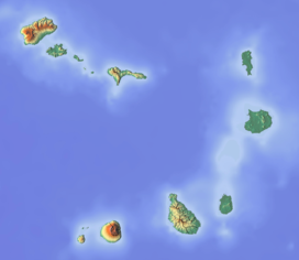 Monte Santo António southeastern Boa Vista | |
See also
References
- Protected areas in the island of Boa Vista - Municipality of Boa Vista, March 2013 (in Portuguese)
- Natural monuments of Cape Verde (in Portuguese)
- Resolução nº 36/2016, Estratégia e Plano Nacional de Negócios das Áreas Protegidas
External links
Wikimedia Commons has media related to Pico do Santo António.
The island of Boa Vista | ||
|---|---|---|
| Santa Isabel |
|  |
| São João Baptista |
| |
| Mountains | ||
| Islets | ||
| Beaches |
| |
| Other geographical features |
| |
| ||
This Cape Verdean location article is a stub. You can help Wikipedia by expanding it. |
Текст в блоке "Читать" взят с сайта "Википедия" и доступен по лицензии Creative Commons Attribution-ShareAlike; в отдельных случаях могут действовать дополнительные условия.
Другой контент может иметь иную лицензию. Перед использованием материалов сайта WikiSort.org внимательно изучите правила лицензирования конкретных элементов наполнения сайта.
Другой контент может иметь иную лицензию. Перед использованием материалов сайта WikiSort.org внимательно изучите правила лицензирования конкретных элементов наполнения сайта.
2019-2026
WikiSort.org - проект по пересортировке и дополнению контента Википедии
WikiSort.org - проект по пересортировке и дополнению контента Википедии