geo.wikisort.org - Mountains
Monte Velha is a peak in the northeastern part of the island of Fogo in Cape Verde. Its elevation is 1,482 m.[1] It is a subpeak of the Pico do Fogo volcano, located at the northeastern end of the crater rim. It lies within the municipality of Mosteiros, 4 km southwest of the city centre. Its forest is a protected area, part of the larger Fogo Natural Park.[2]

| Monte Velha | |
|---|---|
 View of Chã das Caldeiras from the slopes of Monte Velha | |
| Highest point | |
| Elevation | 1,482 m (4,862 ft)[1] |
| Listing | List of mountains in Cape Verde |
| Coordinates | 15°0′08″N 24°20′42″W |
| Geography | |
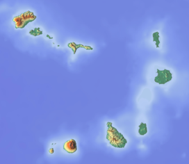 Monte Velha northeastern Fogo | |
Due to the exposure of northeast winds, Monte Velha is the most humid part of the island. The annual precipitation shows much variation: in the period 1990-2000 it ranged between 214 and 1,481 mm.[3]
See also
References
- Cabo Verde Visor, layer Carta Militar (in Portuguese)
- Parques Naturais, Áreas protegidas Cabo Verde
- Teresa Leyens, Biodiversität und Erhalt der Hochlagenvegetation der Insel Fogo (Kap Verde): Ausarbeitung eines Konzeptes für ein Schutzgebiet, University of Bonn, 2002, p. 8 (pdf)
External links
| Wikimedia Commons has media related to Monte Velha. |
- Áreas protegidas, Cabo Verde (Protected areas of Cape Verde) (in Portuguese)
The island of Fogo | ||
|---|---|---|
| Mosteiros |
|  |
| Santa Catarina do Fogo |
| |
| São Filipe |
| |
| Other geographical features |
| |
| Transportation |
| |
| Other topics |
| |
На других языках
- [en] Monte Velha
[es] Monte Velha
Monte Velha es un pico ubicado en la parte noreste de la isla de Fogo en Cabo Verde, entre el Chã das Caldeiras y la costa del municipio de Mosteiros. Es un subpico del volcán Pico do Fogo y parte del parque natural de Fogo.[1][2][fr] Monte Velha
Le monte Velha est un sommet secondaire de l'île de Fogo au Cap-Vert, situé entre la Chã das Caldeiras et la municipalité (concelho) côtière de Mosteiros. Il culmine à 1 482 mètres d'altitude[1] et abrite l'une des plus importantes réserves forestières du pays. Il est également connu des randonneurs qui le franchissent lorsqu'ils empruntent le sentier à fort dénivelé qui relie la caldeira à l'océan Atlantique.Текст в блоке "Читать" взят с сайта "Википедия" и доступен по лицензии Creative Commons Attribution-ShareAlike; в отдельных случаях могут действовать дополнительные условия.
Другой контент может иметь иную лицензию. Перед использованием материалов сайта WikiSort.org внимательно изучите правила лицензирования конкретных элементов наполнения сайта.
Другой контент может иметь иную лицензию. Перед использованием материалов сайта WikiSort.org внимательно изучите правила лицензирования конкретных элементов наполнения сайта.
2019-2026
WikiSort.org - проект по пересортировке и дополнению контента Википедии
WikiSort.org - проект по пересортировке и дополнению контента Википедии