geo.wikisort.org - Mountains
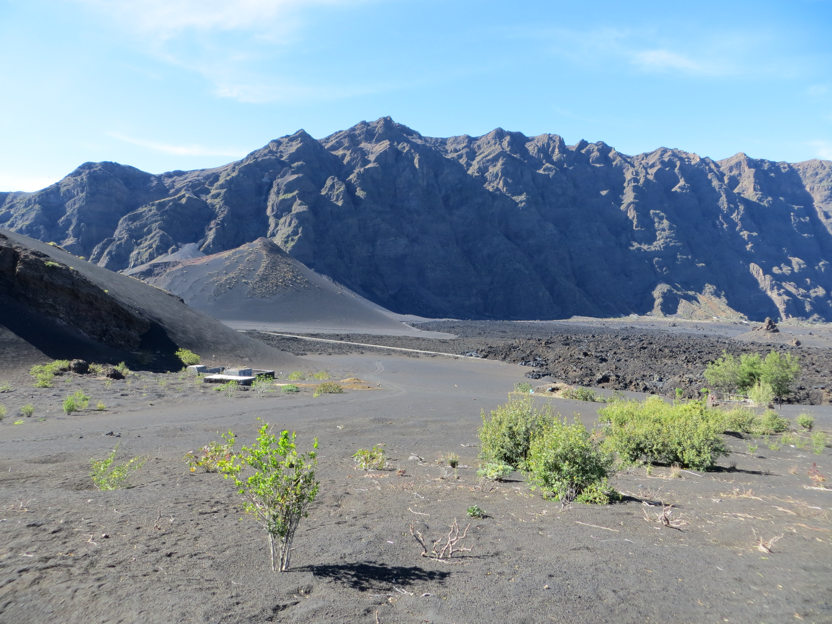
Bordeira is a semicircular mountain in the middle of the island Fogo. It is a crater rim, up to 1 km high, formed by a prehistoric collapse of the volcano Pico do Fogo.[2] At a maximum elevation of 2,692 metres (8,832 ft),[1] it is the second highest point in the nation behind Pico do Fogo. The name literally means the "border". It forms part of Fogo Natural Park. Opening to the east, it effectively protects the northern, western and southern part of the island against lava flows from the volcano.[2] The settlement Chã das Caldeiras lies at the foot of Bordeira, in the caldera. The east side of the Bordeira cliff is much steeper than the west side.

| Bordeira | |
|---|---|
 Bordeira and its summit Pico de Caldeira seen from the foot of Pico do Fogo in 2012, before the most recent eruption | |
| Highest point | |
| Elevation | 2,692 m (8,832 ft)[1] |
| Listing | List of mountains in Cape Verde |
| Coordinates | 14°57′40″N 24°23′31″W[1] |
| Geography | |
 Bordeira central Fogo | |
| Geology | |
| Mountain type | Stratovolcano |
See also
References
- Cabo Verde Visor, layer Carta Militar (in Portuguese)
- S. F. Jenkins; et al. (20 March 2017). "Damage from lava flows: insights from the 2014–2015 eruption of Fogo, Cape Verde". Journal of Applied Volcanology. 6.
External links
 Media related to Bordeira at Wikimedia Commons
The island of Fogo | ||
|---|---|---|
| Mosteiros |  | |
| Santa Catarina do Fogo |
| |
| São Filipe |
| |
| Other geographical features |
| |
| Transportation |
| |
| Other topics |
| |
Текст в блоке "Читать" взят с сайта "Википедия" и доступен по лицензии Creative Commons Attribution-ShareAlike; в отдельных случаях могут действовать дополнительные условия.
Другой контент может иметь иную лицензию. Перед использованием материалов сайта WikiSort.org внимательно изучите правила лицензирования конкретных элементов наполнения сайта.
Другой контент может иметь иную лицензию. Перед использованием материалов сайта WikiSort.org внимательно изучите правила лицензирования конкретных элементов наполнения сайта.
2019-2025
WikiSort.org - проект по пересортировке и дополнению контента Википедии
WikiSort.org - проект по пересортировке и дополнению контента Википедии