geo.wikisort.org - Mountains
The Cima Mongioia or simply Mongioia[3] (in Italian) or Bric de Rubren (in French[1]) is a 3,340 metres high mountain of the Cottian Alps.[4]
| Mongioia | |
|---|---|
| Bric de Rubren, Riouburent, Cima Mongioia | |
 | |
| Highest point | |
| Elevation | 3,340 m (10,960 ft)[1] |
| Prominence | 685 m (2,247 ft)[2] |
| Listing | Alpine mountains above 3000 m |
| Coordinates | 44°37′16″N 6°56′56″E |
| Geography | |
 Mongioia Location in the Alps | |
| Location | Provence-Alpes-Côte d'Azur, France Piemonte, Italy |
| Parent range | Cottian Alps |
| Geology | |
| Type of rock | schists with ophiolites |
| Climbing | |
| First ascent | Paul Agnel e Joseph Risoul / July 20th 1878 |
| Easiest route | Hike, scrabble |
Toponymy
In the alpinistic and geographyc literature the mountain also appears as Grand Rubren or Monte Riouburent .[5] On French maps is usually referred as Bric de Rubren.
Geology
From a geological point of view the whole upper part of the mountain belongs to a complex of schists with ophiolites of a Jurassic-Cretaceous origin. Close to the summit an area of serpentinites can be noticed.[6]
Geography

The Mongioia belongs to the main chain of the Alps. Its Italian side is located in the upper part of the Varaita Valley, while the French one is at the end of the Ubaye valley.
From its summit three ridges branch out:
- the first, heading NW, divides two French dells, Vallon du Loup and Vallon de Rubren;
- the second heads South and consists in the stretch of the Alpine divide connecting the Mongioia with Passo Mongioia and Monte Giuep;
- the third, also belonging to the Alpine divide, heads East towards the Passo di Salza and Monte Salza.
The western face of Mongioia, facing the Vallon de Rubren, consists in sloping block fields, while the other faces of the mountain are steeper and rocky.
SOIUSA classification
According to SOIUSA (International Standardized Mountain Subdivision of the Alps) the mountain can be classified in the following way:[7]
- main part = Western Alps
- major sector = South Western Alps
- section = Cottian Alps
- subsection = Southern Cottian Alps
- supergroup = Chambeyron group in the broad sense
- group = Mongioia group
- subgroup = Costiera del Mongioia
- code = I/A-4.I-A.3.a
History
Mount Riouburent was considered by William Mathews the highest peak of Maritime Alps, but in his view the ridge ended north of Mongioia and not at Colle della Maddalena.[8]
The first known attempt to climb the mountain was of the French militar topographer Loreilhe in 1823, but he didn't reach the summit.[9] A second documented climb by François Arnaud (and the first with a detailed report) took place in 1875, and also turned unsuccessful. The summit of Mongioia was reached for the first time on the 20th of July 1878 by Paul Agnel and Joseph Risoul.[9]
Access to the summit
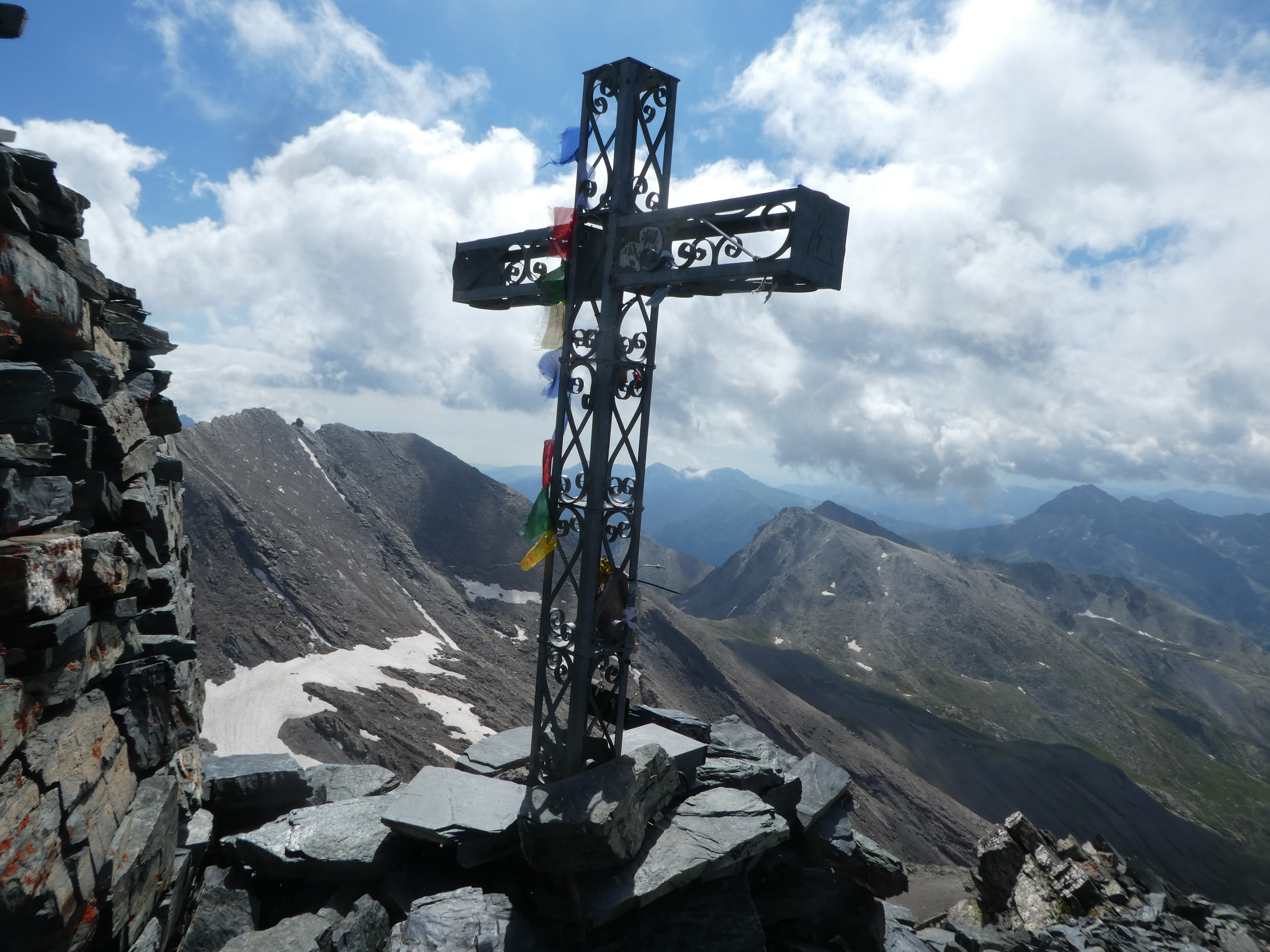
From the Italian side the Mongioia can be reached starting from the village of Sant'Anna (1,850 m, Comune of Bellino). Up to the Bivacco Franco Boerio (a wooden mountain shelter built in 1991,[10] 3,089 m) one must follow marked footpaths. From there on some passage tracks, with an easy climb passage, allow to reach the metallic cross and the trig point on the summit (way up: 4-4.30 hours from Sant'Anna).[11]
Another route reaches the Mongioia lake through the Vallon du Loup and the Passo di Salza.[11]
References
- "Géoportail" (in French). IGN. Retrieved 2019-03-20.
- "Bric de Rubren, France/Italy". Peakbagger.com. Retrieved 2019-03-22.
- AA.VV. (1976). Piemonte (non compresa Torino) (in Italian). Touring Editore. p. 344. ISBN 9788836500017. Retrieved 2018-11-28.
- Reynolds, Kev (2011). Walking in the Alps: a comprehensive guide to walking and trekking throughout the Alps. Cicerone Press Limited. p. 17. ISBN 9781849654388. Retrieved 2018-11-28.
- Ball, John; Desor, Édouard (1863). A Guide to the Western Alps. Longman, Green, Longman, Roberts, & Green. pp. 31. Retrieved 2019-03-20.
Rioburent.
- (in Italian), Carta Geologica d'Italia scala 1:100.000, 78-79 section- Argentera-Dronero Archived 2012-03-14 at the Wayback Machine
- Marazzi, Sergio (2005). Atlante Orografico delle Alpi. SOIUSA (in Italian). Priuli & Verlucca. p. 84. ISBN 978-88-8068-273-8.
- W. Mathews, Explorations round the foot of Monte Viso e Ascent of Monte Viso, in Peaks, Passes and Glaciers, Second Series, Vol. II, London 1862; see Google Books
- (in French), Pierre-Martin Charpenel, Les débuts de l'alpinisme en Ubaye, in Chroniques de Haute-Provence, Bulletin de la Société scientifique et littéraire des Alpes-de-Haute-Provence, n° 293, 1982, p. 79
- Chiaretta, Furio; Molino, Aldo; Ceragioli, Filippo (2006). "Il Mongioia". A piedi in Piemonte (in Italian). Vol. 1. Iter edizioni. pp. 145–147.
- (in Italian), G. Berutto, Monviso e le sue valli - Vol. 1, II edizione, Istituto Geografico Centrale, 1996
Maps
- Italian official cartography (Istituto Geografico Militare - IGM); on-line version: www.pcn.minambiente.it
- French official cartography (Institut géographique national - IGN); on-line version: www.geoportail.fr
- Istituto Geografico Centrale - Carta dei sentieri e dei rifugi scala 1:50.000 n. 6 ‘’Monviso’’'
External links
![]() Media related to Cima Mongioia at Wikimedia Commons
Media related to Cima Mongioia at Wikimedia Commons
- "Bric de Rubren ou Mongioia (3340m) et Mont de Salsa (3328m)" (in French). Altituderando.
- "Escursione alla Cima Mongioia (Bric de Rubren) – 3340 m – Valle Varaita" (in Italian). Cuneotrekking.
На других языках
- [en] Mongioia
[fr] Bric de Rubren
Le Bric de Rubren, ou Grand Rubren, Cima Mongioia ou simplement Mongioia en italien, est une montagne du massif de Chambeyron, culminant à 3 340 m. Le sommet est traversé par la frontière franco-italienne.[it] Cima Mongioia
La Cima Mongioia (3.340 m s.l.m. - detta anche Monte Riouburent) è una montagna delle Alpi Cozie situata lungo il confine tra l'Italia e la Francia. In francese è nota come Bric de Rubren o Grand Rubren.Другой контент может иметь иную лицензию. Перед использованием материалов сайта WikiSort.org внимательно изучите правила лицензирования конкретных элементов наполнения сайта.
WikiSort.org - проект по пересортировке и дополнению контента Википедии