geo.wikisort.org - Mountains
The Maritime Alps (French: Alpes Maritimes [alp maʁitim]; Italian: Alpi Marittime [ˈalpi maˈrittime]) are a mountain range in the southwestern part of the Alps. They form the border between the French region of Provence-Alpes-Côte d'Azur and the Italian regions of Piedmont and Liguria. They are the southernmost part of the Alps.
| Maritime Alps | |
|---|---|
| French: Alpes Maritimes Italian: Alpi Marittime | |
 Maritime Alps | |
| Highest point | |
| Peak | Monte Argentera |
| Elevation | 3,297 m (10,817 ft) |
| Coordinates | 44°10′45″N 7°18′18″E |
| Geography | |
| Countries | France, Italy and Monaco |
| Regions, Régions | Piedmont, Liguria and Provence-Alpes-Côte d'Azur |
| Rivers | Verdon, Ubaye, Roya, Var and Stura di Demonte |
| Range coordinates | 44°13.9′N 7°10.6′E |
| Parent range | Alps |
| Borders on | Ligurian Alps, Cottian Alps, Provence Alps and Prealps and Mediterranean Sea |
| Geology | |
| Orogeny | Alpine orogeny |
Geography
Administratively the range is divided between the Italian provinces of Cuneo and Imperia (eastern slopes) and the French department of Alpes-Maritimes (western slopes).
The Maritime Alps are drained by the rivers Roya, Var and Verdon and their tributaries on the French side; by the Stura di Demonte and other tributaries of the Tanaro and Po on the Italian side. There are many attractive perched villages, such as Belvédère at the entrance to the spectacular Gordolasque valley, some concealing unexpected architectural riches (for example in the south there are numerous churches decorated with murals and altarpieces by primitive Niçois painters).
Borders
The borders of the Maritime Alps are (anticlockwise):
- Vermenagna creek, Col de Tende - which connects them with the Ligurian Alps - and Roya (east);
- Mediterranean Sea and Var valley (south)
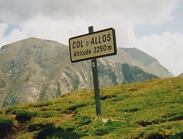
- Verdon, Col d'Allos - which connects them with Provence Alps and Prealps - and Ubaye (west);
- Maddalena Pass (which connects them with the Cottian Alps) and Stura di Demonte (north).
Peaks
The main peaks of the Maritime Alps are:
| Name | Elevation |
|---|---|
| Monte Argentera | 3,297 m |
| Monte Stella | 3,262 m |
| Cime du Gélas | 3,135 m |
| Cima di Nasta | 3,108 m |
| Monte Matto | 3,097 m |
| Mont Pelat | 3,053 m |
| Mont Clapier | 3,046 m |
| Mont Ténibre | 3,032 m |
| Enciastraia | 2,955 m |
| Mont Bégo | 2,872 m |
| Mont Mounier | 2,818 m |
| Roche de l'Abisse | 2,755 m |
| Monte Grammondo | 1,378 m |
Mountain passes
The chief passes of the Maritime Alps are:
| Name | Location | Type | Elevation |
|---|---|---|---|
| Col de la Bonette | Tinée Valley to Barcelonnette | Road (minor loop climbs to 2,802 m) | 2715 |
| Col de Restefond | Col de la Bonette to Barcelonnette | Road | 2680 |
| Bassa di Druos | Tinée Valley to Terme di Valdieri | Bridle path | 2630 |
| Colle di Ciriegia | Saint-Martin-Vésubie to Terme di Valdieri | Bridle path | 2551 |
| Col des Granges Communes | Saint-Étienne-de-Tinée to Barcelonnette | Bridle path | 2512 |
| Col de Pourriac | Tinee Valley to Argentera | Footpath | 2506 |
| Colle di Guercia | Tinee Valley to Vinadio | Footpath | 2451 |
| Col de la Lombarde | Isola to Vinadio | Road | 2350 |
| Col de la Cayolle | Var River valley to Barcelonnette | Road | 2327 |
| Col du Sabion | Tende to Valdieri | Bridle path | 2264 |
| Col d'Allos | Verdon River valley to Barcelonnette | Road | 2250 |
| Maddalena Pass | Barcelonnette to Cuneo | Road | 1995 |
| Col de Tende | Tende to Cuneo | Road, road tunnel Railway tunnel | 1873 |
| Col de Turini | Vésubie river valley to Sospel | Road | 1607 |
Nature conservation

The French Mercantour National Park (central area:68,500 ha + peripheral area:140,000 ha[1]) is part of the Maritime Alps as well as the Parco naturale delle Alpi Marittime, an Italian regional nature park of 28,455 ha.[2]
References
- This article incorporates text from a publication now in the public domain: Coolidge, William Augustus Brevoort (1911). "Alps". In Chisholm, Hugh (ed.). Encyclopædia Britannica. Vol. 1 (11th ed.). Cambridge University Press. p. 741.
- Le Parc national du Mercantour, www.vesubian.com (accessed on April 2012)
- Parco delle Alpi Marittime, web-site of the park on www.parks.it (accessed on April 2012)
Maps
- Italian official cartography (Istituto Geografico Militare - IGM); on-line version: www.pcn.minambiente.it
- French official cartography (Institut Géographique National - IGN); on-line version: www.geoportail.fr
На других языках
[de] Seealpen
Die Seealpen oder auch Meeralpen (französisch Alpes Maritimes, italienisch Alpi Marittime) sind eine Gebirgsgruppe der südlichen Westalpen.- [en] Maritime Alps
[fr] Alpes maritimes
Les Alpes maritimes forment l'extrémité sud des Alpes et se partagent entre trois pays : la France, l'Italie et Monaco.[it] Alpi Marittime e Prealpi di Nizza
Le Alpi Marittime e Prealpi di Nizza sono una sezione alpina definita dalla SOIUSA, dette anche Alpi Marittime i.s.a. (ovvero Alpi Marittime in senso ampio).[ru] Приморские Альпы (горы)
Приморские Альпы (фр. Alpes Maritimes [alp maʁitim]; итал. Alpi Marittime [ˈalpi maˈrittime]) — горы, часть Альп на юго-востоке Франции, на границе с Италией (часто к ним также относят Лигурийские Альпы в Италии).Другой контент может иметь иную лицензию. Перед использованием материалов сайта WikiSort.org внимательно изучите правила лицензирования конкретных элементов наполнения сайта.
WikiSort.org - проект по пересортировке и дополнению контента Википедии