geo.wikisort.org - Mountains
Meall Glas is a mountain situated in the southern highlands of Scotland. It stands on the northern border of the Loch Lomond and the Trossachs National Park, 8.5 kilometres north east of Crianlarich.[2]
| Meall Glas | |
|---|---|
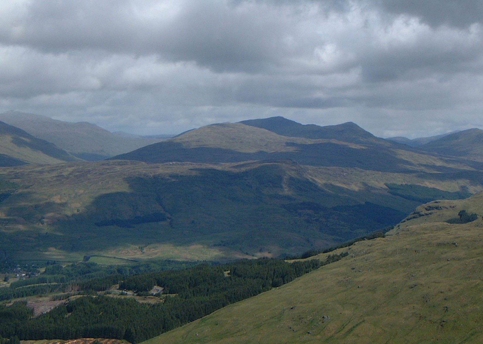 The Meall Glas group of hills from the high ground above Crianlarich, 9 km to the SW. Meall Glas is the highest peak in shade. | |
| Highest point | |
| Elevation | 959 m (3,146 ft)[1] |
| Prominence | 554 m (1,818 ft) |
| Parent peak | Beinn Heasgarnich |
| Listing | Munro, Marilyn |
| Coordinates | 56°27′21″N 4°32′49″W |
| Naming | |
| English translation | Greenish-grey hill |
| Language of name | Gaelic |
| Pronunciation | Scottish Gaelic: [ˈmjaul̪ˠ ˈkl̪ˠas̪] |
| Geography | |
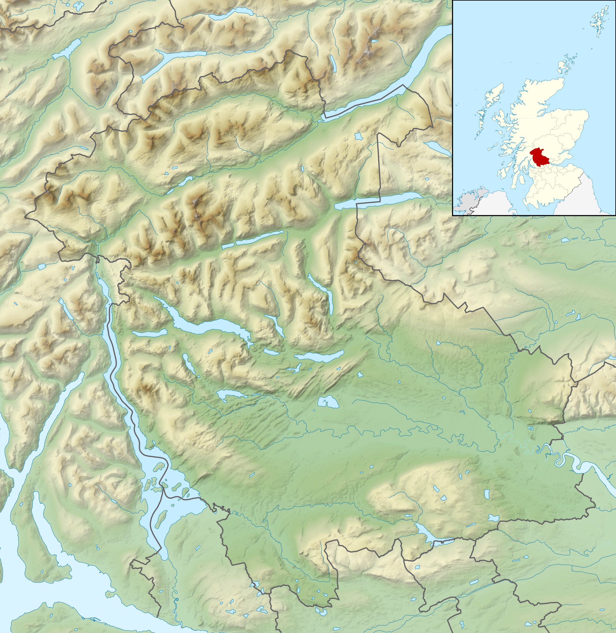 Meall Glas Stirlingshire, Scotland | |
| Parent range | Grampians |
| OS grid | NN431321 |
| Topo map | OS Landranger 51, OS Explorer 378 |
| Listed summits of Meall Glas | ||||
| Name | Grid ref | Height | Status | |
|---|---|---|---|---|
| Beinn Cheathaich | NN444326 | 937 m (3074 ft) | Munro Top | |
Overview
Meall Glas has Munro status with a height of 959 metres (3,146 ft). It is the highest point of the high rolling uplands between Glen Lochay and Glen Dochart, an area lacking distinctive mountainous character.[3] Another Munro, Sgiath Chuil, lies 2 km to the east; the Corbett Beinn nan Imirean is 2 km to the south west. The three hills can be climbed together in the same walk.
Meall Glas is overshadowed by the more impressive mountains around Crianlarich. Its name, which translates from the Gaelic as “Greenish-grey hill” suggests its topographic character. It was probably named by the inhabitants of Glen Lochay to which it shows its more impressive northern outline, with the summit ridge seen as a curving hollow.[4] The hill is not well seen from Glen Dochart to the south, from where it is usually climbed, being observed as merely the top of rising moorland.
Geography
Meall Glas comprises mainly rolling grassy slopes, with two main ridges. The north west ridge drops from the summit to Glen Lochay and can be used as an ascent route. The other ridge curves east round the lip of Coire Cheathaich, passing over an unnamed top at 908m before swinging north east to the Munro Top of Beinn Cheathaich (937 metres), 1.5 km from the main peak. In Sir Hugh Munro’s original tables of 1891, Beinn Cheathaich was listed as the Munro with Meall Glas as the “Top”, an error rectified in the 1921 revision.[5] From Beinn Cheathaich the ridge swings north and drops to Glen Lochay. Broad slopes to the east descend to the Lairig a’ Churain (609 metres) which connects to the adjacent Munro of Sgiath Chuil.
The mountain is made up of schist rocks of the Dalradian group, with outcrops of pink granite on the mountain's upper slopes. The south side of the mountain has a broad shelf at a height of around 450 metres, the result of lateral erosion by glaciers in the Ice Age.[6] Rainfall on Meall Glas drains to the east coast of Scotland via the glens of Dochart (south) or Lochay (north) and then by Loch Tay and the River Tay.
Ascents and view
Meall Glas can be climbed from either Glen Dochart or Glen Lochay. The southern approach from Glen Dochart is the most popular because of ease of access by car. The route starts at Auchessan (grid reference NN446276) on the A85 road and goes north across moorland to reach the summit ridge just to the east of the highest point.[7] The northern approach starts at the road end in Glen Lochay at Kenknock (grid reference NN465364). The route proceeds for 1.5 km west up the glen, crosses the River Lochay by a ford (the bridge no longer exists) and follows a track by the Lubchurran Burn which goes south and west and before reaching the summit via the Top of Beinn Cheathaich.[8]
The summit of Meall Glas is marked by a small cairn perched on a rocky outcrop. The mountain has a considerable prominence of 554 metres and is a good viewpoint, with the Mamlorn peaks around the head of Glen Lochay and the Crianlarich hills to the south west looking especially fine.
References
- The Munros, Donald Bennett (Editor) ISBN 0-907521-13-4
- The Southern Highlands, Donald Bennett (Editor) ISBN 0-907521-34-7
- The Munros, Scotland's Highest Mountains, Cameron McNeish, ISBN 1-84204-082-0
- The Magic Of The Munros, Irvine Butterfield, ISBN 0-7153-2168-4
- Hamish’s Mountain Walk, Hamish Brown, ISBN 1-898573-08-5
- In The Hills Of Breadalbane, V.A. Firsoff,
Footnotes
- "walkhighlands Meall Glas". walkhighlands.co.uk. 2013. Retrieved 26 October 2013.
- "Meall Glas (Walkhighlands)". Walkhighlands. Retrieved 10 January 2017.
- "The Southern Highlands" Page 165 Gives description of area.
- "The Magic of the Munros" Page 35 Gives details of name and translation.
- The Munros and Tops 1891-1997. Spreadsheet giving details of changes in successive editions of Munro's Tables.
- "In The Hills of Breadalbane" Pages 151 - 153 Gives geology and details of glaciation.
- "The Munros" Page 36 Gives description of southern approach.
- "The Munros, Scotland‘s Highest Mountains" Page 43 Gives description of northern approach.
Munros of Scotland: Loch Rannoch to Loch Tay | |||
|---|---|---|---|
 |
|  | |
List of Munros | |||
На других языках
[de] Meall Glas
Der Meall Glas ist ein 959 Meter hoher Berg in Schottland. Sein gälischer Name bedeutet Grün-grauer Hügel.[1] Der Berg ist als Munro eingestuft und liegt in der Council Area Stirling, etwa zehn Kilometer nordöstlich von Crianlarich zwischen den Tälern Glen Lochay und Glen Dochart an der Nordgrenze des Loch Lomond and the Trossachs National Park.- [en] Meall Glas
Другой контент может иметь иную лицензию. Перед использованием материалов сайта WikiSort.org внимательно изучите правила лицензирования конкретных элементов наполнения сайта.
WikiSort.org - проект по пересортировке и дополнению контента Википедии