geo.wikisort.org - Mountains
Meall Ghaordaidh is a mountain in the Southern Highlands of Scotland, approximately 10 km north-west of Killin.
| Meall Ghaordaidh | |
|---|---|
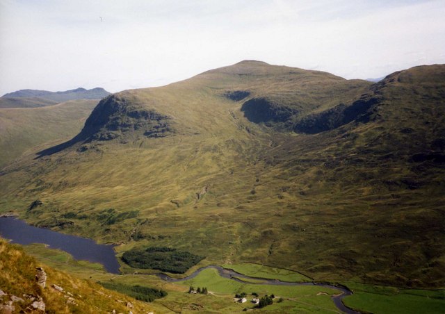 Meall Ghaordaidh (centre) from An Grianan looking over Glen Lyon, with Stronuich Reservoir (bottom left) | |
| Highest point | |
| Elevation | 1,039 m (3,409 ft)[1] |
| Prominence | 491 m (1,611 ft) |
| Listing | Munro, Marilyn |
| Naming | |
| English translation | Possibly derived from gairdean (shoulder, hand or arm) |
| Language of name | Gaelic |
| Geography | |
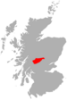
| Location | Stirlingshire, Scotland |
| Parent range | Grampians |
| OS grid | NN514397 |
| Topo map | OS Landranger 51 |
The mountain can be ascended via Glen Lochay starting to the north-west of the Allt Dhùin Croisg near Duncroisk, via an eroded path leading north-west through peat bogs to the summit; alternatively, an ascent can be made from Glen Lyon starting at Stronuich via one of two spurs that lead to the summit (Creag an Tulabhain or Creag Laoghain). The summit is marked by a large circular rock windbreak, within which there is a trig point.
References
- "walkhighlands Meall Ghaordaidh". walkhighlands.co.uk. 2013. Retrieved 26 October 2013.
Munros of Scotland: Loch Rannoch to Loch Tay | |||
|---|---|---|---|
 |
|  | |
List of Munros | |||
На других языках
[de] Meall Ghaordaidh
Der Meall Ghaordaidh (auch als Meall Ghaordie bezeichnet) ist ein 1039 Meter hoher Berg in Schottland. Sein gälischer Name bedeutet wahrscheinlich Hügel der Schulter oder Hügel des Arms.[1] Er liegt nordwestlich von Killin auf der Grenze zwischen den Council Areas Perth and Kinross und Stirling in der ausgedehnten Berglandschaft zwischen Glen Lyon im Norden und Glen Lochay im Süden.- [en] Meall Ghaordaidh
Текст в блоке "Читать" взят с сайта "Википедия" и доступен по лицензии Creative Commons Attribution-ShareAlike; в отдельных случаях могут действовать дополнительные условия.
Другой контент может иметь иную лицензию. Перед использованием материалов сайта WikiSort.org внимательно изучите правила лицензирования конкретных элементов наполнения сайта.
Другой контент может иметь иную лицензию. Перед использованием материалов сайта WikiSort.org внимательно изучите правила лицензирования конкретных элементов наполнения сайта.
2019-2026
WikiSort.org - проект по пересортировке и дополнению контента Википедии
WikiSort.org - проект по пересортировке и дополнению контента Википедии