geo.wikisort.org - Mountains
Khumbutse (Chinese: 坤布崎峰; pinyin: Kūnbùzī Fēng) is the first mountain west (6 km) of Mount Everest. It lies at the border between Nepal and China.
| Khumbutse | |
|---|---|
 Khumbutse | |
| Highest point | |
| Elevation | 6,636 m (21,772 ft)[1] |
| Prominence | 460 m (1,510 ft)[2] |
| Coordinates | 28°01′13″N 86°52′23″E |
| Geography | |
 Khumbutse Solukhumbu District, Sagarmatha Zone, Nepal Tingri County, Shigatse Prefecture, Tibet Autonomous Region, China  Khumbutse Khumbutse (Nepal)  Khumbutse Khumbutse (Tibet) | |
| Parent range | Mahalangur Himal, Himalayas |
| Climbing | |
| First ascent | 1979 by Franček Knez |
| Easiest route | glacier/snow/ice |
 | |
Overview
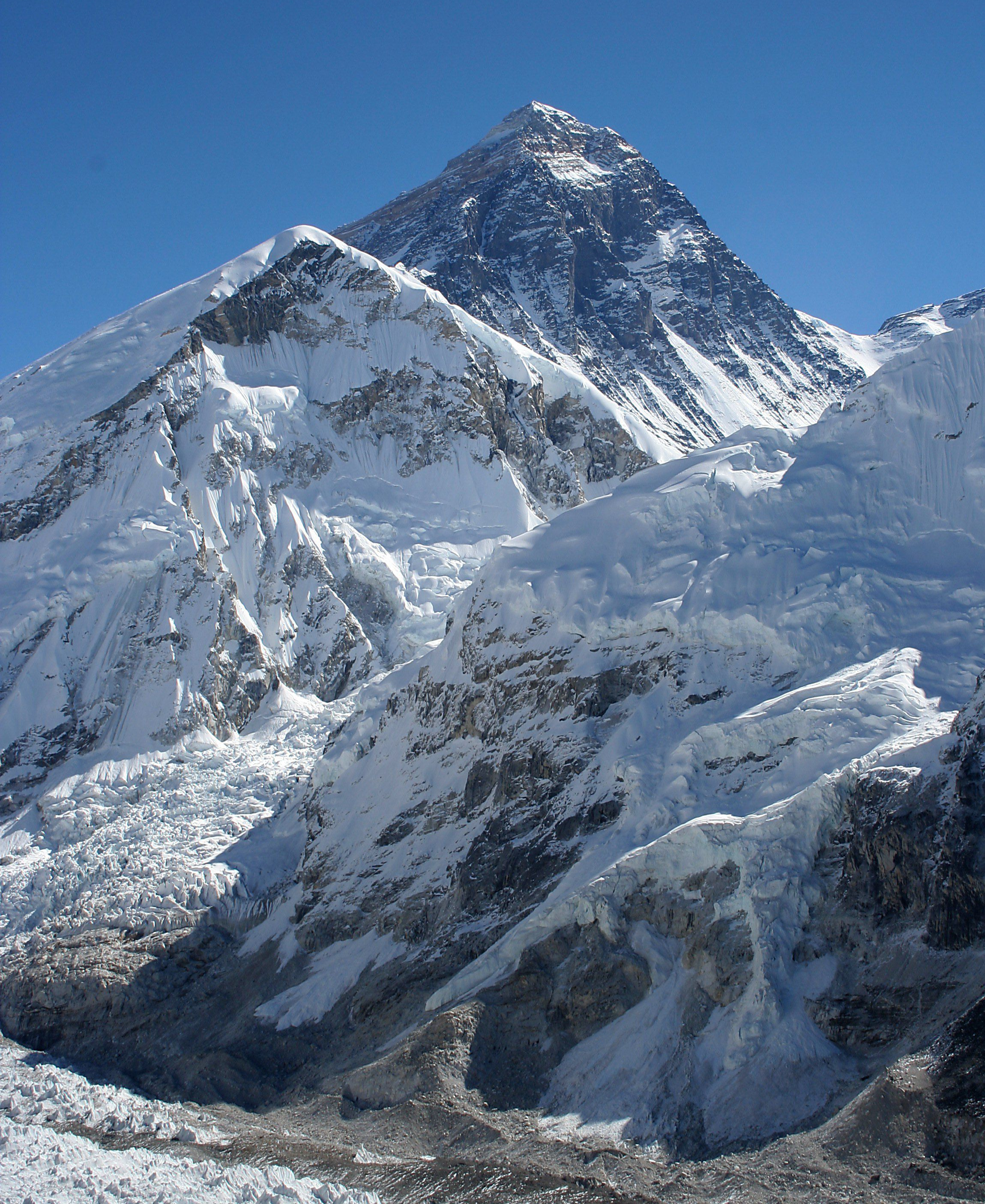
Khumbutse's name indicates its location at the head of the Khumbu valley, down which the Khumbu Glacier flows. It is one of the prominent mountains above the southern Everest Base Camp, and is seen in many views from the nearby trekking routes, including at Gorak Shep.

Gallery

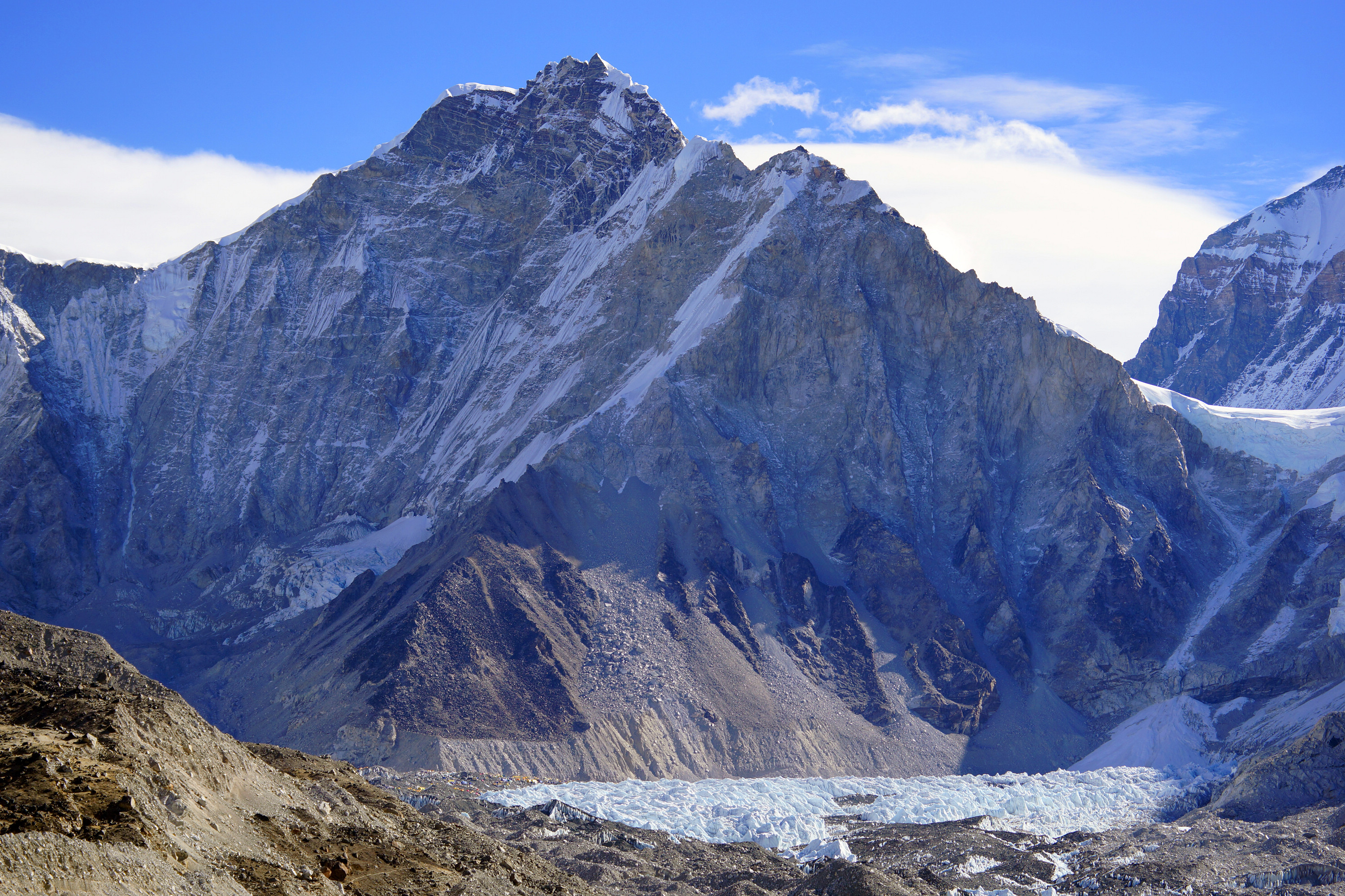
 Lingtren, Khumbutse, and Everest West Shoulder overlook base camp and the Khumbu Icefall. Mount Everest South-West face (above the west shoulder) and Nuptse's side to right
 Left to right: Lingtren-Khumbutse - Everest west shoulder.


See also
- List of mountains in China
- List of mountains in Nepal
- Everest Base Camp
References
- "Khumbutse". Peakware.com. Archived from the original on 2016-03-04. Retrieved 2013-05-05.
- "Khumbutse, China/Nepal". Peakbagger.com. Retrieved 2013-05-05.
External links
Wikimedia Commons has media related to Khumbutse.
| Topography and landmarks |
|  |
|---|---|---|
| Expeditions |
| |
| Notable fatalities |
| |
| Committees |
| |
| In media |
| |
| Years |
| |
| Mount Everest massif | ||
| Records |
| |
| Mountain guides |
| |
This Tibet location article is a stub. You can help Wikipedia by expanding it. |
This article related to a mountain or hill in Nepal is a stub. You can help Wikipedia by expanding it. |
На других языках
[de] Khumbutse
Der Khumbutse (chinesisch: 昆布孜峰) ist ein Sechstausender an der Grenze zwischen der Khumbu-Region Nepals und Tibet westlich des Mount Everest.- [en] Khumbutse
[es] Khumbutse
El Khumbutse (en chino: 坤 布 崎 峰, en pinyin: Kūnbùzī Fēng) es una montaña de la región de Khumbu, en la subcordillera Mahalangur Himal. Se encuentra en la frontera de Nepal y China; en el distrito de Solukhumbu en Nepal, y en la Prefectura de Shigatse del condado de Tingri, en el Tíbet. El pico tiene una altura de 6639 m (21 781 pies).[1][fr] Khumbutse
Khumbutse (chinois : 昆布孜峰) est la première montagne à l'ouest (6 km) de l'Everest.Текст в блоке "Читать" взят с сайта "Википедия" и доступен по лицензии Creative Commons Attribution-ShareAlike; в отдельных случаях могут действовать дополнительные условия.
Другой контент может иметь иную лицензию. Перед использованием материалов сайта WikiSort.org внимательно изучите правила лицензирования конкретных элементов наполнения сайта.
Другой контент может иметь иную лицензию. Перед использованием материалов сайта WikiSort.org внимательно изучите правила лицензирования конкретных элементов наполнения сайта.
2019-2026
WikiSort.org - проект по пересортировке и дополнению контента Википедии
WikiSort.org - проект по пересортировке и дополнению контента Википедии