geo.wikisort.org - Mountains
The Kalar Range (Russian: Каларский хребет, romanized: Kalarskiy khrebet) is a mountain range in Zabaykalsky Krai and the NW end of Amur Oblast, Russian Federation. The highest point of the range is 2,520 m (8,270 ft) high Skalisty Golets.[1][2][3]
| Kalar Range Каларский хребет | |
|---|---|
 One of the right tributaries of the Kalar river | |
| Highest point | |
| Peak | Skalisty Golets |
| Elevation | 2,520 m (8,270 ft) |
| Coordinates | 56°24′01″N 119°05′04″E |
| Dimensions | |
| Length | 350 km (220 mi) WSW / ENE |
| Width | 70 km (43 mi) |
| Geography | |
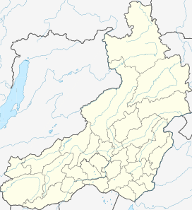 Location in Zabaykalsky Krai | |
| Country | Russia |
| Federal subject | Zabaykalsky Krai / Amur Oblast |
| Range coordinates | 56°20′N 118°0′E |
| Parent range | Stanovoy Highlands South Siberian System |
| Geology | |
| Age of rock | Early Archean and Proterozoic |
| Type of rock | Granite, metamorphic rock |
The range is part of the Udokan Ore Region that includes the Kodar and Udokan ranges.[4]
History
Located in a desolate area, the Kalar Range was first described and roughly put on the map in 1857 by A.F. Usoltsev, Lieutenant of the Corps of Military Topographers of the Russian Imperial Army. Usoltsev sighted the range from the right bank of the Kalar River.[5]
Geography
The Kalar Range belongs to the Stanovoy Highlands. It stretches from WSW to ENE for roughly 350 km (220 mi) from the Vitim river valley to the Olyokma, both right tributaries of the Lena. To the north it borders the Chara depression —in the upper reaches of the Chara river, and the western spurs of the Udokan Range. To the south the range is bound by the valley of the Kalar river, a right tributary of the Vitim, which separates it from the Yankan Range. While peaks in the western part are generally flat-topped, the eastern end has a more marked alpine relief.[6]
Hydrography
A number of rivers have their sources in the range, including the Kalar river, with its right tributaries Katugin, Chukundu and Bugungda. Also the right tributaries of the Vitim river, Taksimo and Kuanda, the left tributaries of the Olyokma, Tas-Yuryah and Imangra, as well as several right tributaries of the Chara, also a left tributary of the Olyokma. River Nyukzha flows across the range in its eastern part.[2]
Flora
The higher slopes of the range are mainly covered with sparse coniferous forest, while below 1,100 m (3,600 ft) to 1,400 m (4,600 ft) mountain larch taiga predominates.[2]
See also
- Baikal Rift Zone
- List of mountains and hills of Russia
References
- M. Murzaev (ed.), USSR Survey of Northeastern China, p. 68
- "Каларский хребет" [Kalar Range] (in Russian). Энциклопедия Забайкалья. Retrieved 17 September 2021. (in Russian)
- Google Earth
- Udokan Ore Region / Great Soviet Encyclopedia: in 30 vols. / Ch. ed. A.M. Prokhorov. - 3rd ed. - M. Soviet Encyclopedia, 1969-1978.
- Obruchev V. A., Шварц на юго-востоке Сибири (Schwartz in the southeast of Siberia) (in Russian)
- "N-49 Chart (in Russian)". Retrieved 5 September 2021.
This Zabaykalsky Krai location article is a stub. You can help Wikipedia by expanding it. |
This Amur Oblast location article is a stub. You can help Wikipedia by expanding it. |
На других языках
- [en] Kalar Range
[it] Monti del Kalar
I Monti del Kalar o Kalarskij (in russo: Каларский хребет Kalarskij chrebet?) sono una catena montuosa della Siberia Orientale meridionale situata nel Territorio della Transbajkalia e nell'Oblast' dell'Amur, in Russia.[ru] Каларский хребет
Кала́рский хребе́т — горный хребет Станового нагорья в Северном Забайкалье, расположенный в пределах Забайкальского края и Амурской области России. Простирается от Витима на юго-западе до Олёкмы на северо-востоке.Другой контент может иметь иную лицензию. Перед использованием материалов сайта WikiSort.org внимательно изучите правила лицензирования конкретных элементов наполнения сайта.
WikiSort.org - проект по пересортировке и дополнению контента Википедии