geo.wikisort.org - Mountains
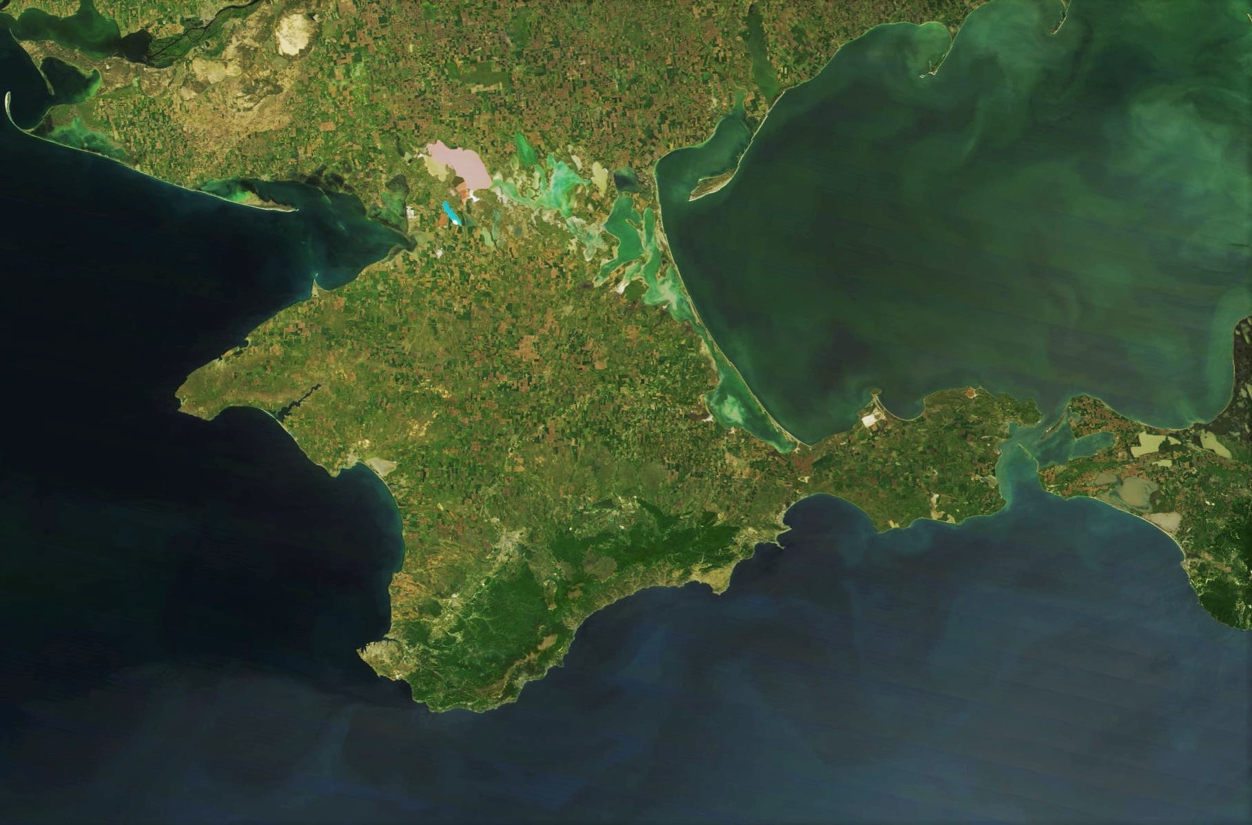
The Crimean Mountains (Ukrainian: Кримські гори, translit. Krymski hory; Russian: Крымские горы, translit. Krymskie gory; Crimean Tatar: Qırım dağları) are a range of mountains running parallel to the south-eastern coast of Crimea, between about 8–13 kilometers (5–8 miles) from the sea. Toward the west, the mountains drop steeply to the Black Sea, and to the east, they change slowly into a steppe landscape.
| Crimean Mountains | |
|---|---|
 Twilight on Demerdji Mountain | |
| Highest point | |
| Peak | Roman-Kosh |
| Elevation | 1,545 m (5,069 ft) |
| Coordinates | 44°36′47″N 34°14′36″E |
| Naming | |
| Native name |
|
| Geography | |

| |
| Location | Southern Crimea |
| Range coordinates | 44°45′N 34°30′E |
| Geology | |
| Age of rock | Cretaceous |
The Crimean Mountains consist of three subranges. The highest is the Main range. The Main range is subdivided into several masses, known as yaylas or mountain plateaus (Yayla is Crimean Tatar for "Alpine Meadow"). They are:
- Baydar Yayla
- Ay-Petri Yayla
- Yalta Yayla
- Nikita Yayla
- Hurzuf Yayla
- Babugan Yayla
- Chatyr-Dag Yayla
- Dologorukovskaya (Subatkan) Yayla
- Demirji Yayla
- Karabi Yayla
Highest peaks
The Crimea's highest peak is the Roman-Kosh (Ukrainian: Роман-Кош; Russian: Роман-Кош, Crimean Tatar: Roman Qoş) on the Babugan Yayla at 1,545 metres (5,069 ft). Other important peaks over 1,200 metres include:
- Demir-Kapu (Ukrainian: Демір-Капу, Russian: Демир-Капу, Crimean Tatar: Demir Qapı) 1,540 m in the Babugan Yayla;
- Zeytin-Kosh (Ukrainian: Зейтин-Кош; Russian: Зейтин-Кош, Crimean Tatar: Zeytün Qoş) 1,537 m in the Babugan Yayla;
- Kemal-Egerek (Ukrainian: Кемаль-Егерек, Russian: Кемаль-Эгерек, Crimean Tatar: Kemal Egerek) 1,529 m in the Babugan Yayla;
- Eklizi-Burun (Ukrainian: Еклізі-Бурун, Russian: Эклизи-Бурун, Crimean Tatar: Eklizi Burun) 1,527 m in the Chatyrdag Yayla;
- Lapata (Ukrainian: Лапата; Russian: Лапата, Crimean Tatar: Lapata) 1,406 m in the Yaltynska Yayla, Yalta Yaylası;
- Northern Demirji (Ukrainian: Північний Демірджі, Russian: Северный Демирджи, Crimean Tatar: Şimaliy Demirci) 1,356 m in the Demirci Yayla;
- Ai-Petri (Ukrainian: Ай-Петрі, Russian: Ай-Петри, Crimean Tatar: Ay Petri) 1,234 m in the Ay Petri Yaylası.
Passes and rivers
The passes over the Crimean Mountains are:
- Angarskyi Pass (752m) near Perevalne, on a road from Alushta to Simferopol
- Baydar Gate (503m) near Foros, connecting Baydar Valley and the sea coast
- Laspi Pass (350m) near Cape Aya, on a road from Yalta to Sevastopol.
Rivers of the Crimean Mountains include the Alma River, Chernaya River, and Salhir River on the northern slope and Uchan-su River on the southern slope which forms the Uchan-su waterfall, and the highest waterfall in Crimea.
History
Archaeologists have found the earliest anatomically modern humans in Europe in the Crimean mountains' Buran-Kaya caves. The fossils are 32,000 years old, with the artifacts linked to the Gravettian culture. The fossils have cut marks suggesting a post-mortem defleshing ritual.[1][2]
Gallery
 Karabi mountain plateau
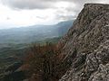 Karabi mountain plateau
 Mountain plateau of Karabi
 Mountain plateau of Chatyr-Dag mountain
 Crimean mountains


See also
References
- Prat, Sandrine; Péan, Stéphane C.; Crépin, Laurent; Drucker, Dorothée G.; Puaud, Simon J.; Valladas, Hélène; Lázničková-Galetová, Martina; van der Plicht, Johannes; et al. (17 June 2011). "The Oldest Anatomically Modern Humans from Far Southeast Europe: Direct Dating, Culture and Behavior". plosone. doi:10.1371/journal.pone.0020834.
- Carpenter, Jennifer (20 June 2011). "Early human fossils unearthed in Ukraine". BBC. Retrieved 21 June 2011.
External links
- Crimean mountains - view on all parts of mountains of Crimea
- Mountains of Crimea - Great collection of Crimean mountains from private mountain guide Sergey Sorokin
Crimea articles | |||||||||||||
|---|---|---|---|---|---|---|---|---|---|---|---|---|---|
| |||||||||||||
| History |
|  | |||||||||||
| Geography |
| ||||||||||||
| Politics |
| ||||||||||||
| Economy |
| ||||||||||||
| Society |
| ||||||||||||
Authority control | |
|---|---|
| General |
|
| National libraries | |
| Other | |
This article about a location in Crimea is a stub. You can help Wikipedia by expanding it. |
На других языках
[de] Krimgebirge
Das Krimgebirge (ukrainisch Кримські Гори .mw-parser-output .Latn{font-family:"Akzidenz Grotesk","Arial","Avant Garde Gothic","Calibri","Futura","Geneva","Gill Sans","Helvetica","Lucida Grande","Lucida Sans Unicode","Lucida Grande","Stone Sans","Tahoma","Trebuchet","Univers","Verdana"}Krymski Hory, russisch Крымские Горы Krymskije Gory, krimtatarisch Yaila) ist eine Gebirgskette auf der Halbinsel Krim, die sich entlang der Süd-Ost-Küste des Schwarzen Meers über eine Länge von ca. 150 km erstreckt. Nach Südosten fällt das Gebirge steil zum Schwarzen Meer hin ab, nach Nordwesten geht es langsam in eine Steppenlandschaft über.- [en] Crimean Mountains
[es] Montes de Crimea
Los montes de Crimea (en ruso, Крымские горы, en ucraniano, Кримські гори, en tártaro de Crimea, Qırım dağları) son una cadena montañosa que recorre en paralelo la costa sureste de la península de Crimea, que está alrededor de 13 kilómetros desde el mar. Hacia el oeste, las montañas caen bruscamente al mar Negro, y al este, cambia lentamente hacia un paisaje de estepa.[fr] Monts de Crimée
Les monts de Crimée (en ukrainien Кримскі Гори, Krymski Hory ; en russe Крымские Горы, Krymskie Gory ; en tatar de Crimée Qırım dağları), sont un massif de montagnes situé le long du littoral sud-est de la péninsule de Crimée, dans la mer Noire.[it] Monti della Crimea
I monti di Crimea (in ucraino: Кримські Гори Krymsʹki Hory, in russo: Крымские Горы Krymskye Hory, in tataro di Crimea: Qırım dağları) sono una catena montuosa che corre parallela alla costa sud-orientale della penisola di Crimea, nella Repubblica autonoma di Crimea (de facto amministrata dalla Russia ma internazionalmente riconosciuta come territorio dell'Ucraina) a circa 8-13 chilometri dal mare. Nel versante ovest le montagne scendono a picco verso il mar Nero, mentre ad est, mutano lentamente in un paesaggio di steppa. La catena montuosa è lunga circa 150 km e una larghezza massima di 50 km e una superficie di circa 7.500 km².[ru] Крымские горы
Кры́мские го́ры (укр. Кримські гори, крымскотат. Qırım dağları, Къырым дагълары), в прошлом также Таври́ческие го́ры[2] — горная система, занимающая южную и юго-восточную часть Крымского полуострова.Другой контент может иметь иную лицензию. Перед использованием материалов сайта WikiSort.org внимательно изучите правила лицензирования конкретных элементов наполнения сайта.
WikiSort.org - проект по пересортировке и дополнению контента Википедии