geo.wikisort.org - Mountains
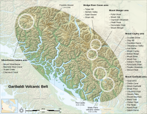
Clinker Peak is a peak on the shoulder of Mount Price in the Garibaldi Provincial Park in British Columbia, Canada. It is a stratovolcano in the Garibaldi Volcanic Belt, part of the Clinker Ridge on the west side of Garibaldi Lake. Clinker Peak is considered a volcanic vent of Mount Price, and produced two large lava flows approximately 9,000 years ago, that ponded against the retreating continental ice sheet and formed The Barrier, containing Garibaldi Lake. Clinker Peak is about 9.5 km (5.9 mi) from the abandoned settlement of Garibaldi. The nearest populated areas are Squamish, 25 km (16 mi) to the south, and Whistler 23 km (14 mi) north.
| Clinker Peak | |
|---|---|
 Clinker Peak (center) and Mount Price (left) | |
| Highest point | |
| Elevation | 1,992 m (6,535 ft)[1] |
| Prominence | 62 m (203 ft) |
| Coordinates | 49°54′53″N 123°02′38″W[2] |
| Geography | |
 Clinker Peak British Columbia, Canada | |
| District | New Westminster Land District |
| Parent range | Garibaldi Ranges |
| Topo map | NTS 92G14 Cheakamus River |
| Geology | |
| Age of rock | Holocene |
| Mountain type | Stratovolcano |
| Volcanic arc/belt | Canadian Cascade Arc Garibaldi Volcanic Belt
|
| Last eruption | 9,000 years ago |
| Climbing | |
| First ascent | 1912 BCMC Party |
Notes
- "Clinker Peak". Bivouac.com.
- "Clinker Peak". BC Geographical Names.
External links
| Wikimedia Commons has media related to Clinker Peak. |
This article about a location on the Coast of British Columbia, Canada is a stub. You can help Wikipedia by expanding it. |
Другой контент может иметь иную лицензию. Перед использованием материалов сайта WikiSort.org внимательно изучите правила лицензирования конкретных элементов наполнения сайта.
WikiSort.org - проект по пересортировке и дополнению контента Википедии