geo.wikisort.org - Mountains
The Chartreuse Mountains (French: massif de la Chartreuse [masif d(ə) la ʃaʁtʁøz]) are a mountain range in southeastern France, stretching from the city of Grenoble in the south to the Lac du Bourget in the north. They are part of the French Prealps, which continue as the Bauges to the north and the Vercors to the south.


Etymology
The name Chartreuse is derived from the village now known as Saint-Pierre-de-Chartreuse, earlier Catorissium, Cantourisa, Caturissium, and Chatrousse.[1] It appears to be of Gaulish origin;[2] and is perhaps related to the name of the Caturiges tribe.[3]
Geography
The mountain range rises between Grenoble (south), Chambéry (north), Voiron and Saint-Laurent-du-Pont (west) and Grésivaudan (Isère valley, east)
Main summits
Summits of the Chartreuse Mountains include:
- Chamechaude, 2,082 metres (6,831 ft)
- Dent de Crolles, 2,062 metres (6,765 ft)
- Les Lances de Malissard 2,045 metres (6,709 ft)
- Grand Som, 2,026 metres (6,647 ft)
- Dôme de Bellefont 1,975 metres (6,480 ft)
- Piton de Bellefont 1,958 metres (6,424 ft)
- Mont Granier, 1,933 metres (6,342 ft)
- La Grande Sure, 1,920 metres (6,299 ft)
- Le Charmant Som 1,867 metres (6,125 ft)
- Sommet du Pinet ou le Truc 1,867 metres (6,125 ft)
- Rochers de Chalves 1,845 metres (6,053 ft)
- Rocher de Lorzier 1,838 metres (6,030 ft)
- Dent de l'Ours 1,820 metres (5,971 ft)
- Scia 1,791 metres (5,876 ft)
- Petit Som 1,772 metres (5,814 ft)
- Pinéa 1,771 metres (5,810 ft)
- Mont Outheran 1,673 metres (5,489 ft)
- Grands Crêts 1,489 metres (4,885 ft)
- Pointe de la Gorgeat 1,486 metres (4,875 ft)
- Écoutoux 1,406 metres (4,613 ft)
- mont Saint-Eynard 1,358 metres (4,455 ft)
- Néron 1,298 metres (4,259 ft)
- Rachais 1,050 metres (3,445 ft)
Main passes
Passes of the Chartreuse Mountains include :
With road
- Col de la Charmette
- Col de la Cluse
- Col du Coq
- Col du Cucheron
- Col du Granier
- Col de Porte
- Col de Palaquit
- Col de Vence
- Col de la Placette
Without road
- Col de l'Alpe
- Col de l'Alpette
- Col des Ayes
- Col de Charmille
- Col des Émeindras
- Col de la Faîta
- Col de Bellefond
- Col de Léchaud
- Col de la Ruchère
- Col de la Sure
- Col de la Grande Vache
- Col de la Petite Vache
- Col du Baure
Main canyons
Canyons of the Chartreuse Mountains include :
- Gorges du Guiers Vif
- Gorges du Guiers Mort
- Gorges du Ténaison
- Gorges de la Vence
- Gorge du Manival
- Gorges de l'Echaillon
- Gorges du Cozon Rau
Main plateaux
Plateaux of the Chartreuse Mountains include :
- Plateau des Petites Roches
- Plateau du Grand-Ratz
Main Caves
The main caves in the Chartreuse include :
- Réseau de l'Alpe
, 69.6 kilometres (43.2 mi) long, 655 metres (2,149 ft) deep.[4] - Réseau de la Dent de Crolles - about 60 kilometres (37 mi) long, 690 metres (2,260 ft) deep.[5]
- Système du Granier, 55.7 kilometres (34.6 mi) long, 635 metres (2,083 ft) deep.[6][7]
- Réseau de malissard, 18.2 kilometres (11.3 mi) long, 415 metres (1,362 ft) deep.[8]
- Système Pinet-Brouillard, 11.2 kilometres (7.0 mi) long, 507 metres (1,663 ft) deep.[9]

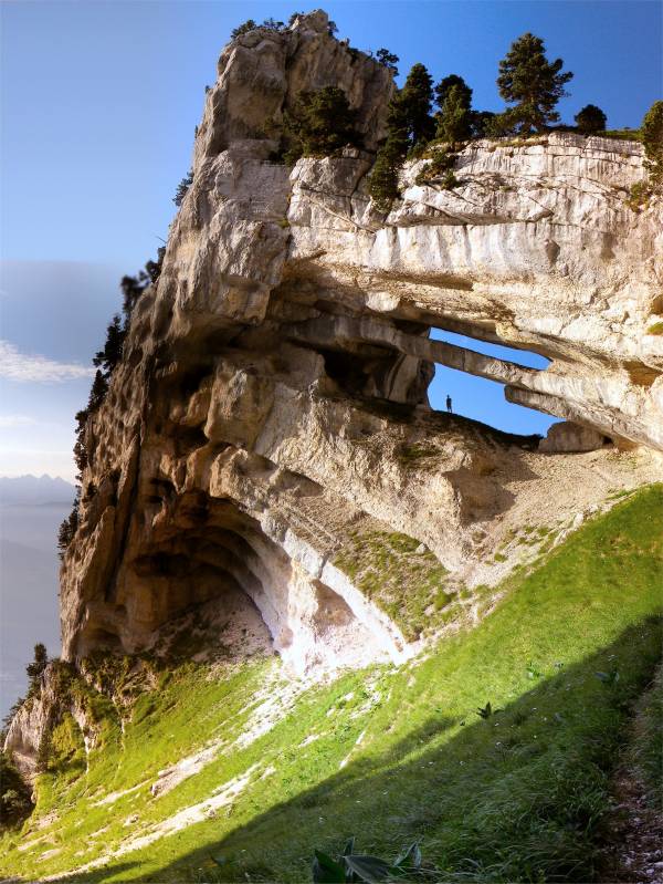
Geology
The lithology is dominated by limestone, and several hundred kilometres of cave passages lie beneath the hills, including the world-famous 60 km long Dent de Crolles system.[citation needed]
Winter sports resorts
Chartreuse winter sports resorts include :
- Le Désert d'Entremont, where the use of snowshoes has been particularly developed
- Granier en Chartreuse
- Saint-Pierre-de-Chartreuse and Le Planolet
- Saint-Hugues-de-Chartreuse
- Col de Porte 1,326 metres (4,350 ft)
- Le Sappey-en-Chartreuse
- La Ruchère (cross-country skiing)
- Saint-Hilaire-du-Touvet
- Col de Marcieu
- Col du Coq
Environment
- The Parc Naturel Régional de la Chartreuse was founded in May 1995.
- The Réserve Naturelle des Hauts de Chartreuse was founded in 1997. It includes seven Isère townships and four Savoie townships.
Miscellaneous
The Chartreuse Mountains gave their name to the monastery of the Grande Chartreuse, the monastic Carthusian Order takes its name from these mountains, where its first hermitage was founded in 1084.[citation needed] Also derived from the mountain range's name is that of the alcoholic cordial Chartreuse produced by the monks since the 1740s, and of the chartreuse colour, greenish hue of the Chartreuse liqueur, named after the drink.[citation needed]
References
- Oxford English Dictionary, 1st edition, 1888 s.v.
- Juan Luis García Alonso, Continental Celtic Word Formation: The Onomastic Data, p. 42
- Robert Ellis, A Treatise on Hannibal's Passage of the Alps, 1853, p. 174
- Denis Bourgeois (2008). "Savoie-Quelques nouvelles des fronts…" (PDF). Spelunca (in French). 111: 25–30. Retrieved 2018-05-30.
- Gardner, John (20 August 2021). "Réseau de la Dent de Crolles, Chartreuse". Réseau de la Dent de Crolles, Chartreuse. Archived from the original on 2021-11-25. Retrieved 25 November 2021.
- Denys Bourgeois (2001). "échos des profondeurs France-Isère-Activités du Spéléo-club de Savoie au Mont Granier (Chartreuse nord)" (PDF). Spelunca (in French). 83: 5–6. ISSN 0991-0735.
- Jean-Louis Fantoli. "gouffre des Myriades". Retrieved 2018-05-18.
- Bernard Loiseleur (1994). "Le massif du Seuil (Chartreuse, France): organisation des réseaux souterrains". revue Karstologia (in French). p. 13-28. Retrieved 2018-06-19.
- Jean-Louis Fantoli. "Gouffre du Brouillard". Retrieved 2018-05-18.
External links
- Chartreuse: A Walking Guide
- A Wiki-Walks guide to some less well known hiking routes in the Chartreuse
Authority control | |
|---|---|
| General |
|
| National libraries | |
На других языках
[de] Chartreuse (Gebirge)
Die Chartreuse ist ein voralpines Gebirgsmassiv aus Kalkstein in den nördlichen französischen Alpen. Das Massiv, dessen höchster Gipfel die Chamechaude mit einer Höhe von 2082 m ist, liegt in den Départements Savoie und Isère. Es wird geografisch den Chaînes Subalpines Septentrionales (nördliche Voralpen) und geologisch den Französischen Kalkalpen zugeordnet. Das recht dünn besiedelte Berggebiet steht unter Naturschutz (Regionaler Naturpark Chartreuse).- [en] Chartreuse Mountains
[fr] Massif de la Chartreuse
Le massif de la Chartreuse est un massif montagneux des Préalpes, situé en majeure partie dans le département français de l'Isère et aussi dans celui de la Savoie, constituant une région naturelle. Il culmine à 2 082 mètres d'altitude à Chamechaude. Il est constitué essentiellement de calcaires disposés en successions d'anticlinaux et de synclinaux formant de longues lignes de crêtes orientées du nord au sud. Les dépressions, au fond desquelles coulent le Guiers et ses affluents, sont séparées par des cols. Le massif, soumis à un climat océanique montagnard, connaît des précipitations relativement importantes mais l'eau est peu présente en surface ; elle s'écoule rapidement dans les réseaux karstiques creusés dans le calcaire.[it] Prealpi della Chartreuse
Le Prealpi della Chartreuse sono una sottosezione[1] delle Prealpi di Savoia in Francia. Si trovano per la maggior parte nel dipartimento dell'Isère ed in parte in quello della Savoia. Costituiscono la parte più meridionale delle Prealpi di Savoia, e hanno dato il loro nome al monastero della Grande Chartreuse.Другой контент может иметь иную лицензию. Перед использованием материалов сайта WikiSort.org внимательно изучите правила лицензирования конкретных элементов наполнения сайта.
WikiSort.org - проект по пересортировке и дополнению контента Википедии