geo.wikisort.org - Mountains
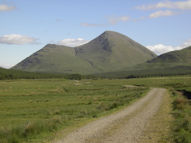
Beinn Talaidh (762 m) is a peak on the Isle of Mull, Scotland, located in the mountainous centre of the Island.
| Beinn Talaidh | |
|---|---|
 Beinn Talaidh | |
| Highest point | |
| Elevation | 762 m (2,500 ft)[1] |
| Prominence | 430 m (1,410 ft) |
| Listing | Graham, Marilyn |
| Coordinates | 56°26′39″N 5°51′19″W |
| Geography | |
| Location | Isle of Mull, Scotland |
| OS grid | NM625347 |
| Topo map | OS Landranger 49 |
The mountain is shaped like a symmetrical cone and can be climbed from the steep facing south side, or more gentle northern side along Glen Forsa. Beinn Talaidh was for many years classed as a Corbett before a resurvey found it to be slightly lower than expected, and it was thus demoted to Graham status; however it is the highest of the 219 Grahams in Scotland.[2]
See also
- List of Graham mountains in Scotland
References
- "Beinn Talaidh - Hillbagging.co.uk". hill-bagging.co.uk. Retrieved 19 May 2019.
- "walkhighlands Beinn Talaidh". walkhighlands.co.uk. Retrieved 19 May 2019.
| British Isles |  | |
|---|---|---|
| Scotland | ||
| Outside Scotland | ||
| England | ||
| Ireland | ||
| County tops |
| |
This Scottish location article is a stub. You can help Wikipedia by expanding it. |
Текст в блоке "Читать" взят с сайта "Википедия" и доступен по лицензии Creative Commons Attribution-ShareAlike; в отдельных случаях могут действовать дополнительные условия.
Другой контент может иметь иную лицензию. Перед использованием материалов сайта WikiSort.org внимательно изучите правила лицензирования конкретных элементов наполнения сайта.
Другой контент может иметь иную лицензию. Перед использованием материалов сайта WikiSort.org внимательно изучите правила лицензирования конкретных элементов наполнения сайта.
2019-2026
WikiSort.org - проект по пересортировке и дополнению контента Википедии
WikiSort.org - проект по пересортировке и дополнению контента Википедии