geo.wikisort.org - Mountains
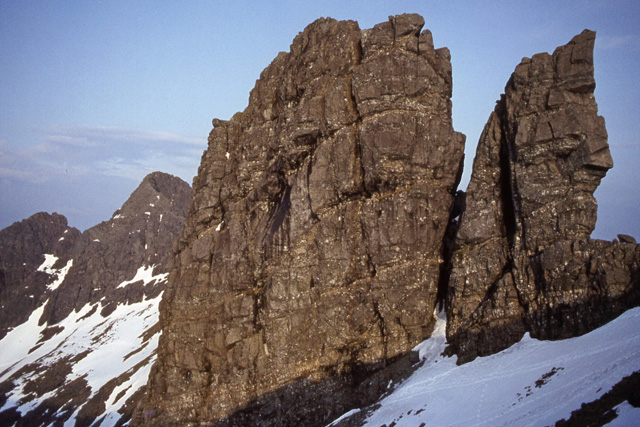
Am Basteir (Scottish Gaelic: Am Bàisteir, 'the baptizer')[2] is a mountain peak in the northern Cuillin range on the Isle of Skye in Scotland. It is 934 metres (3,064 feet) high and classed as a Munro. It forms a narrow blade of rock, which bears comparison with the Inaccessible Pinnacle in the same range.
| Am Basteir | |
|---|---|
| Am Bàisteir | |
 | |
| Highest point | |
| Elevation | 934 m (3,064 ft)[1] |
| Prominence | 49 m (161 ft) |
| Listing | Munro |
| Coordinates | 57°14′53″N 6°12′14″W |
| Naming | |
| Language of name | Gaelic |
| Pronunciation | English: /æm ˈbæstɛər/ Scottish Gaelic: [əm ˈpaʃtʲɛɾʲ] |
| Geography | |
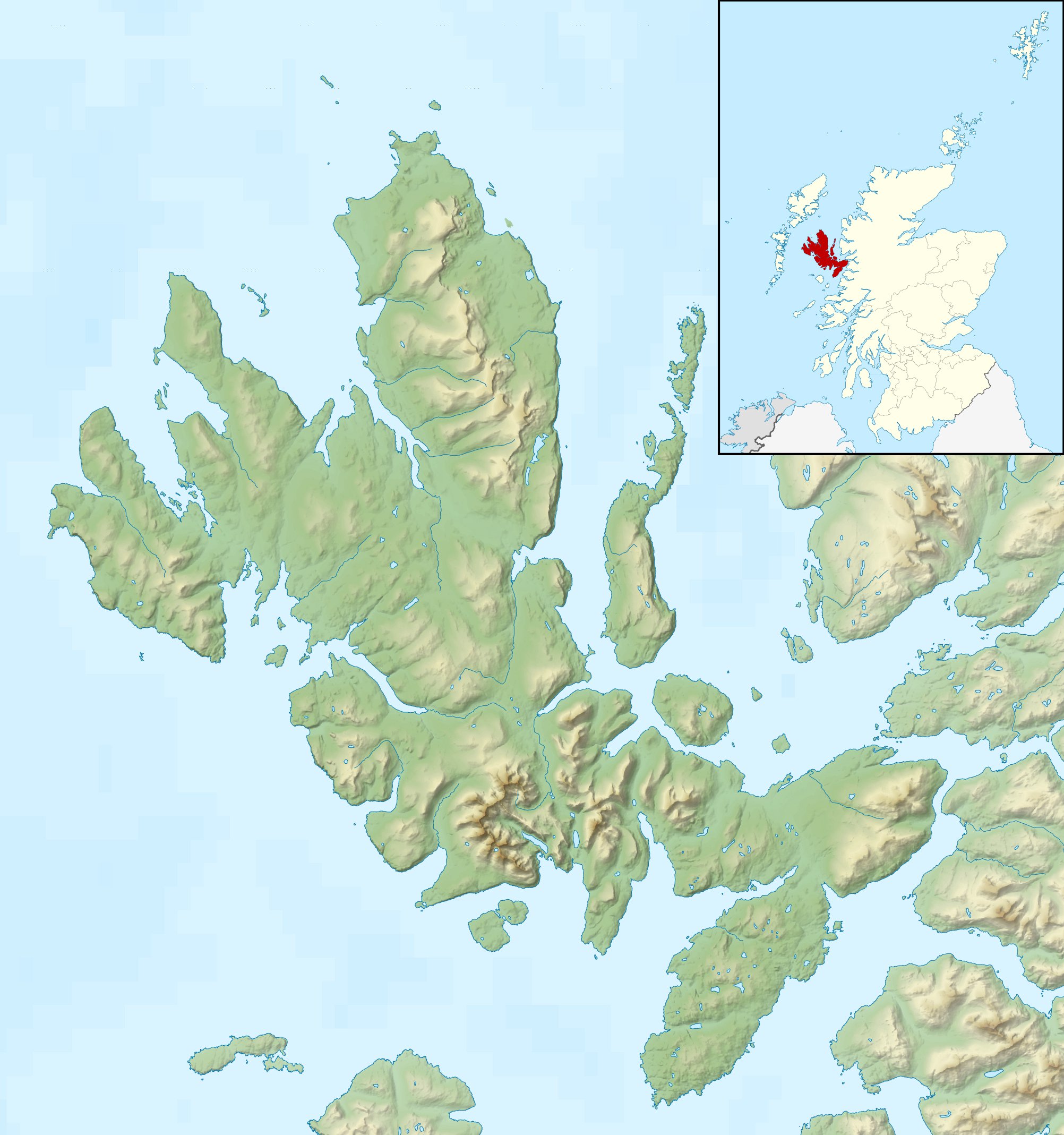 Am Basteir Location in Skye | |
| Location | Cuillin, Skye, Scotland |
| OS grid | NG465253 |
| Topo map | OS Landranger 32 |
The easiest route to the summit starts from Sligachan following a path along the left bank of the Allt Dearg Beag (small red burn) for 5 kilometres (3 miles) to a small lochan in the Coire a' Bhasteir, then up a gruelling scree slope to the bealach on the main ridge between Sgurr nan Gillean and Am Basteir. A scramble of approximately 200 m (660 ft) along the east ridge will bring you to the summit although care should be taken near the top as there is a "bad step", a 3-metre-high (10-foot) notch in the ridge to negotiate. This could be scrambled down until recently but a rockfall now means it must be avoided, downclimbed or abseiled. The bad step is most easily avoided via an elusive moderate scrambling route on the south face but can be reascended (i.e. on descent from the summit) without difficulty. The western end of Am Basteir is vertical, though it is possible for a walker coming from the direction of Bruach na Frìthe to reach the top by skirting below Am Basteir to reach the bealach mentioned above.[citation needed]
At the foot of the western side there is large prominent pinnacle, similar in shape to Am Basteir itself, known as the Basteir Tooth.
References
- "Am Basteir". walkhighlands.co.uk. walkhighlands.co.uk. Retrieved 13 October 2013.
- "Am Basteir". Ainmean-Àite na h-Alba: Gaelic Place-Names of Scotland.


На других языках
[de] Am Basteir
Der Am Basteir (auch Am Baisteir) ist ein 934 m (3.064 ft) hoher Berg auf der schottischen Insel Skye. Die Bedeutung seines gälischen Names ist unsicher. Sehr wahrscheinlich ist die vielfach in Publikationen und Führern zu findende englische Übersetzung als The Executioner (deutsch: Der Scharfrichter) jedoch unzutreffend, da es kein hierzu passendes Wort in der gälischen Sprache gibt. Vermutet wird eher eine Bedeutung in etwa als Tief gespalten oder Tief zerklüftet, passend zur markanten Silhouette des Gipfels mit dem benachbarten Basteir Tooth.[1] Er ist Teil der Bergkette der Black Cuillin und aufgrund seiner Höhe als Munro eingestuft.- [en] Am Basteir
[es] Am Basteir
Am Basteir (en gaélico Am Baisteir; se pronuncia æm bæstjɛəɹ) es una montaña en la cadena Cuillin septentrional en la isla de Skye, en Escocia (Reino Unido). Tiene 934 metros de alto y está clasificada como un munro. Forma una estrecha hoja de roca, comparable con el Inaccessible Pinnacle ("Pináculo inaccesible"). Como el resto de la cadena, está compuesta de gabro, una roca ígnea con excelente agarre para la práctica del montañismo.Другой контент может иметь иную лицензию. Перед использованием материалов сайта WikiSort.org внимательно изучите правила лицензирования конкретных элементов наполнения сайта.
WikiSort.org - проект по пересортировке и дополнению контента Википедии