
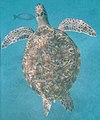
 Turtle at Similan
 Whale shark at Similan
 Phantom Bannerfish at Similan
geo.wikisort.org - Island
The Similan Islands (Thai: หมู่เกาะสิมิลัน, RTGS: Mu Ko Similan, Thai pronunciation: [mùː kɔ̀ʔ si.mi.lan], Malay: Pulau Sembilan) is an archipelago in the Andaman Sea off the coast of, and part of, Phang Nga Province in southern Thailand. It is the maritime border between India and Thailand. It was established as Mu Ko Similan National Park in 1982 after a one-year assessment by the forestry department.[1]

Access and tourism
Access to the Similan Islands is easiest from Tab Lamu Port, just south of Khao Lak in Phang Nga Province. The park headquarters is in Tab Lamu, which is a small fishing village, just 13 km from Bang La On in Khao Lak. Boats depart daily from the middle of October to the middle of May. The trip takes about three hours each way on slower boats or 70 minutes via speedboat.
During the diving season liveaboard boats head to the Similan Islands. These dive boats depart and return from Tab Lamu, Ko Lanta, Phuket, and Ranong and stay for several days at Similan National Marine Park.
The Similan Islands Park is the most overcrowded Thai national park. Five to six thousand persons per day visit the islands during its open season from mid–October to mid–May. The DNP reports that since October 2017 the park has been visited by 883,438 persons. Sheer numbers have resulted in degradation and thus increased regulation.[2]
The park is closed in the rainy season, from 16 May-15 October, every year.[3] The island of Ko Tachai has been closed to tourists indefinitely beginning 15 October 2016 to allow it to recover from effects of its heavy tourist burden.[4] As of the park's re-opening on 15 October 2018, the number of visitors allowed to visit the islands was capped at 3,850 per day in order to slow environmental destruction.[5] Prior to the visitor cap, the islands received about 7,000 visitors per day. In 2017, about 912,000 tourists visited. Tour operators have protested the new rules, saying jobs will be lost.[6] All overnight accommodations on the islands have been demolished as part of the rehabilitation program.[2]
Geography


The islands are at 8°39′09″N 97°38′27″E
The park is an archipelago consisting of 11 islands, occupying an area of approximately 140 km2 with a land area of about 26 km2.[3] For convenience, the Thai Department of National Parks (DNP) has assigned numbers to the islands. From north to south, they are:[7]
- Island 11: Ko Tachai
- Island 10: Ko Bon, also known as Ko Talu
- Island 9: Ko Ba-ngu, also known as Ko Bayu
- Island 8: Ko Similan
- Island 7: Ko Hin Pousar
- Island 6: Ko Payu, also known as Ko Pa Yu
- Island 5: Ko Ha
- Island 4: Ko Miang, also known as Ko Meang. Park HQ is here.
- Island 3: Ko Payan, also known as Ko Pa Yan
- Island 2: Ko Payang, also known as Ko Pa Yang
- Island 1: Ko Huyong, also known as Ko Hu Yong

The Similans lie 70 kilometres off the coast of Phang Nga Province. "Similan" is a Yawi word meaning 'nine'. Ko Bon and Tachai were added to the national park in 1998.
Ko Similan: Ko Similan is the largest island. The sea in the area has an average depth of 60 feet. Underwater it is full of rock formations and coral reefs in several shapes and forms, resembling such things as deer, leaves, brains, and mushrooms. Above the water are found many diverse species such as the Nicobar pigeon, mangrove monitor lizards, flying fox and more.
Ko Huyong: Ko Huyong has the longest and widest beach in the park. However, the park prohibits any tourists from landing on the island as the beach is a place where turtles come to lay their eggs.
Wildlife protection

Islands 1, 2, and 3 are closed to the public due to a turtle hatching protection program and reef conservation efforts. Island number 3 belongs to a Thai princess. Fishing is banned in Similan and Surin National Parks. However, fishing boats are constantly seen in and around the park. When diving, one can often find nets stuck to reefs and illegal fishing traps. In recent years many illegal fishing traps have been found outside the most common dive sites. They have contained among others trevallies, batfish, barracuda, golden pilot jacks, and triggerfish. Fishing traps seem to be overly abundant around Ko Bon and Ko Tachai.[citation needed]
Important Bird Area
The archipelago has been designated an Important Bird Area (IBA) by BirdLife International because it supports a population of Vulnerable pale-capped pigeons.[8]
Ocean Animals at Mu Ko Similan National Park


See also
References
- "Similan Islands National Park". Tourism Authority of Thailand (TAT). Retrieved 31 May 2018.
- Rujivanarom, Pratch (31 May 2018). "Ban on overnight stays at Similan islands from Oct". The Nation. Retrieved 31 May 2018.
- "Mu Ko Similan National Park" (PDF). Department of National Parks (DNP). Retrieved 31 May 2016.
- "Koh Tachai island off Phangnga closed indefinitely". Bangkok Post. 2016-05-16. Retrieved 17 May 2016.
- Rujivanarom, Pratch (15 October 2018). "Tight curbs on visitors to Similan". The Nation. Retrieved 15 October 2018.
- WIpatayotin, Apinya (16 October 2018). "Parks officials refuse to budge over Similan quota". Bangkok Post. Retrieved 17 October 2018.
- "ABOUT THE SIMILAN ISLANDS". Similan Islands. Mu Ko Similan National Park of Thailand. Retrieved 17 May 2016.
- "Mu Ko Similan". BirdLife Data Zone. BirdLife International. 2021. Retrieved 2 March 2021.
External links
Wikimedia Commons has media related to Similan Islands.
 Similan Islands travel guide from Wikivoyage
- Website, Mu Ko Similan National Park
- Similan Islands Guide
- Similan Islands Dive Center & Snorkeling Center
- Overview of diving the Similan Islands
- Diving maps of Similan islands dive sites
Recreational dive sites | |||||||||||||||||||||||||||||||||||||||||||||||||||||||
|---|---|---|---|---|---|---|---|---|---|---|---|---|---|---|---|---|---|---|---|---|---|---|---|---|---|---|---|---|---|---|---|---|---|---|---|---|---|---|---|---|---|---|---|---|---|---|---|---|---|---|---|---|---|---|---|
| |||||||||||||||||||||||||||||||||||||||||||||||||||||||
| |||||||||||||||||||||||||||||||||||||||||||||||||||||||
| |||||||||||||||||||||||||||||||||||||||||||||||||||||||
| |||||||||||||||||||||||||||||||||||||||||||||||||||||||
| |||||||||||||||||||||||||||||||||||||||||||||||||||||||
| |||||||||||||||||||||||||||||||||||||||||||||||||||||||
| |||||||||||||||||||||||||||||||||||||||||||||||||||||||
| |||||||||||||||||||||||||||||||||||||||||||||||||||||||
| |||||||||||||||||||||||||||||||||||||||||||||||||||||||
Authority control | |
|---|---|
| General |
|
| National libraries | |
На других языках
[de] Similan-Inseln
Similan-Inseln (Thai: .mw-parser-output .Thai{font-size:115%}หมู่เกาะสิมิลัน, Mu Ko Similan) wird eine Gruppe von neun Inseln in der Andamanensee vor der Provinz Phang Nga in Thailand genannt. Ihr Name leitet sich vom malayischen Wort „sembilan“ (neun) ab. Die unbewohnten Inseln bilden zusammen mit zwei weiteren Inseln den Nationalpark Mu Ko Similan. Das Meer rund um die Similan-Inseln gilt zum Schnorcheln wie zum Sporttauchen als eines der schönsten Reviere weltweit.- [en] Similan Islands
[fr] Îles Similan
Les îles Similan (en thaï : หมู่เกาะสิมิลัน ; API : mùː kɔ̀ʔ si.mi.lan) est un archipel de la mer d'Andaman dans la province de Phang Nga, dans le sud de la Thaïlande. Il était à l'origine composé de neuf îles et compte aujourd'hui onze îles : Ko Tachai, Ko Bon, Ko Bangu, Ko Similan, Ko Payu, Ko Hin Pousar, Ko Ha, Ko Miang, Ko Payan, Ko Payang et Ko Huyong.[it] Isole Similan
Le isole Similan (in lingua thailandese: หมู่เกาะสิมิลัน) costituiscono un arcipelago della Thailandia, che appartiene alla provincia di Phang Nga.[ru] Симилан
Острова Симилан, Симиланские острова (тайск. เกาะสิมิลัน) — группа островов в Андаманском море в 70 км к западу от провинции Пхангнга, к которой они административно и относятся. На языке Яви название архипелага означает «девять», по количеству островов. В 1982 году был образован национальный парк «Симилан», а в 1998 году острова Бон и Тачай были присоединены к парку.Текст в блоке "Читать" взят с сайта "Википедия" и доступен по лицензии Creative Commons Attribution-ShareAlike; в отдельных случаях могут действовать дополнительные условия.
Другой контент может иметь иную лицензию. Перед использованием материалов сайта WikiSort.org внимательно изучите правила лицензирования конкретных элементов наполнения сайта.
Другой контент может иметь иную лицензию. Перед использованием материалов сайта WikiSort.org внимательно изучите правила лицензирования конкретных элементов наполнения сайта.
2019-2026
WikiSort.org - проект по пересортировке и дополнению контента Википедии
WikiSort.org - проект по пересортировке и дополнению контента Википедии