geo.wikisort.org - River
Erawan National Park (Thai: อุทยานแห่งชาติเอราวัณ) is a 343,735 rai ~ 550 square kilometres (210 sq mi)[2] park in western Thailand in the Tenasserim Hills of Kanchanaburi Province, Amphoe Si Sawat in tambon Tha Kradan. Founded on August 14, 1975, it was Thailand's 12th national park.[3]
| Erawan National Park | |
|---|---|
IUCN category II (national park) | |
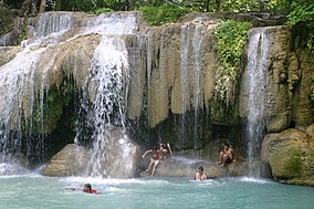
 Erawan Waterfall | |
 | |
| Location | Kanchanaburi Province, Thailand |
| Nearest city | Kanchanaburi |
| Coordinates | 14°23′N 99°07′E |
| Area | 550 km2 (210 sq mi) |
| Established | 14 August 1975 [1] |
| Visitors | 650,852 (in 2019) |
| Governing body | Department of National Park, Wildlife and Plant Conservation (DNP) |
Features
The major attraction of the park is Erawan Falls, a waterfall named after Erawan, the three-headed white elephant of Hindu mythology. The seven-tiered falls are said to resemble Erawan.[4] There are four caves in the park: Mi, Rua, Wang Badan, and Phrathat.[5] Rising northeast of the waterfall area there is a breast-shaped hill named Khao Nom Nang.[6]
Flora
Mixed deciduous forest accounts for 81.05% of the national park area. Deciduous dipterocarp forest accounts for 1.68% of the national park area. Dry evergreen forests account for 14.35% of the national park area.[citation needed]
Fauna
Mammals:
- Asian elephant
- Asian black bear
- Serow
- Muntjac
- Sambar deer
- Wild boar
- Lar gibbon
- Phayre's leaf monkey
- Southern pig-tailed macaque
- Slow loris
- Leopard cat
- Asian palm civet
- Treeshrew
Birds:
- Black baza
- Kalij pheasant
- Red junglefowl
- White-breasted waterhen
- Common sandpiper
- Spotted dove
- Greater coucal
- Indian roller
- Grey-capped pygmy woodpecker
- Ayeyarwady bulbul
- Puff-throated babbler
Reptiles:
- King cobra
- Banded krait
- Burmese python
- Ptyas korros
- Calotes mystaceus
- Eutropis multifasciata
- Trionychidae
Amphibians:
- Asian common toad
- Green puddle frog
- Megophryidae
- Limnonectes hascheanus
- Wallace's flying frog
Aquatic Animals:
- Dwarf snakehead
- Tor tambroides
- Pristolepis fasciata
- Java barb
- Hampala dispar
See also
- List of national parks of Thailand
- List of Protected Areas Regional Offices of Thailand
References
- http://www.ratchakitcha.soc.go.th/DATA/PDF/2538/A/033/22.PDF [bare URL PDF]
- "ข้อมูลพื้นที่อุทยานแห่งชาติ ที่ประกาศในราชกิจจานุบกษา 133 แห่ง" [National Park Area Information published in the 133 Government Gazettes]. Department of National Parks, Wildlife and Plant Conservation (in Thai). December 2020. Retrieved 1 November 2022, no 12
{{cite web}}: CS1 maint: postscript (link) - http://www.ratchakitcha.soc.go.th/DATA/PDF/2538/A/033/22.PDF [bare URL PDF]
- Elliot, Stephan; Cubitt, Gerald (2001). THE NATIONAL PARKS and other Wild Places of THAILAND. New Holland Publishers (UK) Ltd. pp. 32–35. ISBN 9781859748862.
- Erawan National Park Archived December 8, 2006, at the Wayback Machine
- Roadway Thailand Atlas, Groovy Map Co., Ltd. © 4/2010
Further reads
- Notebook, BeautifulbEq. Notebook: Beautiful Waterfalls in the Erawan National Park in Tha , Journal for Writing, College Ruled Size 6 X 9 , 110 Pages. N.p., Independently Published, 2020.
- Atiyah, Jeremy. Southeast Asia. United Kingdom, Rough Guides, 2002.
External links
- National Park, Wildlife and Plant Conservation Department
- Erawan National Park - attractions, species, maps
- Attractions of Erawan
- Erawan Waterfall
- Get there
- How to get from Bangkok to Kanchanaburi
Другой контент может иметь иную лицензию. Перед использованием материалов сайта WikiSort.org внимательно изучите правила лицензирования конкретных элементов наполнения сайта.
WikiSort.org - проект по пересортировке и дополнению контента Википедии
