geo.wikisort.org - Island
Sepanggar Island (Malay: Pulau Sepanggar) is an island located off Sepanggar, Sabah. Its eastern shore supports a small community. The island is easily spotted from the city centre and from Likas Bay. It has a northeast–southwest orientation and therefore commands a view of Gaya Bay on the eastern shoreline. The island has two main peaks and is covered in thick tropical rainforest. This island can be accessed by the jetty near the city centre or from Sepanggar Bay, near the navy base. This island, however, is not really visited by tourists but mostly fishermen stay there. This island is known to be where several World War II bombs have been found.[1][2]
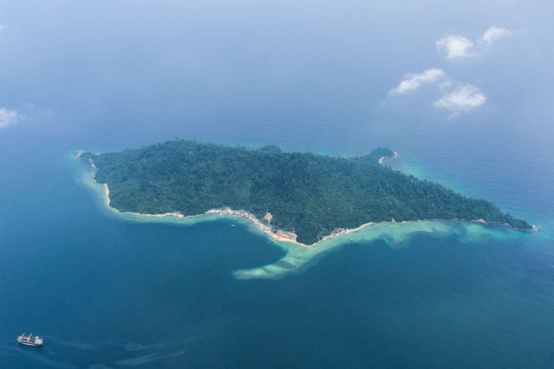 Aerial view of Sepanggar Island | |
 Sepanggar Island | |
| Geography | |
|---|---|
| Coordinates | 6°4′4″N 116°4′26″E |
| Administration | |
| State | |
See also
References
- "Sepangar Island". WikiMapia. Retrieved 21 March 2012.
- "Sepangar Island". World Flicks. Retrieved 21 March 2012.
This article about an island of Malaysia is a stub. You can help Wikipedia by expanding it. |
This Sabah location article is a stub. You can help Wikipedia by expanding it. |
На других языках
[de] Pulau Sapanggar
Pulau Sapanggar oder Pulau Sepangar ist eine zum malaysischen Bundesstaat Sabah gehörende Insel im Südchinesischen Meer an der Einfahrt zur Sapanggar Bay. Die überwiegend bewaldete Insel liegt etwa 10 Kilometer nördlich von Kota Kinabalu und steigt vom Meer aus steil zu einem Höhenrücken mit zwei Berggipfeln von 150 und 181 Metern an. Sie erstreckt sich über 2,5 Kilometer in nördlicher Richtung und ist bis zu einem Kilometer breit.[1][Anm. 1]- [en] Sepanggar Island
Другой контент может иметь иную лицензию. Перед использованием материалов сайта WikiSort.org внимательно изучите правила лицензирования конкретных элементов наполнения сайта.
WikiSort.org - проект по пересортировке и дополнению контента Википедии