geo.wikisort.org - Island
Qikiqtaryuaq formerly Melbourne Island[1] is an island in the Kitikmeot Region, Nunavut, Canada. It is located at the western end of Queen Maud Gulf, off Kiillinnguyaq. To the north lies the Canadian Arctic's second largest island, Victoria Island.
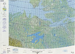
 Map including Qikiqtaryuaq | |
 Qikiqtaryuaq  Qikiqtaryuaq | |
| Geography | |
|---|---|
| Location | Northern Canada |
| Coordinates | 68°30′02″N 104°42′44″W |
| Archipelago | Arctic Archipelago |
| Area | 381 km2 (147 sq mi) |
| Administration | |
Canada | |
| Territory | Nunavut |
| Region | Kitikmeot |
| Demographics | |
| Population | Uninhabited |
Melbourne Island is oval shaped, and dominated by lakes and marshlands. It has an area of 381 km2 (147 sq mi).
References
- Oceandots.com at the Wayback Machine (archived December 23, 2010)
На других языках
[de] Melbourne Island
Melbourne Island (Inuktitut: Qitiqtaryuaq) ist eine unbewohnte Insel in der Kitikmeot-Region des kanadischen Territoriums Nunavut.- [en] Qikiqtaryuaq (Queen Maud Gulf)
[ru] Мелборн (остров)
Мелборн (англ. Melbourne Island) — остров Канадского Арктического архипелага. В настоящее время остров необитаем (2012).Текст в блоке "Читать" взят с сайта "Википедия" и доступен по лицензии Creative Commons Attribution-ShareAlike; в отдельных случаях могут действовать дополнительные условия.
Другой контент может иметь иную лицензию. Перед использованием материалов сайта WikiSort.org внимательно изучите правила лицензирования конкретных элементов наполнения сайта.
Другой контент может иметь иную лицензию. Перед использованием материалов сайта WikiSort.org внимательно изучите правила лицензирования конкретных элементов наполнения сайта.
2019-2025
WikiSort.org - проект по пересортировке и дополнению контента Википедии
WikiSort.org - проект по пересортировке и дополнению контента Википедии