geo.wikisort.org - Island
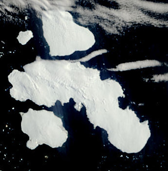
Limoza Island (Bulgarian: остров Лимоза, romanized: ostrov Limoza, IPA: [ˈɔstrof liˈmɔzɐ]) is the rocky island off D'Urville Island in the Joinville Island group, Antarctica extending 470 m in west–east direction and 230 m wide.
 | |
 Limoza Island Location of Limoza Island  Limoza Island Limoza Island (Antarctic Peninsula) | |
| Geography | |
|---|---|
| Location | Antarctica |
| Coordinates | 62°59′40.6″S 56°16′27″W |
| Archipelago | Joinville Island group |
| Length | 470 m (1540 ft) |
| Width | 230 m (750 ft) |
| Administration | |
Antarctica | |
| Administered under the Antarctic Treaty System | |
| Demographics | |
| Population | uninhabited |
The island is “named after the ocean fishing trawler Limoza of the Bulgarian company Ocean Fisheries – Burgas whose ships operated in the waters of South Georgia, Kerguelen, the South Orkney Islands, South Shetland Islands and Antarctic Peninsula from 1970 to the early 1990s. The Bulgarian fishermen, along with those of the Soviet Union, Poland and East Germany are the pioneers of modern Antarctic fishing industry.”[1]
Location
Limoza Island is located at 62°59′40.6″S 56°16′27″W, which is 1.5 km north of the coast of D'Urville Island, 10.98 km east-southeast of Cape Juncal, 6.32 km southeast of Harris Rock, and 13.8 km west-northwest of the largest of Français Rocks. British mapping in 1973.[1]
Maps
- Joinville Island. Scale 1:250000 topographic map SP 21-22/14. Directorate of Overseas Surveys, 1973.
- Antarctic Digital Database (ADD). Scale 1:250000 topographic map of Antarctica. Scientific Committee on Antarctic Research (SCAR). Since 1993, regularly upgraded and updated.
Notes
- "SCAR Composite Gazetteer of Antarctica". data.aad.gov.au. Retrieved 28 December 2018.
References
- Limoza Island. SCAR Composite Gazetteer of Antarctica.
- Bulgarian Antarctic Gazetteer. Antarctic Place-names Commission. (details in Bulgarian, basic data in English)
External links
- Limoza Island. Copernix satellite image
This article includes information from the Antarctic Place-names Commission of Bulgaria which is used with permission.
Antarctica | ||||||||
|---|---|---|---|---|---|---|---|---|
| Geography |
|  | ||||||
| History |
| |||||||
| Politics |
| |||||||
| Society |
| |||||||
| Famous explorers |
| |||||||
| ||||||||
This Joinville Island group location article is a stub. You can help Wikipedia by expanding it. |
На других языках
[de] Limoza Island
Limoza Island (englisch; bulgarisch остров Лимоза .mw-parser-output .Latn{font-family:"Akzidenz Grotesk","Arial","Avant Garde Gothic","Calibri","Futura","Geneva","Gill Sans","Helvetica","Lucida Grande","Lucida Sans Unicode","Lucida Grande","Stone Sans","Tahoma","Trebuchet","Univers","Verdana"}ostrow Limosa) (in Argentinien Isla Ruiz) ist eine in west-östlicher Ausrichtung 470 m lange und 230 m breite Felseninsel in der Gruppe der Joinville-Inseln vor der nordöstlichen Spitze der Antarktischen Halbinsel. Sie liegt 1,5 km vor der Nordküste der D’Urville-Insel, 10,98 km ostsüdöstlich des Kap Juncal, 6,32 km südöstlich des Harris Rock und 13,8 km westnordwestlich des größten der Français Rocks.- [en] Limoza Island
Другой контент может иметь иную лицензию. Перед использованием материалов сайта WikiSort.org внимательно изучите правила лицензирования конкретных элементов наполнения сайта.
WikiSort.org - проект по пересортировке и дополнению контента Википедии