geo.wikisort.org - Island
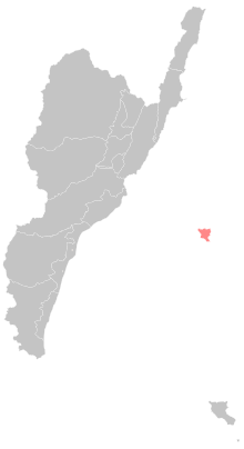
Green Island, also known by other names, is a small volcanic island in the Pacific Ocean about 33 km (21 mi) off the eastern coast of Taiwan. It is 15.092 km2 (5.83 sq mi) at high tide and 17.329 km2 (6.69 sq mi) at low tide, making it the seventh-largest island in Taiwan Area. The island is administered as Lyudao Township,[1][2] a rural township of Taitung County and one of the county's two offshore areas (the other being Orchid Island). The island once served as a penal colony for political prisoners during Taiwan's period of martial law, although today it is primarily known as a tourist hotspot.
Native name: Sanasai | |
|---|---|
 Satellite view of the Green Island, with coral reefs along the coastline are shown. | |
 Green I. Green Island in Taiwan | |
| Geography | |
| Location | Philippine Sea |
| Coordinates | 22°40′00″N 121°28′59″E |
| Area | 15.092 km2 (5.827 sq mi) |
| Administration | |
Republic of China | |
| Township | Lyudao |
| County | Taitung |
| Demographics | |
| Ethnic groups | Amis, Han |
| Green Island | |||||||||||||||||||||||||||
|---|---|---|---|---|---|---|---|---|---|---|---|---|---|---|---|---|---|---|---|---|---|---|---|---|---|---|---|
 Lyudao Township in Taitung County | |||||||||||||||||||||||||||
| Chinese name | |||||||||||||||||||||||||||
| Traditional Chinese | 綠島 | ||||||||||||||||||||||||||
| Simplified Chinese | 绿岛 | ||||||||||||||||||||||||||
| Literal meaning | "Green Island" | ||||||||||||||||||||||||||
| |||||||||||||||||||||||||||
| Japanese name | |||||||||||||||||||||||||||
| Hiragana | りょくとう | ||||||||||||||||||||||||||
| Kyūjitai | 綠島 | ||||||||||||||||||||||||||
| Shinjitai | 緑島 | ||||||||||||||||||||||||||
| |||||||||||||||||||||||||||
| Bonfire Island | |||||||||||||||||||||||||||
|---|---|---|---|---|---|---|---|---|---|---|---|---|---|---|---|---|---|---|---|---|---|---|---|---|---|---|---|
 Lüdao Lighthouse, east of the airport | |||||||||||||||||||||||||||
| Chinese name | |||||||||||||||||||||||||||
| Traditional Chinese | 火燒島 | ||||||||||||||||||||||||||
| Simplified Chinese | 火烧岛 | ||||||||||||||||||||||||||
| Literal meaning | "Fire-Roasted Island" | ||||||||||||||||||||||||||
| |||||||||||||||||||||||||||
| Alternative Chinese name | |||||||||||||||||||||||||||
| Traditional Chinese | 火燒嶼 | ||||||||||||||||||||||||||
| Simplified Chinese | 火烧屿 | ||||||||||||||||||||||||||
| Literal meaning | "Fire-Roasted Islet" | ||||||||||||||||||||||||||
| |||||||||||||||||||||||||||
| Japanese name | |||||||||||||||||||||||||||
| Hiragana | かしょうとう | ||||||||||||||||||||||||||
| Kyūjitai | 火燒島 | ||||||||||||||||||||||||||
| Shinjitai | 火焼島 | ||||||||||||||||||||||||||
| |||||||||||||||||||||||||||

Names
The island was known as Sama-Sana,[3] Samasana and as Samasana Island[4] in the 19th and early 20th centuries, a transcription of its Amis name Sanasai.
The name "Green Island" is a calque of the island's Chinese name, written 綠島 in traditional characters. It is also known as Lyudao, Lüdao or Lü Dao from the pinyin romanization of the name's Mandarin pronunciation; as Lu Tao[5] from its Wade-Giles romanization; and as Lek-to from its Hokkien pronunciation. The name was adopted by the Republic of China on August 1, 1949, at the behest of Huang Shih-hung (黃式鴻), the magistrate of Taitung.
Before that, it was usually known as Bonfire Island (or Huoshao), a calque of its original Chinese name Huǒshāo Dǎo (火燒島, 火烧岛).
History
The island was originally inhabited by the aboriginal Amis people.
In March 1864 the British brig Susan Douglas was swept off course and wrecked on the island.[6] Her captain then sailed by junk from the island to Kaohsiung,[6] and the Royal Navy gunboat HMS Bustard found and rescued the remainder of the survivors.[7][8]
In the early 1870s, William Campbell saw the island from aboard the Daphne, and wrote:[9]
We sighted also the Island of Samasana, which is thirty-four miles north of Botel Tobago, and fully fifteen miles east from the Formosan village of Po-song. Consul Swinhoe supposes that it is inhabited by fishermen of Luchuan origin ; but Captain Belcher, of H.M.S. Samarang called there in 1845, and found the population to consist of about a hundred and fifty Chinese from the region of Amoy. They were then gathered into one village, and have greatly increased since that time.
On 11 December 1937 the Dollar Steamship Company luxury ocean liner SS President Hoover ran aground in a typhoon on a reef at Zhongliao Bay.[10] All 503 passengers and 330 crew survived and were safely brought ashore.[10] Over the next few days the cargo liners SS President McKinley and SS President Pierce took the survivors off the island, helped by boats provided by the Japanese cruiser Ashigara and an Imperial Japanese Navy destroyer.[10] Dollar Lines sold President Hoover's wreck to a Japanese salvage company, which spent the next three years breaking her up in situ.[10]
In response to the wreck, members of the US public gave money through the American Red Cross for a lighthouse to be built near Zhongliao village.[6] Lyudao or Lüdao Lighthouse was designed by Japanese engineers, built by local islanders in 1938[6] and is 33.3 metres (109 ft) high.[11]
A shipwreck of Dutch origin dating to the 19th century was found in June 2013.[12]
Prisons
Green Island first served as an isolated spot and place of exile for political prisoners during the martial law period during the Kuomintang government, and especially in the White Terror. After their release, many of the prisoners jailed between the late 1940s and the late 1980s went on to establish the Democratic Progressive Party, most notably Shih Ming-teh. Writer and political dissident Bo Yang served his prison terms there.
The place where most of the political prisoners (such as Shih Ming-teh) were held was "Green Island Lodge" (Lǜ Dǎo Shānzhuāng). "Oasis Village" was the main penal colony. The prison was later closed, and its interior is now open to the public. "Green Island Prison" (Lǜdǎo Jiānyù) is also on the island and has housed prisoners considered to be among Taiwan's most dangerous criminals and gangsters. However, this has changed in recent years.
Geography
The island is formed of volcanic tholeiite, andesite, and volcanic explosive fragments with an area of 15 km2.[13] The volcano erupted from the Pliocene to Pleistocene epochs and is part of the Luzon Volcanic Arc. Magma was formed by subduction of oceanic crust at a depth of about 25 kilometres (16 mi). The andesite rock contains some visible crystals of pyroxene or amphibole. The geochemistry of the rock shows it is enriched in potassium, strontium and rubidium and light rare earth elements. Chromium and nickel are depleted.[14]
Fauna
The island is a habitat for Formosan sika deer, Reeves's muntjacs, Ryukyu flying foxes, and resident and migratory birds.[15]
Local population
In 1995 fewer than half of the registered 2,634 residents of the island actually lived on the island. The population is dwindling due to the difficulty of finding jobs on the island. The island has two pre-schools, one kindergarten, two elementary schools and one middle school. To pursue any education at the senior high school level or above, islanders must move to the main island of Taiwan. Public service centres include one seniors' home, one library, and one community centre.
The villages and the settlements (聚落) they administer are:
- Zhongliao Village (中寮村)
- Zhongliao
- Nanliao Village (南寮村)
- Nanliao (南寮)
- Yugang (漁港)
- Gongguan Village (公館村)
- Gongguan (公館)
- Chaikou (柴口)
- Liumagou (流麻溝)
- Dahu (大湖)
- Zuoping (左坪)
The following abandoned aboriginal tribal settlements also belong to Gongguan Village:
- Youzihu (柚子湖)
- Nanzihu (楠子湖)
- Haishenping (海參坪)
- Dabaisha (大白沙)
Power generation
The island is powered by its only diesel-fired power plant with a capacity of 29.1 MW, consisting of 28 units of generation.[16]
Tourist attractions
- Green Island Human Rights Culture Park
- Lüdao Lighthouse
- Green Island Dive Sites Recreational diving is popular for visitors. There are many dive sites that are established with walkways down to ocean About 150 meter Off Shilang, lies the biggest reef attraction 'Big Mushroom Coral' its height about 12m, width around 31m.
- Sika Deer Ecological Park
- Sleeping Beauty Rock
- Zhaori Hot Spring Sea water heated from the volcanic action rises to the surface next to coral reefs at 53℃ and pH7.5.
Transportation

Lüdao Airport provides flights to Taitung Airport in Taitung City. There are also ferries travelling from Nanliao Harbor to Fugang Fishery Harbor in Taitung City.[17]
Books
Green island is a subject in the following book:
See also
References
Citations
- "About Taitung". Taitung County Government English. Retrieved 14 April 2019.
Lyudao Township{...}Lyudao (Green Island), {...}Lyudao (Green Island)
- "Township (City) Offices". Taitung County Government English. Retrieved 14 April 2019.
Lyudao Township Office
- "The Zoology of the voyage of H.M.S. Samarang, under the command of Captain Sir Edward Belcher, C.B., F.R.A.S., F.G.S., during the years 1843-1846". 1848.
- Campbell (1896), map.
- Lu Tao Lighthouse
- "Part Two: The Wreck of the SS President Hoover". SS President Hoover. The Takao Club. Retrieved 7 May 2013.
- "(untitled)". Otago Daily Times. 29 September 1864. p. 4.
- "(untitled)". The Southland Times. 1 October 1864. p. 2.
- William Campbell (1915). "Sketches from Formosa". pp. 46–47.
- Tully, Anthony; Hackett, Bob; Kingsepp, Sander (2012). "Stranding of S.S. PRESIDENT HOOVER - December 1937". Rising Storm – The Imperial Japanese Navy and China 1931–1941. Imperial Japanese Navy Page. Retrieved 7 May 2013.
- "Lyudao Lighthouse". About Taitung. Department of Culture and Tourism, Taitung Government. Retrieved 7 May 2013.
- Hsu, Elizabeth (16 July 2014). "Century-old sunken ship discovered off Green Island". Central News Agency. Retrieved 17 July 2014.
- "Executive Yuan, R.O.C. (Taiwan)". ey.gov.tw. Archived from the original on 2015-10-12.
- Zhang, Jinhai; He, Lishi (2002). "Geology of Taiwan Province". Geology of China. Geological Publishing House. ISBN 7-116-02268-6.
- "Green Island Adventures, Taiwan". greenislandadventures.com.
- "Energy Statistical annual Reports - Energy Statistics - Bureau of Energy, Ministry of Economic Affairs, R.O.C." moeaboe.gov.tw.
- "Taitung Islands Transportation". Tour.taitung.gov.tw. Archived from the original on 2014-04-25. Retrieved 2014-04-30.
Bibliography
- Campbell, William (1896), "The Island of Formosa: Its Past and Future", Scottish Geographical Magazine, vol. 12, pp. 385–399, doi:10.1080/00369229608732903.
External links
- Tourism (Chinese)
- Book Trips to Green Island here! (English)
Cities and townships of Taitung County | ||
|---|---|---|
County seat: Taitung City | ||
| Cities |
|  |
| Urban townships |
| |
| Rural townships |
| |
| Mountain indigenous townships |
| |
Administrative divisions of outlying islands of Taiwan | ||
|---|---|---|
| Kaohsiung |
|  |
| Kinmen |
| |
| Lienchiang1 |
| |
| Penghu |
| |
| Pingtung | ||
| Taitung | ||
| Yilan | Toucheng (Guishan Island and Diaoyutai Islands2) | |
1 Lienchiang County commonly known as Matsu. 2Diaoyutai Islands are controlled by Japan, (called Senkaku Islands). 3Seat of the outlying islands' counties | ||
| Authority control: National libraries |
|---|
На других языках
[de] Lü Dao
Lü Dao, auch Lyudao bzw. Lutao (chinesisch 綠島 / .mw-parser-output .Hans{font-size:110%}绿岛, Pinyin Lǜ Dǎo, Tongyong Pinyin Lyù Dǎo, W.-G. Lü Tao, Zhuyin .mw-parser-output .Bopo{font-size:110%}ㄌㄩˋ ㄉㄠˇ, Pe̍h-ōe-jī Le̍k-tó – „Grüne Insel“), bekannt auch unter dem englischen Namen Green Island, ist eine gut 15 km² große Vulkaninsel südöstlich von Taiwan. Die von der Republik China (Taiwan) als Landgemeinde Lüdao (綠島鄉, Lǜdǎo Xiāng) im Landkreis Taitung verwaltete Insel liegt etwa 33 km östlich der Hafenstadt Taitung im Pazifik. Die Einwohnerzahl beträgt etwa 3500 (Stand 2013). Zwischen Taitung und Lü Dao bestehen regelmäßige Fährverbindungen. Vom kleinen Inselflughafen Lü Dao geht durchschnittlich täglich mehr als ein Flug nach Taitung.- [en] Green Island, Taiwan
[es] Isla Verde (Taiwán)
Isla Verde, también conocido como Lvdao o Ludao (en chino:綠島; pinyin: Lǜ Dǎo), es un municipio ubicado en el condado de Taitung, Taiwán. Tiene una población estimada, a fines de febrero de 2022, de 4132 habitantes.[1][fr] Île Verte (Taïwan)
Ludao ou île verte (chinois traditionnel: 綠島; pinyin: Lǜdǎo) est une petite île volcanique de l'Océan Pacifique à environ 33 kilomètres au large de la côte orientale de Taïwan. Elle couvre une superficie de 15,09 km² à marée haute et de 17,33 km² à marée basse, faisant de cette île la septième plus grande île de la République de Chine. L'île est administrée sous la commune rurale de Lüdao, appartenant au comté de Taitung et est l'une des deux communes d'outre-mer du comté, à l'instar de l'île aux Orchidées. L'île a, par le passé, servi de colonie pénitentiaire pour les prisonniers politiques pendant la période de l'instauration de la loi martiale à Taiwan, même si elle est, de nos jours, principalement connue comme une destination touristique.[it] Green Island (Taiwan)
Green Island (cinese tradizionale: 綠島; pinyin: Lǜ Dǎo; POJ: Le̍k-tó; traduzione: isola verde) è una piccola isola vulcanica dell'Oceano Pacifico, situata a circa 33 km (20.5 miglia) al largo della costa orientale di Taiwan. Nel XIX secolo era conosciuta come Isola Samasana, mentre i giapponesi la chiamavano Kasho-to (火燒島). L'isola è ampia 15.092 km² durante l'alta marea, e 17.329 km² durante la bassa. Green Island, quarta isola per grandezza dello Stato di Taiwan, è amministrata dalla contea di Taitung, insieme all'isola di Orchid Island più al largo, e governativamente prende il nome di Lutao Hsiang (綠島鄉). L'isola è accessibile via aereo dalla città di Taitung, dalla quale il volo impiega in genere 12 minuti; in alternativa, vi si arriva con dei traghetti della capacità massima di 250 passeggeri.[ru] Люйдао
Люйдао[2] (Людао[3][4], кит. 綠島 — Зелёный остров), также Хошаода́о[5][6][4][7][8][9] (火燒島 — Огненный остров) — вулканический остров[10] в Филиппинском море у восточного побережья Тайваня. Наивысшая точка — гора Хошаошань высотой 281 м над уровнем моря[7]. Административно относится к уезду Тайдун. Остров привлекает любителей рекреационного дайвинга.Другой контент может иметь иную лицензию. Перед использованием материалов сайта WikiSort.org внимательно изучите правила лицензирования конкретных элементов наполнения сайта.
WikiSort.org - проект по пересортировке и дополнению контента Википедии