geo.wikisort.org - Island
Gabo Island is a 154-hectare (380-acre) island located off the coast of eastern Victoria, Australia, between Mallacoota and Cape Howe on the border with New South Wales.[1] It is separated from the mainland by a 500-metre (1,600 ft) wide channel; access is available by arranged flights and boats.[2] Gabo Island is a shipping reference commonly referred to in Victorian weather warnings issued by the Australian Bureau of Meteorology. The island is an unincorporated area under the direct administration of the government of Victoria.
 Gabo Island Location off the coast near Shire of East Gippsland | |
| Geography | |
|---|---|
| Location | Bass Strait |
| Coordinates | 37°33′47″S 149°54′39″E |
| Length | 2.4 km (1.49 mi)[1] |
| Width | 0.8 km (0.5 mi)[1] |
| Highest elevation | 52 m (171 ft)[1] |
| Administration | |
Australia | |
| State | Victoria |
Gabo Island Lighthouse
Gabo Island is well known for its historic lighthouse. This lighthouse, Australia's second tallest, was completed in 1862 and made from pink granite quarried from the island itself. The focal plane of the light is situated at 55 metres (180 ft) above sea level, the characteristic is a group of three flashes that occurs every twenty seconds. A keeper's house is occupied by a caretaker; another building may be rented for overnight stays.[3]
Climate
| Climate data for Gabo Island Lighthouse | |||||||||||||
|---|---|---|---|---|---|---|---|---|---|---|---|---|---|
| Month | Jan | Feb | Mar | Apr | May | Jun | Jul | Aug | Sep | Oct | Nov | Dec | Year |
| Record high °C (°F) | 40.8 (105.4) |
39.1 (102.4) |
38.6 (101.5) |
35.0 (95.0) |
26.6 (79.9) |
22.5 (72.5) |
23.3 (73.9) |
26.7 (80.1) |
31.0 (87.8) |
35.6 (96.1) |
37.2 (99.0) |
38.4 (101.1) |
40.8 (105.4) |
| Average high °C (°F) | 21.3 (70.3) |
21.6 (70.9) |
21.0 (69.8) |
19.2 (66.6) |
16.9 (62.4) |
14.8 (58.6) |
14.1 (57.4) |
14.7 (58.5) |
15.9 (60.6) |
17.2 (63.0) |
18.4 (65.1) |
19.9 (67.8) |
17.9 (64.2) |
| Average low °C (°F) | 15.8 (60.4) |
16.2 (61.2) |
15.4 (59.7) |
13.5 (56.3) |
11.2 (52.2) |
9.3 (48.7) |
8.2 (46.8) |
8.5 (47.3) |
9.7 (49.5) |
11.2 (52.2) |
12.8 (55.0) |
14.4 (57.9) |
12.2 (54.0) |
| Record low °C (°F) | 6.3 (43.3) |
7.8 (46.0) |
7.8 (46.0) |
6.4 (43.5) |
2.2 (36.0) |
3.3 (37.9) |
2.0 (35.6) |
2.8 (37.0) |
2.8 (37.0) |
2.8 (37.0) |
1.7 (35.1) |
7.2 (45.0) |
1.7 (35.1) |
| Average precipitation mm (inches) | 70.2 (2.76) |
67.7 (2.67) |
72.5 (2.85) |
84.4 (3.32) |
98.3 (3.87) |
103.4 (4.07) |
85.4 (3.36) |
71.5 (2.81) |
72.5 (2.85) |
74.4 (2.93) |
73.1 (2.88) |
66.7 (2.63) |
941.9 (37.08) |
| Average precipitation days | 9.4 | 9.1 | 10.6 | 11.8 | 13.4 | 14.4 | 13.7 | 13.3 | 13.3 | 13.3 | 11.6 | 10.8 | 144.7 |
| Source: Bureau of Meteorology[4] | |||||||||||||
Birds
The island is home to the world's second largest colony of little penguins.[2] Gabo and nearby Tullaberga Island have been identified by BirdLife International as an Important Bird Area because of the numbers of breeding penguins (up to 21,000 pairs) and white-faced storm petrels (up to 20,000 pairs).[5] Concern of predation of native birds and animals led to a successful feral cat eradication program on the island between 1987 and 1991.[6][7]
Literary references
“The wind that blows by Gabo,” is the title of a poem by E.J. Brady.[8]
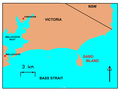 Map of Gabo Island, Victoria, Australia
 Map of Gabo Island


References
- Reilly, P. N. (September 1977). "Seabird islands No 45, Gabo Island, Victoria" (PDF). Corella. 1 (3): 51–53. Retrieved 23 August 2020.
- Parks Victoria. "Gabo Island". Archived from the original on 27 July 2008.
- Rowlett, Russ. "Lighthouses of Australia: Victoria". The Lighthouse Directory. University of North Carolina at Chapel Hill.
- "Climate Statistics for Gabo Island Lighthouse". Climate statistics for Australian locations. Bureau of Meteorology. Archived from the original on 14 November 2016. Retrieved 13 November 2016.
- "IBA: Gabo and Tullaberga Islands". Birdata. Birds Australia. Archived from the original on 6 July 2011. Retrieved 23 June 2011.
- Twyford, B. K.; Humphrey, P. G.; Nunn, R. P.; Willoughby, L (2000). "Eradication of Feral Cats (Felis catus) from Gabo Island, south-east Victoria". Ecological Management and Restoration. 1 (1): 42–49. doi:10.1046/j.1442-8903.2000.00007.x.
- Nogales, Manuel; Martín, Aurleio; Tershy, Bernie. R.; Donlan, C. Josh; Witch, Dick; Puerta, Néstor; Wood, Bill; Alonso, Jesús (2004). "A review of feral cat eradication on islands". Conservation Biology. 18 (2): 310–319. doi:10.1111/j.1523-1739.2004.00442.x. hdl:10261/22249. Archived from the original on 1 September 2017. Retrieved 1 September 2017.
- Brady, E.J., (1933) Wardens of the sea, Sydney, Endeavour Press, p.24-26
External links
| Wikimedia Commons has media related to Gabo Island. |
Islands and islets of Victoria, Australia | |
|---|---|
| Near East Gippsland | |
| Near Corner Inlet | |
| Near Wilsons Promontory | |
| In Western Port |
|
| In Port Phillip | |
| Near Portland Bay | |
| In rivers | |
| |
Authority control | |
|---|---|
| General |
|
| National libraries | |
На других языках
- [en] Gabo Island
[fr] Île Gabo
L'île Gabo est une petite île située au large de la côte de l'est du Victoria, en Australie, entre Mallacoota et cap Howe à proximité de la frontière avec la Nouvelle-Galles du Sud.[it] Gabo Island
Gabo Island è un'isola di granito situata nello stretto di Bass, tra la cittadina di Mallacoota e Cape Howe, all'estremità orientale dello stato di Victoria, in Australia.Другой контент может иметь иную лицензию. Перед использованием материалов сайта WikiSort.org внимательно изучите правила лицензирования конкретных элементов наполнения сайта.
WikiSort.org - проект по пересортировке и дополнению контента Википедии