geo.wikisort.org - Sea
The Corner Inlet is a 600-square-kilometre (230 sq mi) bay located 200 kilometres (120 mi) south-east of Melbourne in the South Gippsland region of Victoria, Australia. Of Victoria's large bays it is both the easternmost and the warmest. It contains intertidal mudflats, mangroves, salt marsh and seagrass meadows, sheltered from the surf of Bass Strait by a complex of 40 sandy barrier islands, the largest of which are Snake, Sunday and Saint Margaret Islands.
| Corner Inlet | |
|---|---|
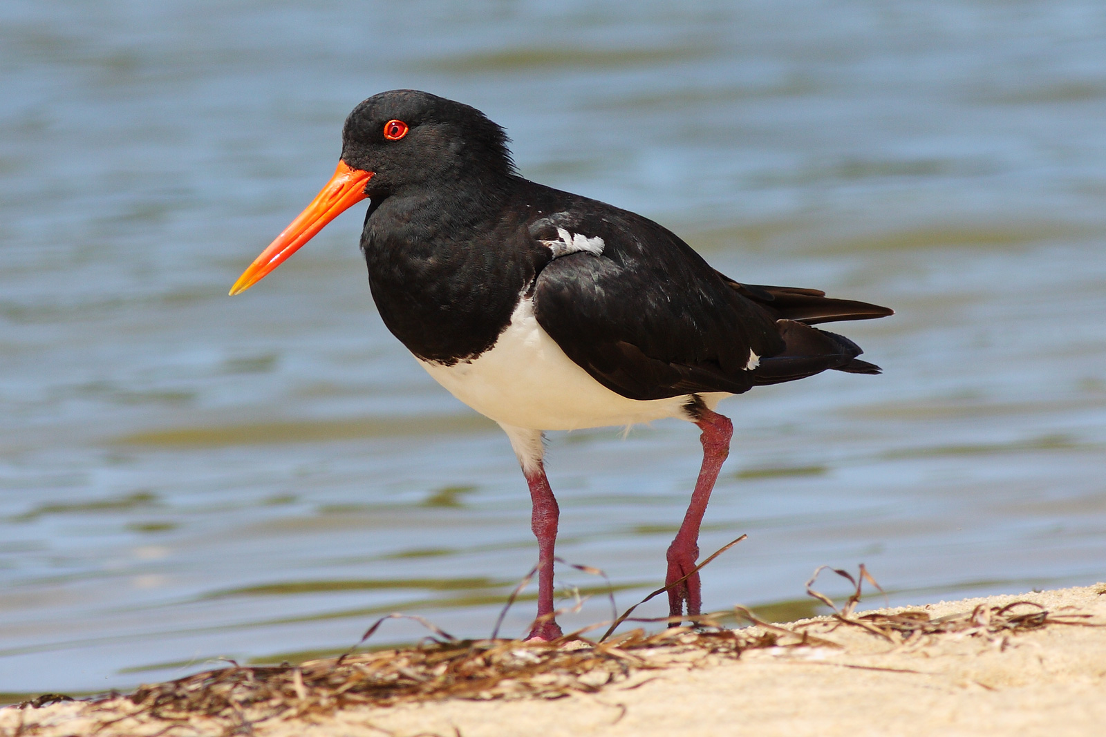 Corner Inlet is an important site for pied oystercatchers | |
 Corner Inlet Location in Victoria | |
| Location | South Gippsland, Victoria |
| Coordinates | 38°45′57″S 146°20′21″E[1] |
| Primary inflows | |
| Primary outflows | Bass Strait |
| Basin countries | Australia |
| Surface area | 600 km2 (230 sq mi) |
| Islands | Snake, Sunday and Saint Margaret |
Ramsar Wetland | |
| Designated | 15 December 1982 |
| Reference no. | 261[2] |

The inlet is protected as a Ramsar site by the Nooramunga and Corner Inlet Marine and Coastal Parks, and by part of it lying within the 1,550-hectare (3,800-acre) Corner Inlet Marine National Park. The inlet adjoins Wilsons Promontory in the west, extends to Ninety Mile Beach in the east, and supports large numbers of migratory waders and other birds as well a rich marine flora and fauna.[3]
History
Corner Inlet lies within the traditional lands of the Brataolong clan of the Gunai nation. In the early 1840s, European settlers moved into the area and established agricultural, mining and forestry enterprises. Commercial fishing became established in the 1860s. The surrounding land was originally covered by forest which has mostly since been cleared. It has become a popular tourist destination for recreational boating and fishing.[3]
Birds
Some 720 square kilometres (280 sq mi) of land and water covering Corner Inlet has been recognised by BirdLife International as an Important Bird Area. Containing the most extensive intertidal mudflats in Victoria, it supports over 1% of the world populations of chestnut teal, Far Eastern curlew, red-necked stint, pied and sooty oystercatchers and the hooded plover. The critically endangered orange-bellied parrot has occasionally been seen there.[4]
See also
References
- "Corner Inlet (VIC)". Gazetteer of Australia online. Geoscience Australia, Australian Government.
- "Corner Inlet". Ramsar Sites Information Service. Retrieved 25 April 2018.
- Corner Inlet Marine National Park Archived 19 July 2008 at the Wayback Machine
- "IBA: Corner Inlet". Birdata. Birds Australia. Archived from the original on 6 July 2011. Retrieved 2011-06-16.
External links
Coastal bays and inlets of Victoria, Australia | |
|---|---|
| |
|
Другой контент может иметь иную лицензию. Перед использованием материалов сайта WikiSort.org внимательно изучите правила лицензирования конкретных элементов наполнения сайта.
WikiSort.org - проект по пересортировке и дополнению контента Википедии