geo.wikisort.org - Island
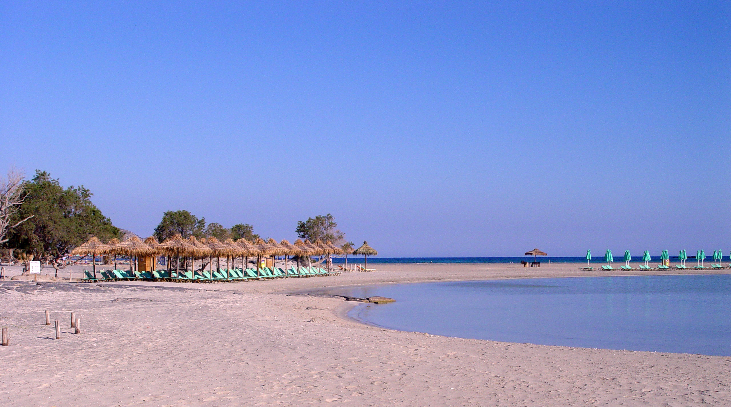
Elafonisi (Greek: Ελαφονήσι [elafoˈnisi] "deer island") is an island located close to the southwestern corner of the Mediterranean island of Crete, of which it is administratively a part, in the regional unit of Chania. When the weather is fine it is possible to walk to the island through the shallow water. The island is a protected nature reserve. It is known for its pink sand beaches, created by tidal and wave-induced deposits of pigmented microorganisms living in a symbiotic relationship with native seaweed.
Native name: Ελαφονήσι | |
|---|---|
 Southeastern coast of Elafonisi | |
 | |
| Geography | |
| Coordinates | 35.27°N 23.532°E |
| Archipelago | Cretan Islands |
| Area | 1.5 km2 (0.58 sq mi) |
| Administration | |
Greece | |
| Region | Crete |
| Regional unit | Chania |
| Demographics | |
| Population | 0 (2001) |
| Additional information | |
| Vehicle registration | ΧΝ |
Greek War of Independence
At the highest point on the island there is a plaque that commemorates a tragic event. On Easter Sunday of 18 April 1824 several hundred Greeks, mostly women and children, were killed on Elafonisi by Ottoman soldiers. To avoid advancing Turkish Ottoman troops, forty armed men had taken refuge on the island with women, children and old folk where they were waiting for a ship to take them to the Ionian Islands. The Ottoman soldiers had decided to camp on the beach opposite the island. One of their horses walked along the shallow water to the island and the people hiding on the island were discovered. According to several sources there were between 640 and 850 people in total, most of whom were killed and the remaining survivors were sold into slavery in Egypt.[1][2][3]
Shipwreck of the Imperatrix
A large wooden cross commemorates a shipwreck from 22 February 1907. It was an Österreichischer Lloyd passenger steamer, called the Imperatrix. Due to strong northwest winds 38 people died in a lifeboat that tried to reach the shore. They were all buried on the island. The Imperatrix still lies on the seabed in front of the island's cliffs and was the reason that a lighthouse was built on an island hilltop.[4]
The lighthouse was destroyed during the Second World War by the occupying German troops.[5]
Monastery
On the mainland the 17th century Chrysoskalitissa Monastery is approximately 5 km (3.1 miles) from the island, it was built on a promontory overlooking the sea.
The monastery is dedicated to the Dormition of the Virgin. According to tradition, the name Chrysoskalitissa comes from the fact that the 98 steps to the top of the monastery would be gold (Chrysoskalitissa in Greek means, golden step).
It also hosted illegally Greek school children during the Turkish occupation in 1821. The construction of the present church began May 9, 1894.
Gallery
 Elafonisi beach
 Elafonisi island in the distance from the coast of Crete.
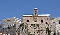 Chrysoskalitissa monastery.


See also
- List of settlements in the Chania regional unit
References
- Website of local Kissamos, Mythymna and Inachorio Archived 2011-07-21 at the Wayback Machine (Greek)
- Article in Ta Nea newspaper of 17 August 2007 Archived 7 January 2013 at archive.today (Greek)
- Alan Hall: Walking in Western Crete: 45 walks in Kissamos and Selinos, S.200 (English)
- Imperatrix – The Wreck Archived 2012-01-18 at the Wayback Machine (English)
- Kissamoslive (clubs.pathfinder.gr) Archived 2011-07-01 at the Wayback Machine (Greek)
External links
See Chania Region for maps
На других языках
[de] Elafonisi (Kreta)
Elafonisi (griechisch Ελαφονήσι (n. sg.), auch Ελαφόνισος Elafonisos und Elafonissi, = „Hirsch-Insel“) ist eine kleine Insel im Südwesten der griechischen Mittelmeerinsel Kreta.- [en] Elafonisi
[fr] Elafonísi
Elafonísi (en grec moderne : Ελαφονήσι) est une île grecque, située en mer de Libye, au sud-ouest de la Crète et à proximité immédiate du rivage. Elle dépend du district régional de La Canée. Par beau temps, il est possible de marcher jusqu'à l'île en passant par les eaux peu profondes. L'île est une réserve naturelle protégée. Elle est connue pour ses plages de sable rose, créées par des dépôts de micro-organismes pigmentés, induits par les marées et les vagues, qui vivent en symbiose avec les algues indigènes.[it] Elafonīsi
Elafonīsi (In greco: Ελαφονήσι) è una isoletta situata vicino alla costa sud-occidentale dell'isola di Creta, di cui amministrativamente fa parte, ricadendo nell'unità periferica de La Canea.[ru] Элафониси
Элафониси[1] (греч. Ελαφονήσι, буквально — «Олений остров») — необитаемый остров в Средиземном море, расположенный у юго-западного побережья Крита. Административно относится к сообществу Вати[el] в общине Кисамос в периферийной единице Ханья в периферии Крит.Другой контент может иметь иную лицензию. Перед использованием материалов сайта WikiSort.org внимательно изучите правила лицензирования конкретных элементов наполнения сайта.
WikiSort.org - проект по пересортировке и дополнению контента Википедии