geo.wikisort.org - Island
Buariki is the largest island in the Aranuka atoll of the Gilbert Islands in the Republic of Kiribati. Together with Takaeang the two large islands form the triangle shape of the atoll with Buariki forming the base.[1]
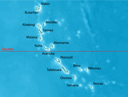
 Map of Aranuka | |
 | |
| Geography | |
|---|---|
| Location | Pacific Ocean |
| Coordinates | 0°09′N 173°35′E |
| Archipelago | Gilbert Islands |
| Area | 13.228 km2 (5.107 sq mi) |
| Highest elevation | 3 m (10 ft) |
| Administration | |
Kiribati | |
| Capital | Buariki |
| Demographics | |
| Population | 1,057 (2010 Census) |
| Pop. density | 79.9/km2 (206.9/sq mi) |
| Ethnic groups | I-Kiribati 99.6% |
Villages
- Baurua
- Buariki
Air transportation
The humble Aranuka Airport is located about one kilometre north of Buariki village.
See also
References
- "10. Aranuka" (PDF). Office of Te Beretitent - Republic of Kiribati Island Report Series. 2012. Retrieved 28 April 2015.
На других языках
[de] Buariki (Aranuka)
Buariki ist die größte Insel des Aranuka-Atolls, das zu den Gilbertinseln in der Republik Kiribati gehört. Die Insel bildet die östliche Seite des im Grundriss annähernd dreieckigen Atolls.- [en] Buariki (Aranuka)
[fr] Buariki (Aranuka)
Buariki est une île de l'atoll d'Aranuka dans les Kiribati.Текст в блоке "Читать" взят с сайта "Википедия" и доступен по лицензии Creative Commons Attribution-ShareAlike; в отдельных случаях могут действовать дополнительные условия.
Другой контент может иметь иную лицензию. Перед использованием материалов сайта WikiSort.org внимательно изучите правила лицензирования конкретных элементов наполнения сайта.
Другой контент может иметь иную лицензию. Перед использованием материалов сайта WikiSort.org внимательно изучите правила лицензирования конкретных элементов наполнения сайта.
2019-2025
WikiSort.org - проект по пересортировке и дополнению контента Википедии
WikiSort.org - проект по пересортировке и дополнению контента Википедии
