geo.wikisort.org - Island
Beru is an atoll in the Southern Gilbert Islands in the Pacific Ocean, part of the Republic of Kiribati. Beru was previously known as Eliza, Francis Island, Maria, Peroat, Peru Island or Sunday. Beru is home of 2,051 inhabitants (2015 census).
This article's lead section may be too short to adequately summarize the key points. (January 2021) |
 Beru Atoll | |
 | |
 Beru 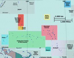 Beru  Beru  Beru | |
| Geography | |
|---|---|
| Location | Pacific Ocean |
| Coordinates | 1°19′S 175°58′E |
| Archipelago | Gilbert Islands |
| Administration | |
Kiribati | |
| Capital | Utiroa |
| Former capital | Buariki |
| Demographics | |
| Population | 2,051 (2015 Census) |
| Ethnic groups | I-Kiribati 99.7% |
Etymology
Beru means gecko in Gilbertese and its pronunciation is similar to Peru, with a P (there is no P sound in Gilbertese).
Geography

Beru is part of a larger reef, some 15 kilometres (9 mi) long (NW-SE) and 4.75 kilometres (3 mi) wide at the widest point (NE-SW). The center of the reef is a shallow depression called Nuka Lagoon. The land mass occupies fully a third or more of the shallow reef structure and is positioned mostly towards the northeast edge of the reef. In maximum dimension the islet is 13.9 kilometres (9 mi) long, and varies in width between 0.5 km (0 mi) and 2.9 km (2 mi).[1][2]
Extensive spit development has created the nearly enclosed Tabiang Lagoon at the north end where mangroves are present. A small lagoon or barachois at the northern tip is surrounded by man-made fishponds to hold Milkfish, as is a similar feature at the south end of the islet. A 3 km (2 mi) long barachois with extensive mangroves occupies the interior south of Nuka Lagoon. A causeway is present across the inlet mouth and a landing strip is present on the interior flats. The lagoon on the island known as Nuka Lagoon, has a broad passage entering it.[1][2]
The island is 96 km (60 mi) east of Tabiteuea Atoll and 426 km (265 mi) southeast of Tarawa Atoll and is located near the equator (1°20' S latitude). The closest island to Beru is the island of Nikunau. The island is served by Beru Island Airport.
Settlements
- Nuka
- Rongorongo
- Tabukiniberu
- Teteirio
Environmental issues
The windward side of the atoll is experiencing coastal erosion due to wave action. The Leeward side of the atoll has the shallow lagoon, which the islanders have experienced becoming shallower that is linked to mud-sand accretion that is thought to be the result of the causeways.[1] The construction of causeways has been thought to change the currents in the lagoon and along the shoreline.[1] Frequent and stronger sea surges is damaging the seawalls that have been constructed by the islanders.[1] Aggregate mining and the removal of coral boulders is exacerbating coastal erosion.[1]
Myths and legends
There are different stories told as to the creation of Beru and the other islands in the Southern Gilberts. An important legend in the culture of Beru is that spirits who lived in a tree in Samoa migrated northward carrying branches from the tree, Te Kaintikuaba, which translates as the tree of life.[1] It was these spirits, together with Nareau the Wise who created the islands of Tungaru (the Gilbert Islands).[Note 1]
History
Beru Post Office opened around 1911.[5]
Education
The island has the one Christian senior high school, Hiram Bingham High School.[6]
Notes
- Sir Arthur Grimble, cadet administrative officer in the Gilberts from 1914 and resident commissioner of the Gilbert and Ellice Islands colony from 1926, recorded the myths and oral traditions of the Kiribati people. He wrote the best-sellers A Pattern of Islands (London, John Murray 1952,[3] and Return to the Islands (1957), which was republished by Eland, London in 2011, ISBN 978-1-906011-45-1. He also wrote Tungaru Traditions: writings on the atoll culture of the Gilbert Islands, University of Hawaii Press, Honolulu, 1989, ISBN 0-8248-1217-4.[4]
References
- Temakei Tebano & Riibeta Abeta (March 2008). "Island/atoll climate change profiles - Beru Atoll". Office of Te Beretitent - Republic of Kiribati Island Report Series (for KAP II (Phase 2). Archived from the original on November 6, 2011. Retrieved 28 April 2015.
- "14. Beru" (PDF). Office of Te Beretitent - Republic of Kiribati Island Report Series. 2012. Retrieved 28 April 2015.
- Grimble, Arthur (1981). A Pattern of Islands. Penguin Travel Library. Penguin Books. ISBN 0-14-009517-9.
- Grimble, Arthur (1989). Tungaru traditions: writings on the atoll culture of the Gilbert Islands. Penguin Travel Library. University of Hawaii Press. ISBN 978-0-8248-1217-1.
- Premier Postal History. "Post Office List". Premier Postal Auctions. Retrieved 5 July 2013.
- "TABITEUEA NORTH 2008 Socio-Economic Profile" Part 2 of 4. Strengthening Decentralized Governance in Kiribati Project , Ministry of Internal and Social Affairs (Kiribati). p. 48 (PDF p. 13/15). Part 1 is here.
- Exhibit: The Alfred Agate Collection: The United States Exploring Expedition, 1838-1842 from the Navy Art Gallery
Geography of Kiribati | ||
|---|---|---|
| Gilbert Islands |  | |
| Phoenix Islands | ||
| Line Islands | ||
| West of Gilberts | ||
| Reefs |
| |
| ||
На других языках
[de] Beru (Insel)
Beru (früher auch bekannt als Eliza, Francis Island, Maria, Peroat, Peruinsel oder Sunday) ist eine Insel im südlichen Teil des Archipels der Gilbertinseln im Pazifischen Ozean. Sie gehört zum Gebiet des Inselstaates Kiribati. Die Insel besteht größtenteils aus einem etwa 14 km langen Riff, das sich von Nordwest nach Südost erstreckt und an der breitesten Stelle etwa 4,75 km breit ist. In der Mitte des Riffs befindet sich die aus seichtem Gewässer bestehende Nuka-Lagune.- [en] Beru (atoll)
[es] Beru
Beru (también conocida como Eliza, Isla Francis, Maria, Peroat, Isla Peru y Sunday) es un atolón coralino localizado al sur de las islas Gilbert, pertenecientes a la República de Kiribati, en el océano Pacífico.[fr] Beru
Beru est un atoll des Kiribati, dans l'archipel des îles Gilbert. Sa superficie est de 17,7 km2.[it] Beru
Beru è un'isola situata nel Sud delle Isole Gilbert nell'Oceano Pacifico. Fa parte della Repubblica delle Kiribati.[ru] Беру (атолл)
Беру (англ. Beru) — атолл в архипелаге Гилберта (Республика Кирибати). Находится в 96 км восточнее атолла Табитеуэа и в 426 км юго-восточнее атолла Тарава. Беру имеет длину 15 км и ширину 4,75 км. Площадь острова — 17,65 км². Численность населения — 2099 человек[1] (2010). Большинство населения является протестантами. Остров Беру имеет двух представителей в Парламенте.Другой контент может иметь иную лицензию. Перед использованием материалов сайта WikiSort.org внимательно изучите правила лицензирования конкретных элементов наполнения сайта.
WikiSort.org - проект по пересортировке и дополнению контента Википедии