geo.wikisort.org - Insel
Die Hawaii-Inselkette besteht aus acht großen Hauptinseln im Südosten des Archipels, im Englischen auch als Southeastern oder Windward Islands bezeichnet, denen zahlreiche „Satelliteninseln“ (engl. Offshore Islets) vorgelagert sind. Nordwestlich der Hauptinseln liegen unbewohnte Inseln und Atolle, die sogenannten Nordwestlichen Hawaii-Inseln (engl. Northwestern Hawaiʻian Islands oder Leeward Islands). Mit Ausnahme der Midwayinseln gehören alle Inseln politisch zum US-Bundesstaat Hawaii.

Hauptinseln
| Insel | Nebeninsel | Fläche (km²) | Höhe (m) | Koordinaten | |
|---|---|---|---|---|---|
| Hawaii (Big Island) | 10.432,5 | 4.205 | 19° 34′ N, 155° 30′ W | ||
| Keʻaʻoi | 0,001 | 3 | 19° 16′ N, 155° 15′ W | ||
| Mokupuku | 18 | 20° 12′ N, 155° 42′ W | |||
| Pāʻalaea | 12 | 20° 11′ N, 155° 42′ W | |||
| Paoakalani | 0,008 | 65 | 20° 12′ N, 155° 42′ W | ||
| Kahoʻolawe | 115,5 | 452 | 20° 33′ N, 156° 36′ W | ||
| ʻAleʻale 1) | 0,012 | 20° 31′ N, 156° 36′ W | |||
| Puʻukoaʻe | 0,053 | 100 | 20° 31′ N, 156° 37′ W | ||
| Kauaʻi | 1.433 | 1.598 | 22° 05′ N, 159° 30′ W | ||
| Mokuʻaeʻae | 0,03 | 35 | 22° 14′ N, 159° 24′ W | ||
| Lānaʻi | 364 | 1.027 | 20° 50′ N, 156° 56′ W | ||
| Kiʻei | 12 | 20° 48′ N, 156° 59′ W | |||
| Moku Naio | 9 | 20° 44′ N, 156° 58′ W | |||
| Nanahoa 2) | 0,008 | 40 | 20° 50′ N, 157° 00′ W | ||
| Poʻopoʻo | 0,008 | 18 | 20° 44′ N, 156° 55′ W | ||
| Puʻupehe | 0,006 | 30 | 20° 44′ N, 156° 53′ W | ||
| Maui | 1.883,5 | 3.055 | 20° 48′ N, 156° 20′ W | ||
| ʻĀlau | 0,02 | 45 | |||
| Hulu | 0,008 | 30 | |||
| Kaemi | 0,008 | 37 | |||
| Keōpuka | 0,009 | 38 | |||
| Makoloaka | 0,001 | 24 | |||
| Mokeʻehia | 0,034 | 50 | |||
| Mokuhala | 0,001 | 17 | |||
| Mokuhuki | 0,001 | 17 | |||
| Mokumana | 0,006 | 20 | |||
| Mokupipi | 0,004 | 12 | |||
| Molokini | 0,093 | 55 | 20° 38′ N, 156° 30′ W | ||
| Papanui o Kane | |||||
| Puʻukiʻi | 0,006 | 18 | |||
| Molokaʻi | 673,4 | 1.512 | 21° 08′ N, 157° 02′ W | ||
| Huelo | 0,01 | 61 | |||
| Kanahā | 0,005 | 30 | |||
| Mōkapu | 0,04 | 110 | |||
| Mokohola | |||||
| Mokuhoʻoniki | 0,044 | 65 | |||
| Mokumanu | ca. 0,01 | 45 | |||
| Okala | 0,008 | 120 | |||
| Pāʻūonuʻakea | 0,003 | 15 | |||
| Niʻihau | 179,9 | 382 | 21° 54′ N, 160° 10′ W | ||
| Kaʻula | 0,64 | 167 | 21° 39′ N, 160° 33′ W | ||
| Lehua | 1,03 | 213 | 22° 01′ N, 160° 06′ W | ||
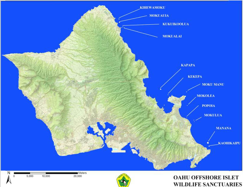
| Oʻahu | 1.557 | 1.225 | 21° 28′ N, 157° 58′ W | ||
| Ahuʻolaka | 0,01 | 1 | |||
| Ford Island (Moku ʻUmeʻume) | 1,83 | ||||
| Kāohikaipu | 0,044 | 12 | |||
| Kapapa | 0,038 | 5 | |||
| Kekepa (Turtle Rock) | 0,008 | 6 | |||
| Kīhewamoku | 21° 40′ N, 157° 55′ W | ||||
| Kūkaimanini | 21° 42′ N, 158° 01′ W | ||||
| Kukuiohoʻolua | 21° 39′ N, 157° 55′ W | ||||
| Mānana (Rabbit Island) | 0,271 | 110 | |||
| Mokolea | 0,000 | 5 | 21° 26′ N, 157° 43′ W | ||
| Mokoliʻi | 0,047 | 70 | |||
| Mokuālai | |||||
| Mokuʻauia (Goat Island) | 0,053 | 6 | 21° 40′ N, 157° 55′ W | ||
| Moku Manu | 0,084 | 62 | |||
| Moku Moʻo 3) | |||||
| Moku o Loʻe (Coconut Island) | 21° 26′ N, 157° 47′ W | ||||
| Nā Mokulua (Twin Islands) | 0,09 | 65 | 21° 23′ N, 157° 42′ W | ||
| Pōhaku Kulaʻilaʻi | |||||
| Popoiʻa (Flat Island) | 0,016 | 3 | |||
| Pulemoku | 21° 40′ N, 157° 55′ W | ||||
| Sand Island (Anuenue) | 2,038 | 21° 18′ N, 157° 53′ W | |||
| Wānanapaoa 4) | 21° 38′ N, 158° 04′ W | ||||
| 1) gemäß GNIS eine Halbinsel | |||||
| 2) Inselgruppe bestehend aus vier Felsinseln | |||||
| 3) Binneninsel im Waokele Pond | |||||
| 4) Inselgruppe bestehend aus zwei Felsinseln | |||||
Nordwestliche Hawaii-Inseln
| Insel / Atoll | Motu | Fläche (km²) | Höhe (m) | Koordinaten | |
|---|---|---|---|---|---|
| French Frigate Shoals (Kānemilohaʻi) | 0,25 | 36 | 23° 46′ N, 166° 11′ W | ||
| Bare Island 1) | 0,0004 | ||||
| East Island 2) | 0,036 | ||||
| Disappearing Island | 0,010 | ||||
| Gin Island | 0,010 | ||||
| La Perouse Pinnacle | 0,004 | 36 | |||
| Little Gin Island | 0,019 | ||||
| Mullet Island | 0,002 | ||||
| Round Island | 0,005 | ||||
| Shark Island | 0,004 | ||||
| Skate Island (Whale Island) | * 0,032 | ||||
| Tern Island | 0,105 | ||||
| Trig Island | 0,023 | ||||
| Whale Island (Skate Island) | * 0,032 | ||||
| Gardner Pinnacles (Pūhāhonu) | 0,024 | 52 | 25° 01′ N, 167° 59′ W | ||
| Big Rock | |||||
| Little Rock | |||||
| Kure Atoll (Mokupāpapa) | 0,86 | 5 | 28° 25′ N, 178° 20′ W | ||
| Green Island | 0,777 | 5 | |||
| Sand Island | 0,085 | 1 | |||
| Laysan Island (Kauō) | 4,114 | 12 | 25° 46′ N, 171° 44′ W | ||
| Lisianski Island (Kānemilohaʻi) | 1,556 | 12 | 26° 04′ N, 173° 58′ W | ||
| Midway Atoll (Pihemanu) | 6,23 | 28° 13′ N, 177° 22′ W | |||
| Eastern Island | 1,35 | ||||
| Sand Island | 4,86 | ||||
| Spit Island | 0,02 | ||||
| Necker Island (Mokumanamana) | 0,183 | 84 | 23° 35′ N, 164° 42′ W | ||
| Nihoa | 0,70 | 273 | 23° 04′ N, 161° 55′ W | ||
| Pearl and Hermes Atoll (Holoikauaua) | 0,36 | 27° 48′ N, 175° 51′ W | |||
| Bird Island | 0,011 | ||||
| Grass Island | 0,049 | ||||
| Little North Island | 0,032 | ||||
| North Island | 0,073 | ||||
| Planetree Island | 0,007 | ||||
| Sand Island | 0,007 | ||||
| Seal-Kittery Island 3) | 0,057 | ||||
| Southeast Island | 0,130 | ||||
| 1) Bare Island ist auf Satellitenbildern noch zu erkennen, im Census Tract jedoch nicht (mehr) aufgeführt.[1] In einer Veröffentlichung von 1971 ist für Bare Island eine Fläche von 0,1 acres (etwa 400 m²) angegeben.[2] | |||||
| 2) East Island wurde durch einen Hurrikan im Oktober 2018 fast vollständig überflutet.[3] | |||||
| 3) derzeit eine Doppelinsel | |||||
Siehe auch
Einzelnachweise
- PDF bei www.statecountymaps.com (Memento vom 1. Februar 2012 im Internet Archive)
- A. Binion Amerson jr.: The Natural History of French Frigate Shoals, Northwestern Hawaiian Islands. Atoll Research Bulletin No. 150, 1971, Seite 28: Bare Island … is awash at high tide and is usually about 100 feet long, 10 feet wide, and 4 feet high. It covers an area of 0.1 acre. Wetmore (ms.) in 1923 described it as "60 yards long by 10 wide, merely a ridge of sand rising 5 feet above the water and evidently swept" by waves.
- Göttinger Tageblatt vom 26. Oktober 2018
Weblinks
- Offshore Islet Restoration Committee (Memento vom 13. Mai 2012 im Internet Archive) (englisch)
- Geographical Names Information System (englisch)
- Map: Offshore islets of Oahu
На других языках
- [de] Liste der Hawaii-Inseln
[en] Hawaiian Islands
The Hawaiian Islands (Hawaiian: Mokupuni o Hawai‘i) are an archipelago of eight major islands, several atolls, and numerous smaller islets in the North Pacific Ocean, extending some 1,500 miles (2,400 kilometers) from the island of Hawaiʻi in the south to northernmost Ocean Island. Formerly the group was known to Europeans and Americans as the Sandwich Islands, a name that James Cook chose in honor of the 4th Earl of Sandwich, the then First Lord of the Admiralty. Cook came across the islands by chance when crossing the Pacific Ocean on his Third Voyage, on board HMS Resolution; he was later killed on the islands on a return visit. The contemporary name of the islands, dating from the 1840s, is derived from the name of the largest island, Hawaiʻi Island.[es] Archipiélago de Hawái
El archipiélago de Hawái (en inglés, Hawaiian Islands), antes conocidas como islas Sandwich (no confundir con las islas Sandwich del Sur), está formado por nueve islas y atolones, además de islotes, arrecifes y bancos de arena, en una alineación del noroeste al sureste a lo largo de 2450 km en el Pacífico Norte. El archipiélago toma el nombre de la isla más grande, Hawái, que a la vez es la más oriental.[it] Isole delle Hawaii
Le isole delle Hawaii , o isole avajane in italiano arcaico[1], costituiscono un arcipelago di otto isole grandi, numerosi atolli e numerosi piccoli isolotti, nonché montagne sottomarine nel nord dell'oceano Pacifico. Esse si estendono per circa 2400 km dall'isola di Hawaii (estremità sud) all'atollo di Kure (estremità nord).[ru] Гавайские острова
Гава́йские острова́ (или Гавайский архипелаг, англ. Hawaiian Islands, гав. mokupuni o Hawaiʻi) — архипелаг из 24 островов и атоллов, расположенный в северной части Тихого океана (между 19° и 29° северной широты). Архипелаг вытянут с северо-запада на юго-восток, имеет вулканическое происхождение, как и фиджийские.Текст в блоке "Читать" взят с сайта "Википедия" и доступен по лицензии Creative Commons Attribution-ShareAlike; в отдельных случаях могут действовать дополнительные условия.
Другой контент может иметь иную лицензию. Перед использованием материалов сайта WikiSort.org внимательно изучите правила лицензирования конкретных элементов наполнения сайта.
Другой контент может иметь иную лицензию. Перед использованием материалов сайта WikiSort.org внимательно изучите правила лицензирования конкретных элементов наполнения сайта.
2019-2026
WikiSort.org - проект по пересортировке и дополнению контента Википедии
WikiSort.org - проект по пересортировке и дополнению контента Википедии