geo.wikisort.org - Insel
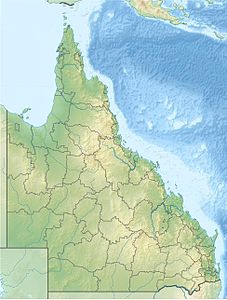
Die Kulbi-Inseln (auch Kulbi Islets genannt) liegen in der Torres-Straße zwischen Australien und Papua-Neuguinea, nur wenige Kilometer nordöstlich von Moa Island.
| Kulbi-Inseln | ||
|---|---|---|
 | ||
| Gewässer | Pazifischer Ozean | |
| Archipel | Torres-Strait-Inseln | |
| Geographische Lage | 10° 7′ S, 142° 21′ O | |
|
| ||
| Anzahl der Inseln | 3 | |
| Hauptinsel | Portlock Island | |
| Gesamte Landfläche | 0,26 km² | |
| Einwohner | unbewohnt | |
Tabelle der Inseln
Zur unbewohnten Inselgruppe gehören:
| Inselname | Alternativ | Lage | Fläche km² |
Geokoordinaten |
|---|---|---|---|---|
| North Possession Island | Iem | Norden | 0,13 | 10° 05′ S, 142° 20′ O |
| Tobin Island | Zagarsum | Mitte | 0,03 | 10° 06′ S, 142° 21′ O |
| Portlock Island | Kulbi | Süden | 0,10 | 10° 07′ S, 142° 21′ O |
Verwaltungsmäßig gehören die Kulbi-Inseln zu den Western Islands, einer Inselregion im Verwaltungsbezirk Torres Shire von Queensland.
Siehe auch
Текст в блоке "Читать" взят с сайта "Википедия" и доступен по лицензии Creative Commons Attribution-ShareAlike; в отдельных случаях могут действовать дополнительные условия.
Другой контент может иметь иную лицензию. Перед использованием материалов сайта WikiSort.org внимательно изучите правила лицензирования конкретных элементов наполнения сайта.
Другой контент может иметь иную лицензию. Перед использованием материалов сайта WikiSort.org внимательно изучите правила лицензирования конкретных элементов наполнения сайта.
2019-2025
WikiSort.org - проект по пересортировке и дополнению контента Википедии
WikiSort.org - проект по пересортировке и дополнению контента Википедии
