geo.wikisort.org - Insel
Chatham Island (Moriori: Rekohu; Māori: Wharekauri) ist die größte Insel im Archipel der zu Neuseeland gehörenden Chatham-Inseln im südwestlichen Pazifik.
| Chatham Island | ||
|---|---|---|
 | ||
| Gewässer | Pazifischer Ozean | |
| Inselgruppe | Chatham-Inseln | |
| Geographische Lage | 43° 54′ S, 176° 32′ W | |
| ||
| Fläche | 899 km² | |
| Höchste Erhebung | Maungatere Hill 294 m | |
| Einwohner | 564 (2006) <1 Einw./km² | |
| Hauptort | Waitangi | |
 | ||

Geographie
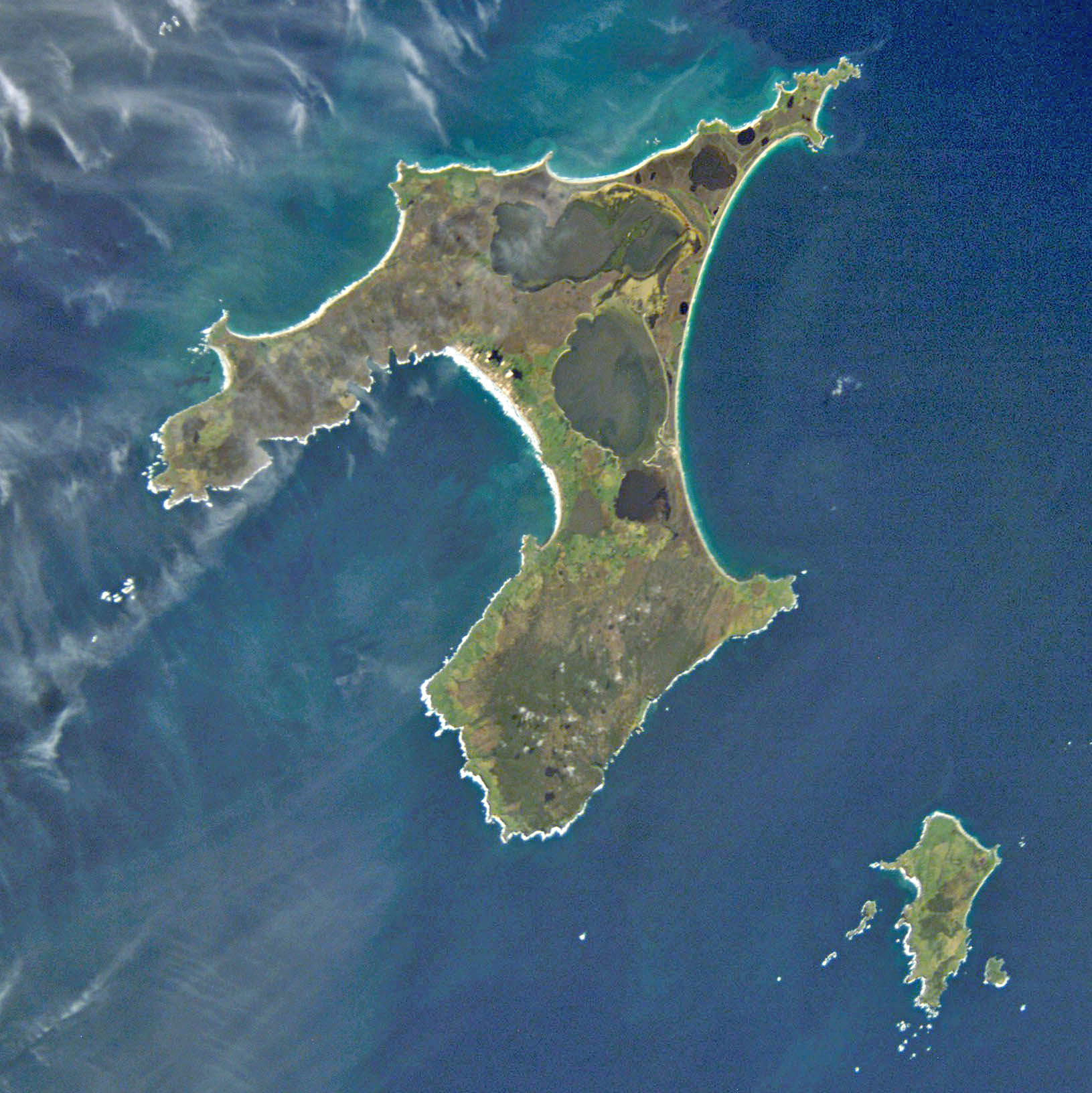
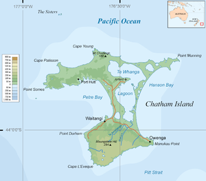
Die T-förmige, 899 km² große Insel ist geprägt von zwei großen Buchten, der Petre Bay im Westen mit dem Hauptort Waitangi und der über 35 km langen Hanson Bay im Osten. Dazwischen befindet sich die 179 km² große Te Whanga-Lagune, die nur durch Landbrücken von der See getrennt ist. Der Süden der Insel wird von einem Hochplateau eingenommen und erreicht im Maungatere Hill eine Höhe von 294 m über dem Meer. Weiterhin gibt es Torflandschaften und lange Sandstrände. Auf einer in die Lagune ragenden Halbinsel befindet sich der Flughafen Tuuta (IATA: CHT, ICAO: NZCI).
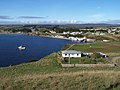 Hauptort Waitangi

Weblinks
- Chatham Islands - Natural Heritage. Kiwi Favourites, abgerufen am 5. Januar 2016 (englisch, Blog mit verschiedenen Artikeln zum Thema).
На других языках
- [de] Chatham Island
[en] Chatham Island
Chatham Island is by far the largest island of the Chatham Islands group, in the south Pacific Ocean off the eastern coast of New Zealand's South Island. It is said to be "halfway between the equator and the pole, and right on the International Date Line", though the point (180°, 45°S) in fact lies ca. 173 miles WSW of the island's westernmost point. The island is called Rekohu ("misty skies") in Moriori, and Wharekauri in Māori.[1][es] Isla Chatham
La isla Chatham es la más grande del grupo de Islas Chatham, en el océano Pacífico sur frente a la costa oriental de Nueva Zelanda (no exactamente “a mitad de camino entre el ecuador y el polo, y justo sobre la línea internacional de cambio de fecha” pero lo suficientemente cerca para los propósitos publicitarios). Está situada a 43°53′54″S 176°31′44″O. Fue bautizada en honor al survey ship HMS Chatham, el cual descubrió la isla en 1791. Tiene una superficie de 900 km².[fr] Île Chatham (Nouvelle-Zélande)
L'île Chatham (en maori de Nouvelle-Zélande : Wharekauri, en moriori : Rekohu) est une île de Nouvelle-Zélande située à environ 800 kilomètres à l'est de l'île du Sud, dans l'océan Pacifique Sud. Elle fait partie de l'archipel des îles Chatham dont elle est l'île la plus grande et la plus peuplée.[it] Isola Chatham
L'isola Chatham è di gran lunga la maggiore isola dell'arcipelago omonimo, situato nel Pacifico meridionale, al largo delle coste orientali della Nuova Zelanda; è posta a metà strada tra l'Equatore e il polo, nei pressi della linea internazionale del cambio di data. L'isola, così come l'arcipelago, deve il nome alla nave britannica Chatham, che la individuò per la prima volta nel 1791. Si estende su un'area di 347 km².[ru] Чатем (остров)
Ча́тем (или Рекоху) (англ. Chatham, маори Rekohu) — крупнейший остров одноимённого архипелага. Географические координаты острова: 43°53′ ю. ш. 176°31′ з. д.HGЯO.Текст в блоке "Читать" взят с сайта "Википедия" и доступен по лицензии Creative Commons Attribution-ShareAlike; в отдельных случаях могут действовать дополнительные условия.
Другой контент может иметь иную лицензию. Перед использованием материалов сайта WikiSort.org внимательно изучите правила лицензирования конкретных элементов наполнения сайта.
Другой контент может иметь иную лицензию. Перед использованием материалов сайта WikiSort.org внимательно изучите правила лицензирования конкретных элементов наполнения сайта.
2019-2026
WikiSort.org - проект по пересортировке и дополнению контента Википедии
WikiSort.org - проект по пересортировке и дополнению контента Википедии