geo.wikisort.org - Остров
Ча́тем (или Рекоху) (англ. Chatham, маори Rekohu) — крупнейший остров одноимённого архипелага. Географические координаты острова: 43°53′ ю. ш. 176°31′ з. д.HGЯO.
| Чатем | |
|---|---|
| англ. Chatham, маори Rekohu | |
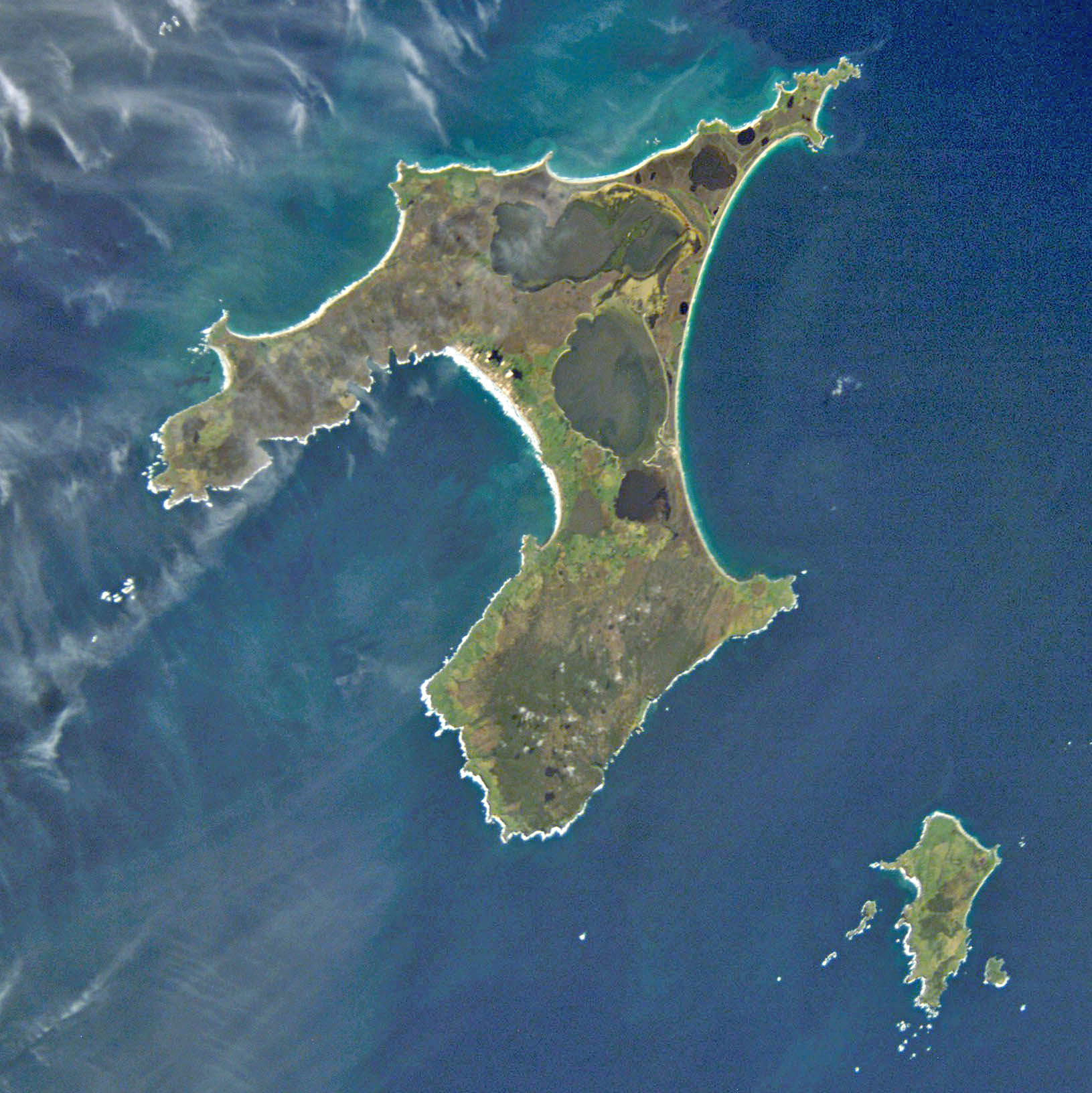 Остров Чатем, вид из космоса | |
| Характеристики | |
| Площадь | 900 км² |
| Наивысшая точка | 294 м |
| Население | 600 чел. (2006) |
| Плотность населения | 0,67 чел./км² |
| Расположение | |
| 43°53′ ю. ш. 176°31′ з. д.HGЯO | |
| Акватория | Тихий океан |
| Страна |
|
| Регион | Внешние острова |

География
Площадь — более 900 км²[1].
История
Европейцами остров был открыт в 1791 году, хотя коренное население (мориори) жило на острове с 1000 года нашей эры.
Население
На острове проживает около 600 человек (2013).
Примечания
- Government of New Zealand, Dept. of Conservation (1999) Chatham IslandsConservation Management Strategy Архивная копия от 7 июня 2011 на Wayback Machine. Accessed on 2012-07-13.
| Субантарктические острова | ||
|---|---|---|
| Севернее 40° ю. ш. |  | |
| Ревущие сороковые 40—50° ю. ш. | ||
| Неистовые пятидесятые 50—60° ю. ш. |
| |
| ||
На других языках
[de] Chatham Island
Chatham Island (Moriori: Rekohu; Māori: Wharekauri) ist die größte Insel im Archipel der zu Neuseeland gehörenden Chatham-Inseln im südwestlichen Pazifik.[en] Chatham Island
Chatham Island is by far the largest island of the Chatham Islands group, in the south Pacific Ocean off the eastern coast of New Zealand's South Island. It is said to be "halfway between the equator and the pole, and right on the International Date Line", though the point (180°, 45°S) in fact lies ca. 173 miles WSW of the island's westernmost point. The island is called Rekohu ("misty skies") in Moriori, and Wharekauri in Māori.[1][es] Isla Chatham
La isla Chatham es la más grande del grupo de Islas Chatham, en el océano Pacífico sur frente a la costa oriental de Nueva Zelanda (no exactamente “a mitad de camino entre el ecuador y el polo, y justo sobre la línea internacional de cambio de fecha” pero lo suficientemente cerca para los propósitos publicitarios). Está situada a 43°53′54″S 176°31′44″O. Fue bautizada en honor al survey ship HMS Chatham, el cual descubrió la isla en 1791. Tiene una superficie de 900 km².[fr] Île Chatham (Nouvelle-Zélande)
L'île Chatham (en maori de Nouvelle-Zélande : Wharekauri, en moriori : Rekohu) est une île de Nouvelle-Zélande située à environ 800 kilomètres à l'est de l'île du Sud, dans l'océan Pacifique Sud. Elle fait partie de l'archipel des îles Chatham dont elle est l'île la plus grande et la plus peuplée.[it] Isola Chatham
L'isola Chatham è di gran lunga la maggiore isola dell'arcipelago omonimo, situato nel Pacifico meridionale, al largo delle coste orientali della Nuova Zelanda; è posta a metà strada tra l'Equatore e il polo, nei pressi della linea internazionale del cambio di data. L'isola, così come l'arcipelago, deve il nome alla nave britannica Chatham, che la individuò per la prima volta nel 1791. Si estende su un'area di 347 km².- [ru] Чатем (остров)
Текст в блоке "Читать" взят с сайта "Википедия" и доступен по лицензии Creative Commons Attribution-ShareAlike; в отдельных случаях могут действовать дополнительные условия.
Другой контент может иметь иную лицензию. Перед использованием материалов сайта WikiSort.org внимательно изучите правила лицензирования конкретных элементов наполнения сайта.
Другой контент может иметь иную лицензию. Перед использованием материалов сайта WikiSort.org внимательно изучите правила лицензирования конкретных элементов наполнения сайта.
2019-2026
WikiSort.org - проект по пересортировке и дополнению контента Википедии
WikiSort.org - проект по пересортировке и дополнению контента Википедии